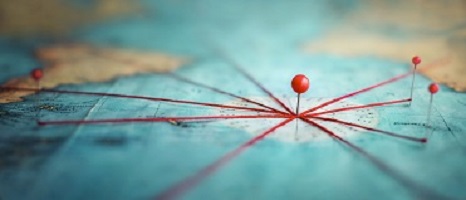
We thought we’d go back this month, all the way back. What we do here at Land-Mark is to understand terrain and land for the purposes of historical records, construction, and more. All of that began, however, with the idea of mapping and what is known as cartography.
Understanding the terrain which we inhabit has been a natural impulse for people and therefore early attempts at mapping our surroundings appear early on in human history. The earliest maps date back to 16, 500 BCE. These maps, however, were focused on the night sky more than they were the earth itself. Ancient cave paintings often depict landscape features like hills and mountains. These early forms of maps were there to help people navigate the world.
In ancient Babylonia maps on clay tablets, as well as routes done by ancient Egyptians on papyrus paper. In fact, many ancient civilizations would come to develop their own systems of mapping and drawing out the landscape.
The Greeks
The Greek civilization was no different. They helped develop the industry of cartography as an important science. Many notable ancient Greeks would study the size and shape of the earth and its habitable areas, climatic zones, and country positions. We might all be familiar with Pythagoras, as he was the first one to draw the map of the earth that showed it as a sphere. Geographers of ancient Greece started trying to calculate the circumference of the earth.
Ancient maps are always fascinating, as they tend to be a little biased. Early Greek maps, for example, tend to show Greece as the center of the world. And this happened with China as well. Other early Greek maps, however, do show the landmasses divided into two continents: Asia and Europe. This was derived, in large part, by Homer’s work and other notable works of the time.
The Roman Empire
The Roman empire began to see a real practical and functional use for their maps. Understanding the terrain meant that this could help them for military purposes and other expansion efforts. The need for the empire to control and protect their empire in both military and economic aspects, meant that they needed to have a precise picture of boundaries and road networks.
Other important map contributions include the Ptolemy map, which is notable for its probable role in the Roman expansion. This is the beginning of latitude and longitude, which we still use today in all of mapping and land surveying. This was originally done around 130 AD but was lost and had to be recreated in 1300 AD. Cartographers that came after this then adopted this system and refined it to be far more accurate.
During the Middle Ages, where so much scientific and artistic advancement was halted, the work of map-making continued. Many Muslim scholars followed the methods of latitude and longitude. As travel across the glove increased, various notes and writing became essential to understanding the new terrain.
Later on, medieval European maps adopted their own form of doing things. They called them ‘mappa mundi.’ The largest Medieval map still in existence includes the Hereford Mappa Mundi—an elaborately and delicately colored map. The Fra Mauro map is another notable map of the ancients. It was created by a monk and it is a large round map of the world.
Let’s skip to the 1600s. There is the famed Ricci Map, a.k.a the Impossible Black Tulip—which is a great name for a map! This map was put together by a Jesuit priest and actually shows the Americas, though it has China in the center.
As Modernity Sets In….
As people continued exploring and mapping out the world, discovering new worlds, mapping those out and so on and so forth, maps became more and more accurate, necessary, and detailed. As the Industrial Revolution set it, trade and commerce began to connect the whole world through a vast network of trading routes and travel. This meant that a more defined understanding of our world was needed. All of a sudden, travel for pleasure was possible and people taking vacations or exploring new areas of the world were looking to move through the areas.
The ornate maps of earlier times, however, were replaced with far more functional and practical maps that could be used for various types of travelers including business travelers, explorers, and even leisure travelers. During the 19th century, railroads expanded rapidly throughout the world, connecting the world once again.
Reading maps is something that used to be taught in school, perhaps not so much anymore if most people use the GPS technology. Nevertheless, the world of mapmaking continues to be a fascinating field, as it is focused on providing detailed information about a certain terrain.
Find a Trustworthy Land Surveyor — A Different Kind of Map Maker
Here at Land-Mark Land Surveying, we don’t make your typical maps but we engage in the practice of creating detailed and informative depictions of a particular landmass or piece of land.