Are You Dealing With a Property Dispute? Land Surveying Can Help
24 JanuaryWhile there is typically a fence or barrier that tells commercial property owners where their land begins and ends, when a conflict coming from their neighbor arises, it can be complicated or downright impossible to settle the dispute. Many times these invisible borders aren’t enough to determine where one property owner’s land begins and where the neighboring property begins. This is where land surveying comes in.
Common Property Disputes
It’s often assumed that when you purchase a piece of land there exists a boundary set in stone. Although this is often the case, in some cases, such as with a change of ownership, the new owner can come in and request to place a wall or fence along his property. It’s common courtesy to speak to the neighbor prior to making any changes but it’s not required. If the neighbor sees an issue with the new fence or wall, he or she can argue that it’s obstructing or interfering with his or her piece of land. They can say that it’s interfering with their view or preventing others from seeing their property, creating a blockade if you will. Moreover, land disputes often come about when property owners decide to make additions to their building such as spreading out the parking lot, adding a front entrance, or extending their offices.
Requesting a Land Survey
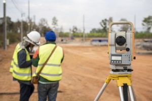
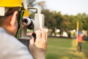
Bringing in an unbiased, independent party will help meddle the constant bickering. Who wants to live this way, anyway? A land surveyor will conduct a physical lot line assessment and mark the boundaries that are in accordance with the local, state, and national guidelines. Although many times the land survey provides answers from a legal standpoint, if the issues get out of hand, the land survey can be court-ordered. The goal is to provide answers and have them solidified from a legal stand-point.
Why It Matters
Owning a piece of land is a huge investment. As the owner, it’s important that you do your part to protect your land. A land survey is the best way to provide answers and set the record straight. Even if your neighbor has already put up a fence, you still have the right to dispute the area it currently occupies. Lot line conflicts are quite common, which is why land surveyors are ready to settle the arguments.
Contact Land-Mark Professional Surveying
For professional service, contact Land-Mark. We’re licensed in Texas, New Mexico, and Arizona. As experienced land surveyors, we’ll provide the tangible and legal answers you need to keep your property protected. Connect with us today to learn more!
The Utility of a Topographic Survey in El Paso
29 OctoberIf you’re buying or have bought land and are planning to build on it, you might soon find that you are required to conduct a topographic survey of the area. People are often surprised that any transaction involving land is much more involved than first meets the eye. It depends, of course, on what the land is for and the kind of construction that will be occurring. Topography studies the shape and features of the earth. So a topography survey will look like a map with a lot of contour lines that indicate patterns and relief of terrain.
A topographical survey can typically be conducted for a variety of reasons: military purposes and planning, geological exploration, environmental improvement projects, construction, civil engineering purposes and so on. The survey provides valuable information about the land in question.
What a Topographical Survey Will Indicate
A general land survey will usually demarcate the boundaries of a piece of land, but a topographical survey will do more than that and also note the natural and manmade features of the land itself. The main objective of the survey is that it provides you with a map of the area and its natural features. This, in turn, will help with any kind of building that is planned on the land. The survey will also help:
- Determine the existing conditions of the land or area.
- Assess whether there are any problems or issues that might interfere with construction.
- Provide engineers and architects with the necessary information to plan and make decisions on the design.
- Indicate whether or how new features such as bridges, building structures, or drainage ditches can be built.
- Provide information on how the site’s previous use affected the land and its features.
- Gives necessary information on utility design.
- Can give general and useful insights for any kind of building project.
- Will determine the boundary measurements of the land.
- If purchasing land for real estate the survey will let you know what exactly you are purchasing. This includes trees, building, fences, sidewalks, driveways, and other features.
- For land that is being redeveloped, this kind of survey is particularly useful as new uses for the land are found.
Today’s technology might allow for detailed interactive 3-D maps that allow architects and engineers to view potential changes in the land. These features really provide the landowner with a lot of options as they make important decisions about their land.
Trust the Professionals With Your El Paso Topographic Survey
Land-Mark Professional Surveying is ready to help provide you with the most in-depth land surveys in the area. Obtaining the most accurate information on your soon to be a land investment is no laughing matter. Get your survey done!


