The Utility of a Topographic Survey in El Paso
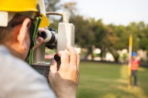
29 OctoberIf you’re buying or have bought land and are planning to build on it, you might soon find that you are required to conduct a topographic survey of the area. People are often surprised that any transaction involving land is much more involved than first meets the eye. It depends, of course, on what the land is for and the kind of construction that will be occurring. Topography studies the shape and features of the earth. So a topography survey will look like a map with a lot of contour lines that indicate patterns and relief of terrain.
A topographical survey can typically be conducted for a variety of reasons: military purposes and planning, geological exploration, environmental improvement projects, construction, civil engineering purposes and so on. The survey provides valuable information about the land in question.
What a Topographical Survey Will Indicate
A general land survey will usually demarcate the boundaries of a piece of land, but a topographical survey will do more than that and also note the natural and manmade features of the land itself. The main objective of the survey is that it provides you with a map of the area and its natural features. This, in turn, will help with any kind of building that is planned on the land. The survey will also help:
- Determine the existing conditions of the land or area.
- Assess whether there are any problems or issues that might interfere with construction.
- Provide engineers and architects with the necessary information to plan and make decisions on the design.
- Indicate whether or how new features such as bridges, building structures, or drainage ditches can be built.
- Provide information on how the site’s previous use affected the land and its features.
- Gives necessary information on utility design.
- Can give general and useful insights for any kind of building project.
- Will determine the boundary measurements of the land.
- If purchasing land for real estate the survey will let you know what exactly you are purchasing. This includes trees, building, fences, sidewalks, driveways, and other features.
- For land that is being redeveloped, this kind of survey is particularly useful as new uses for the land are found.
Today’s technology might allow for detailed interactive 3-D maps that allow architects and engineers to view potential changes in the land. These features really provide the landowner with a lot of options as they make important decisions about their land.
Trust the Professionals With Your El Paso Topographic Survey
Land-Mark Professional Surveying is ready to help provide you with the most in-depth land surveys in the area. Obtaining the most accurate information on your soon to be a land investment is no laughing matter. Get your survey done!
A Quick Guide on Construction Surveys in New Mexico
27 MayConstruction Surveys in Las Cruces, New Mexico is an important part of any subdivision that is in the process of development. Land-Mark Professional Surveying, Inc. is highly trained and experienced in conducting the necessary preliminary steps before construction projects are able to begin. We also know just important it is that these projects are carried out properly. Here are some reasons why construction surveying is so critical to the building industry.
Construction Surveys Begin with Land Inspection
One of the most important aspects of construction surveys in New Mexico, includes taking into account the topographical condition of the land. Before any construction can begin, the contours of the land are analyzed. Here in New Mexico, the land is different than other parts of the nation. Our land can be dry and have a mix of sand in the dirt, which is all taken into consideration when assessing the preliminary foundation. These topographical features also includes where the existing drainage patterns are and how the entire area sits in relation to sea level. This is highly important to the elevations that will be used in the construction process. If this part of the process is not properly conducted, it may result in excessive flooding or weak areas in the foundation that cause problems in the future.
Establishing Proper Boundaries
Of course everyone living in a brand new subdivision wants to know where their property starts and where exactly it ends. This is another function of construction surveys in Las Cruces. Surveying the boundary lines includes understanding exactly where the existing points are on the property, so everyone working on the project knows where to position the new construction. 
Workers also need to determine where each individual lot sits and that is the job of professionals in the field like Land-Mark Professional Surveying Inc. Lot lines need to be carefully established in relation to the schools and other municipal buildings that are planned for the area. For more information, contact us today!


