A Land Survey Helps Avoid Cemeteries, Gas Lines, and More
25 October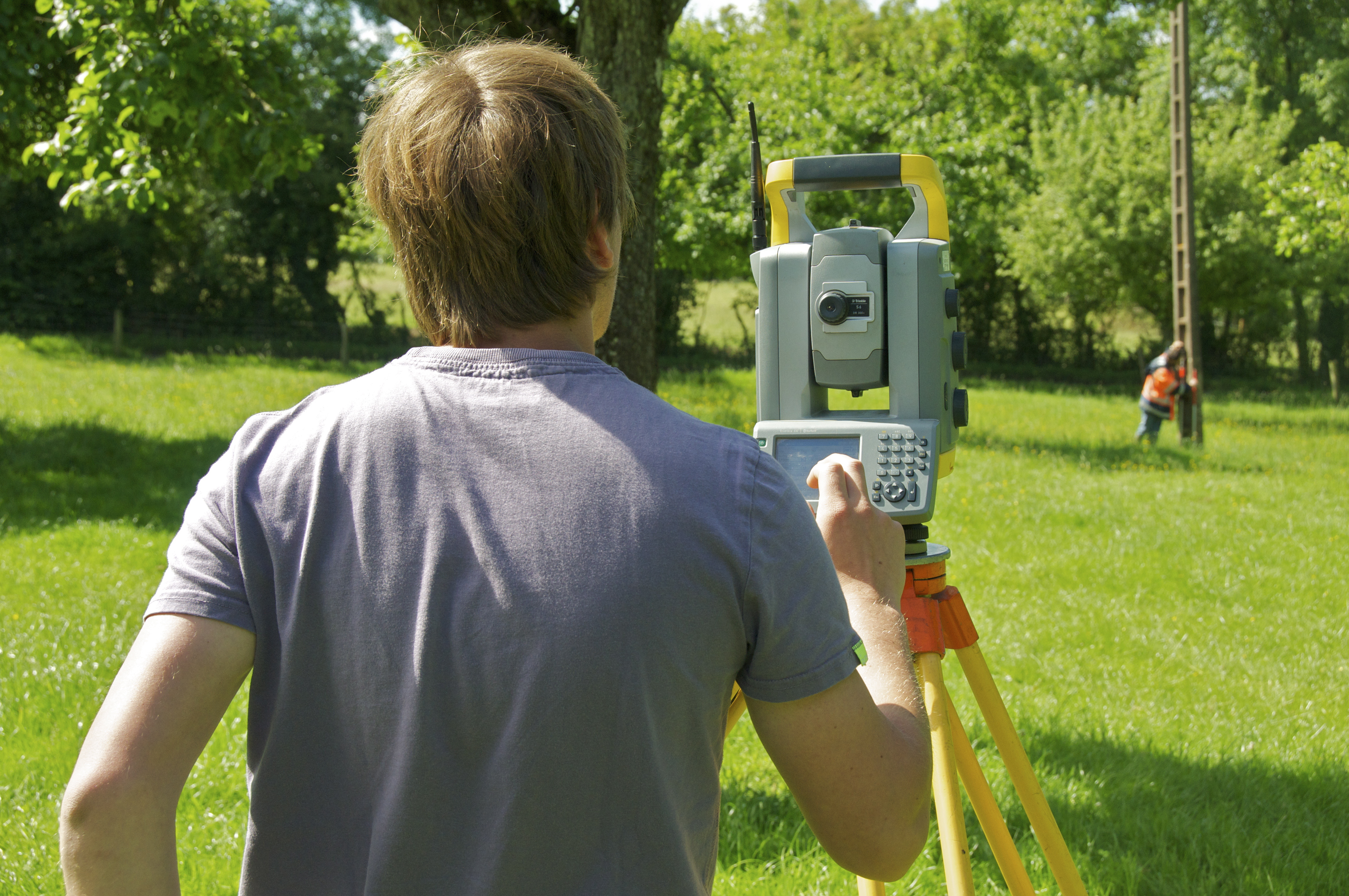 If you want to place boundaries in Odessa, maybe you should get a land survey. Land measurements can be difficult to make because there are constant changes in elevation. Even more so, where the land is flat, the lengths of the land can take time to accurately notate. That is why a land survey is important to have to mark territories. Landmark Professional Surveying is a company that provides accurate, expert land surveying. Here is what landowners should know about a survey and how it can help them avoid future problems.
Land Survey in Odessa Presents Accurate Ownership
A land surveyor can measure land and determine the property’s physical and legal boundaries. Land survey maps are also legally binding, and a surveyor is often called in court to support claims by either party that emanate from a map he has created. This is why accurate land surveying can help recover lost land. Without a survey, you may be underestimating the size of your land. Not only that, having a legal document will provide protection.
A Survey Can Reveal Service lines
When developing a property, it is crucial to follow zoning regulations. As a builder, you can only follow these regulations with an accurate survey. That’s because an accurate survey can show you where service lines lay. This includes electrical, water, and sewage lines that can mark where it is appropriate to build . This is crucial because you will avoid your property getting brought down for violation of these regulations. Even more so, you can avoid accidents from unintentionally hitting lines.
Safeguard Your Property
Therefore, if there is ever a property dispute, a survey can provide a factual info. Without a survey map, any claim would be groundless. It may happen that the government tries to take your land for public interests. In this case they should give compensation. Without an accurate survey map, your land could be under appraised for its true value. By giving the evidence of a land survey, you can regain the value of your land. A legal document is your best defense.
A land survey in Odessa can go a long way into protecting your rights as a land owner. By accurately representing the borders of your property, you value your land properly. At Land Mark Professional Surveying, we want to use our experience to help you protect the land you own. Our experts are prepared to help you and answer any questions. Contact us today.
What Are Boundary Surveys and Why Are They Needed?
14 December
Boundary land surveys are necessary in order to determine the exact dimensions of a land that has been left to someone else. Not only will these kinds of surveys make sure that the parcel of land matches land spelled out in a will, but also find out whether or not the land has been encroached upon, and if the land is subject to any regulations at both the state and local level. There are phases of a boundary land survey that are necessary in order to make sure the rules are followed when performing one of these land surveys.
Research Must Be Done
The first step of land boundary surveys is to make sure that the land surveyor does the proper amount of research into the records involving the parcel of land. A boundary survey can be good for up to 30 years, or if/when whoever owns the land decides to break it up and sell pieces.
The Records of Boundary Construction Must Be Examined
The state of Texas has recorded data on every piece of land in the state. When the dimensions of a particular piece of land are in question, it is the job of the land surveyor to go through these records, and all documentation, to determine the boundaries. This is why it is essential that an accurate boundary survey is done, which is why you need the services of Land-Mark Professional Surveying, Inc.
Check Into All Boundary Construction Information
Land surveyors will begin at the Texas General Land Office, but this is not the only record office they must check over. They must also head on over to the county clerk, the county appraisal district, utility companies, and any other departments that may have any information about the piece of land in question. From all of this information, a land surveyor will create a sketch of the land based on the information that was uncovered.
The Field Work and Final Survey
After all records have been looked at, and a sketch has been created, it is time for some work out in the field. At this time, it is time for an actual survey, and a land surveyor may use the aid of technology such as a GPS device. Once the land has been scanned, and technology has been used to map it out, then a final survey is done, and all lines of the land are located.
When it comes time for a land boundary survey, Land Mark Professional Survey, Inc., is able to handle such survey. Contact our offices today for more information.