Land Surveying in the Age of Coronavirus and New Technologies
29 July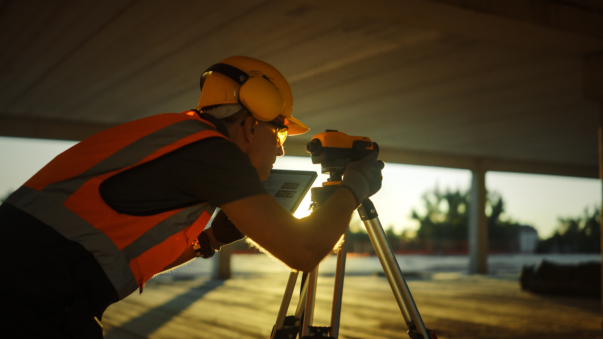 Much of the world hit the pause button in the middle of March up to May and even continuing on into the summer of 2020. It has been a strange year for everyone worldwide but despite the many changes and shifts, land surveyors have continued to do their jobs in mapping out our world. As it turns out, surveying land is a pretty essential endeavor and one that we may not realize impacts our lives pretty significantly. The last few decades have had a considerable effect on land surveying, as technologies have improved and embedded themselves in the process. We thought we’d take a look at some of the changes in the industry in the past couple of years and how we have coped with the changes of the virus.
The Close Call — Keeping Land Surveyors Working Through the Pandemic
Across the country, governors made moves to protect their populations by shutting down what they considered ‘non-essential’ businesses. This led to a lot of other businesses to question the metric of ‘essential.’ Who, after all, decides what is essential and what is not in American life. Surveyors across the country began to make a case for their services as quite essential.
President Trump issued two national emergency declarations under the Stafford Act and the National Emergencies Act. Several players petitioned to keep surveying operations open and exempt from the governor’s orders. The letter making this case was shared with other parties including the National Society of Professional Surveyors, which encouraged surveyors all across the country to send to their governors preemptively to prevent shutdowns of surveying operations. While some governors exempted surveyors by name, others did not consider our work particularly necessary. Many appealed this by showing how surveyors are actually critical to the economic well-being of the state. The reason being that many government construction or private construction, building permits, or other infrastructure cannot proceed without a survey.
According to many surveyors across the country, some private-sector jobs have been put on hold by the pandemic but many public sector jobs have increased. This might be because localities and other entities are taking advantage of the reduced traffic and crowds to work on important city projects.
At the same time, land surveyors are not exactly working amidst large crowds. Our profession is pretty isolated and doesn’t require large teams or working in highly trafficked areas. All of our work can easily be done with social distancing and by taking precautions. Here at Land-Mark, we continue to do our important work while ensuring that all of our workers and any member of the public we might come across, is protected.
Another aspect of our industry that has changed considerably has been the use of new technologies. These, of course, have been in the works for many years at this point. We’ve written about how GPS technology specifically has altered our industry, but technology has impacted us in several ways:
Accuracy: Modern instruments allow land surveyors to have an accuracy of measurements. Compared to the tools in use even a decade ago, the accuracy has improved exponentially.
Speed: Today, the speed of the surveying process has also greatly been improved by technology. Accurate results can be presented in a few hours, allowing for projects and infrastructure to get rolling. With the use of drones, for example, areas can be surveyed without exceeding human effort.
Improved possibilities: Development really begins with the land surveys and thanks to the improvement of technology, we are able to create surveys that create even more building possibilities. A lot of cities that are approaching development in a smarter, high-tech way, is a result of improved results in the land surveying arena.
As cities grow, there might be limited space available and large metropolitan areas have to get creative about the way they develop some of these areas. Cities often have to perform complex planning in small and complicated areas. Land surveying is imperative when looking to make the most out of space.
As we look to the uncertain future, we know that land surveying will continue to improve as technology improves. Automation and artificial intelligence will surely trickle into the industry, as they have already begun to do so. The use of drones, for example, has become useful in surveying difficult terrain. Other features like cloud-based storage and instant data seem to be right on the horizon.
Get Accurate Land Surveys for Your Project
Whether you are involved in a private contract, government contract, or public sector infrastructure project, Land-Mark Land Surveying is here to provide the quality land survey you need. Get the right view of the land and proceed with confidence.
Where Technology and Infrastructure Meet
15 June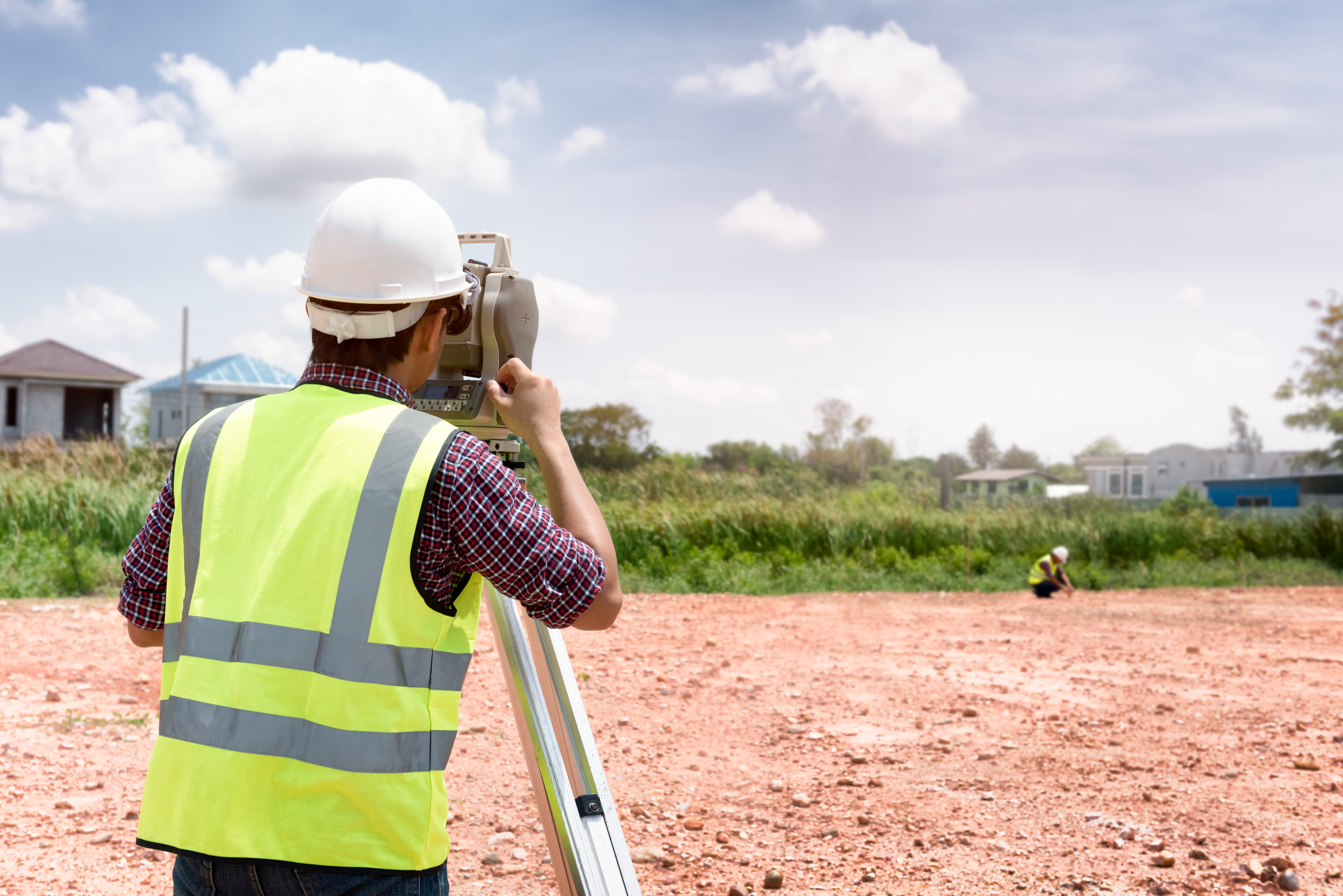 Since 1991 Land-Mark has been at the forefront of the land surveying industry. A lot has changed since 1991, of course. In the early nineties, very few people could imagine that their cumbersome beepers would be transformed into sophisticated mobile devices capable of helping them navigate unknown territory (figuratively and literally), facilitate immediate communication across the globe, provide up-to-date news, take decent photographs, and store hundreds of bits of information. Similarly, technology has found its way to land-surveying and other relevant industries, providing equipment that increases accuracy and efficiency.
We use a variety of equipment, depending on the specific job, land, and project at hand. One of our trusted partners includes the company TopCon. These guys are highly innovative and perfectionists in developing new systems and equipment to improve the construction and planning of infrastructure and land planning. Topcon provides the positioning technology for surveyors, civil engineers, construction contractors, equipment owners, and operators. The geospatial solutions from Topcon have the most in-depth precision measurement for land mapping and surveying.
The Use of Digital Systems in Construction, Infrastructure, and Mapping
As land surveyors, Land-Mark is at the opening stages of a construction project. We form, however, part of the bigger picture that is all infrastructure building and construction. The use of technology in all stages of the construction industry has improved construction’s accuracy, safety, and efficiency.
In 1927, as TopCon points out, the world had 2 billion people. Only about one hundred years later did that number rise all the way to 7 billion. This means thousands of more acres developed, millions of more buildings erected, hundreds of more cities extended and expanded, and a constant and consistent demand for better and smarter building solutions.
A Few Amazing Examples….
Building great structures has always come at a human cost. There is not only a demand for human toil and labor but a high risk of accidents and injuries in any construction site. Any great building or structure you can think up has come at a cost of human lives. Some projects have been more successful than others. The Golden Gate bridge, for example, had 11 laborers died, a neighboring bridge, the Oakland Bay Bridge, had 28 people die in its construction. The World Trade Centers had 60 construction deaths. Recent technology, however, has allowed engineers to survey an area using drone technology without putting human lives at risk. A TopCon project to repair the Great Wall of China would have required workers to traverse a dangerous area. Instead, they sent a drone that was able to take thousands of high-resolution images that could then be input into a 3-D model, that was then used to examine the area and determine what needed to be done.
Measurement instruments have improved the ability for land surveyors like ourselves to enhance our workflow and improve our accuracy. Another great thing that technology offers is that added guarantee of accurate measurements and absolute efficiency. Land-Mark personnel is trained in a variety of high-tech and highly-specialized equipment that will ensure the proper mapping and measurements of your land project.
Explore the Wonders of Accurate Land Surveyors
So whether it is expanding a university campus in the middle of the growing El Paso central area or any other construction project in Las Cruces or Odessa, we are here to provide the most accurate topographic, stand land, improvement, and above and below grown surveying in the Southwest. Call Land-Mark today and find out more about our exciting projects in the area, both private and government work, that will show our dedication and find out about what we can do for your upcoming project.
A Few FAQs About ALTA Land Surveys
18 May If you are buying a piece of land in Las Cruces, you have probably been asked by the bank or titling company for an ALTA survey. You may be irritated that you need to obtain such a detailed land survey, but this document provides a wealth of info about the property at hand. It may be more costly, but it is an excellent document to have to avoid issues later on down the line. We have answered a few frequently asked questions about these specific surveys here.
Why Do I Need an ALTA Survey?
This land survey is quite detailed, as mentioned before. It can be a bit more costly than the average land survey, but with reason. Title companies as well as lenders may ask for this survey. It can happen either when you are buying, selling or refinancing a property. Most often times, lenders are looking to avoid “survey risks.” This can include disputes over boundaries, encroachments and other difficult issues that can lead to problems and even lawsuits down the line. An ALTA Survey would reveal any of these issues and more. Even if the bank or titling company doesn’t require you to purchase this detailed survey, it may be advisable to avoid problems. This can be especially true when purchasing vacant land that has never been surveyed, or has been survey over a decade ago.
Why is an ALTA Survey More Costly?
Some land buyers in Las Cruces may be unhappy with the higher cost of an ALTA Survey. However, this type of survey is only performed by a registered, licensed surveyor. It means specific standards outlined by the American Land Title Association (ALTA) and the American Congress of Surveying and Mapping (ACSM). In essence, this survey meets the highest standards recognized throughout the U.S. It includes much more detail than most other land surveys. This can include boundaries, fences, utility lines, roads, easements and areas that have been improved.
How Do I Get Started With a Land Survey?
Getting started with any kind of survey in Las Cruces is as simple as calling us up at Land-Mark Professional Surveying, Inc.. We are one of the best and most reliable land surveyors in the Southwest. We provide a wealth of services to help you with your property. Whether you are buying, selling or refinancing a piece of land, our certified experts can help. Contact us today for more info.
Land Surveys in Odessa
18 April Land surveys are essential for certain circumstances. Surveying is the process of calculating and measuring specific points in relation to each other. It is used to create maps, establish boundaries and more. Land surveyors in Odessa use a wide range of tools to complete the task at hand. When you hire a firm to conduct a survey you may be baffled at the info they provide. You may even find it hard to understand some of the terminology, or even what surveying may be all about. We have a few facts here for you.
Understanding Land Survey Terms
The first thing to understand about a land survey is the fact that wide range of units of measurements can be applied. Surveying even pretty much has its own language rooted in a deep history of tradition and accuracy. The best thing you can do is speak directly with your surveyor over the questionable terms at hand. Most firms will provide a glossary for client use.
Determine Land Size and Measurements
Surveys are often used to find the exact size and measurement of a plot of land at hand. This can be useful for government use when city lines and districts are drawn. Map making is a large part of the survey industry. This can include creating road, topographical, and other types of maps. State-of-the-art technology, GPS tools, and satellite imaging are employed to create accurate intelligible maps.
Land Survey for Construction in Odessa
A survey is an important part of any construction project. Surveyors provide vital info that can streamline and improve construction projects. A surveyor can inform engineers the best place for roads, drainage, buildings, parking and more. They can also provide info concerning the makeup of the soil and land, which in turn can affect which equipment and processes will be employed.
Find the Proper Land Boundaries
Finding the proper land boundaries is a large part of surveying. Establishing boundaries to put up fences or settle disputes is an important part of the industry. Overtime land lines that aren’t marked can shift, leaving landowners shortchanged.
Contact Us Today
If you are interested in hiring Land-Mark Professional Surveying, Inc. in Odessa be sure to contact us right away. We offer a wide variety of surveys and can help you in any circumstance. Whether you have a new construction project or you need to establish boundaries, our experts have the experience to provide you accurate, timely service. Give us a call today for more info.
How Land Surveying Set America on Its Upward Trajectory
8 December If you require ALTA surveys in Las Cruces, you’re taking part in a historical moment. Land surveys and land surveyors have been a crucial part of American history for centuries. In fact, many presidents of this great country had the distinction of being land surveyors at one point or another. If you require assistance with ALTA surveys in Las Cruces, choose Land-Mark Professional Land Surveyors!
Washington, Jefferson, Lincoln: American’s Land Surveyors
George Washington, Thomas Jefferson and Abraham Lincoln have more in common than the presidency. They all worked as land surveyors. In fact, the first two were Surveyor General for Virginia. At the young age of 17, George Washington was appointed as the Surveyor General of Virginia. Years later, Thomas Jefferson received the same designation as Washington, as County Surveyor for Albemarle County in Virginia. Under Jefferson’s careful tutelage, he appointed surveyors which resulted in the necessary direction to achieve the most orderly settlement acquisition. Abraham Lincoln served as Deputy County Surveyor in 1833, at the age of 24. In less than thirty years, he would become the 16th President of the United States.
The art of land surveying requires an individual to have careful and proper foresight. Through proper land surveying, the space can be used to its fullest extent. Land surveying is an apt metaphor for the presidency. The three men listed above undoubtedly used the skills and experiences they gained from their days of land surveying during their presidencies. It’s no wonder why they helped shaped the United States we know today!
Lewis & Clark: Discovering the True Beauty of the United States of America
Although Merriwether Lewis and William Clark may be most well known for their expedition, they got their start as land surveyors. Their days as land surveyors gave them the skills necessary to properly traverse through the land acquired in the Louisiana Purchase. Basically doubling the size of the United States, the Louisiana Purchase is seen as one of the most important chapters in early American history.
The Importance of ALTA Surveys Today
ALTA surveys in Las Cruces make use of the decades and decades of history and importance set before them. ALTA surveys follow strict guidelines set forth by the American Land Title Association, which got it start in 1907. Land surveying is deeply rooted in American history. If you require an ALTA surveys in Las Cruces, contact Land-Mark Professional Land Surveyors today! We understand the importance of land surveying so our services are as reliable and dependable as you deserve them to be.
How is a Land Survey Conducted?
16 November An El Paso land survey might seem like a mystery at first. You may need a survey and not even know how the experts conduct the process. Surveying is technique the experts use to map out points and distances on a piece of land. A land surveyor is the expert that conducts the process. Others use the land marks they set to make maps or set boundaries for property ownership. Most developers can’t start construction without a survey. If you need one conducted for construction or land purchase or sale in El Paso LandMark Professional Surveying, Inc. can help.
The Rectangular Survey System
Land surveying is all about determining measurements of pieces of land. The Rectangular Survey System also called the Public Land Survey System (PLSS) is the process that surveryors usually use throughout the United States. The system is setup on a grid. The main goal is to find out approximate values of one mile square sections. It is actually one square mile of space. This is the main system used because it is accurate and precise.
Existing Property
A surveyor starts by finding out what the property owners legally needs. There are many different reasons why you would need a surveyor in El Paso. Perhaps you”ve bought a property and want to know where the property boundaries are so they can go about making an addition. They might have an existing property and want a topographical survey done so they understand the grades on that land better. Land surveys don’t just map property borders. Surveyors can also provide helpful info about the terrain.
How do Surveyors Conduct a Land Survey?

The first step is to find where the property sits in relation to the other sites around it. This is usually accomplished by finding the property bars which are metal stakes placed in the ground at each corner of the property and often at intervals in between. The expert surveyors look for these bars. The surveyors use a variety of methods to make sure the property stakes are related to each other and the property around them. For example, a land survey could very well need to show a few of the other benchmark property markers used in the area before by other surveys to show this kind of relationship.
Even if you don’t quite understand the process, you may need one done on a specific piece of land. Land-Mark Professional Surveying has been providing service for the El Paso, Las Cruces, and Odessa areas for over 25 years. Please contact us today for more info.
A Land Survey Helps Avoid Cemeteries, Gas Lines, and More
25 October If you want to place boundaries in Odessa, maybe you should get a land survey. Land measurements can be difficult to make because there are constant changes in elevation. Even more so, where the land is flat, the lengths of the land can take time to accurately notate. That is why a land survey is important to have to mark territories. Landmark Professional Surveying is a company that provides accurate, expert land surveying. Here is what landowners should know about a survey and how it can help them avoid future problems.
Land Survey in Odessa Presents Accurate Ownership
A land surveyor can measure land and determine the property’s physical and legal boundaries. Land survey maps are also legally binding, and a surveyor is often called in court to support claims by either party that emanate from a map he has created. This is why accurate land surveying can help recover lost land. Without a survey, you may be underestimating the size of your land. Not only that, having a legal document will provide protection.
A Survey Can Reveal Service lines
When developing a property, it is crucial to follow zoning regulations. As a builder, you can only follow these regulations with an accurate survey. That’s because an accurate survey can show you where service lines lay. This includes electrical, water, and sewage lines that can mark where it is appropriate to build . This is crucial because you will avoid your property getting brought down for violation of these regulations. Even more so, you can avoid accidents from unintentionally hitting lines.
Safeguard Your Property
Therefore, if there is ever a property dispute, a survey can provide a factual info. Without a survey map, any claim would be groundless. It may happen that the government tries to take your land for public interests. In this case they should give compensation. Without an accurate survey map, your land could be under appraised for its true value. By giving the evidence of a land survey, you can regain the value of your land. A legal document is your best defense.
A land survey in Odessa can go a long way into protecting your rights as a land owner. By accurately representing the borders of your property, you value your land properly. At Land Mark Professional Surveying, we want to use our experience to help you protect the land you own. Our experts are prepared to help you and answer any questions. Contact us today.
What Does the Cost of a Land Survey Depend On?
4 October
Getting a land survey in Las Cruces is important if you are going to purchase or develop a property. Although it may be a cost you want to skip, a land survey pays off in the long run. Even more so, you may require a land survey to secure financing or to get permits for development. It is important to budget for this cost while you plan for your closing costs on a real estate purchase. You should consider this cost when planning for the development costs for a construction project as well. Land-Mark Professional Surveying, Inc. can provide you with a professional land survey in Las Cruces. Give us a call today to find out about the services that we provide and about the costs associated with that service.
How Much Will I Pay for a Land Survey in Las Cruces?
Land-Mark Professional Surveying, Inc. provides surveying services which are affordable to property owners, investors, and developers. There are many different factors which will go into determining what the cost of surveying a particular plot of land will be. For example, several key things that can affect the cost of a survey include the type of survey to be performed; accessibility of the property; size and shape of the property; time of year; vegetation on the property; and terrain. The cost will also vary depending upon the existence of records on the property, whether there are conflicting deed calls, and what applicable standards of performing the survey. So, if these components sound unfamilar to you, our experts can walk you through every step of the process.
Getting Help with a Land Survey in Las Cruces

If you need a land survey in Las Cruces, have a consummate professional conduct your survey. Find out more about your options for completing your survey for an affordable price; Contact Land-Mark Professional Surveying, Inc
A Land Survey Helps Avoid Cemeteries, Gas Lines, and More
9 September If you want to place boundaries in Odessa, maybe you should get a land survey in Odessa. Land measurements can be difficult to make since there are constant changes in elevation. Even where the terrain is flat, the lengths of the land can take time to accurately notate. That is why a land survey is important to have to mark territories. Land-Mark Professional Surveying is a company that provides accurate land surveying. Here is what landowners should know about a survey and how it can help them avoid future problems.
Land Survey in Odessa Presents Accurate Ownership
A land surveyor can measure land and determine the property’s physical and legal boundaries. Land survey maps are considered legally binding, and a surveyor is often called in court to support claims by either party that emanate from a map he has created. This is why accurate land surveying can help recover lost land. Without a survey, you may also be underestimating the size of your land.
A Survey Can Reveal Service Lines
When developing a property, it is crucial to follow zoning regulations. As a builder, you can only follow these regulations with an accurate survey. That’s because an accurate survey can show you where service lines. So, this includes electrical, water, and sewage lines that can mark where it is appropriate to build . This is crucial as it will avoid your property coming down for regulation violations.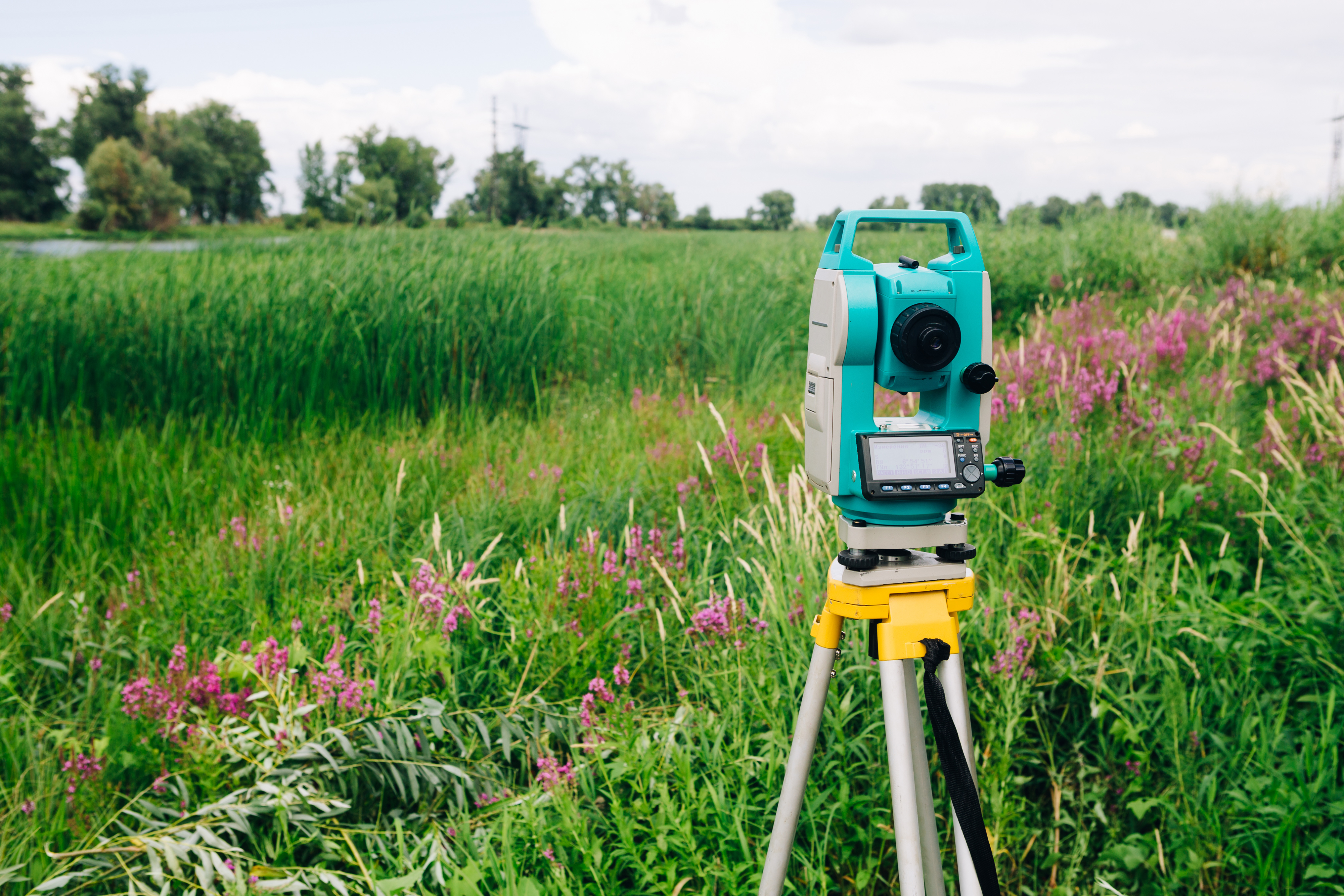
Safeguard Your Property
If there is ever a property dispute, a survey can provide a factual resolution. Without a survey map, any claim would be groundless. If the government is trying to acquire your land for public interests, you should receive compensation. But, without an accurate survey map, your land could be under appraised for its true value. By presenting the evidence of a land survey, you can regain the value of your land.
A land survey in Odessa can go a long way into protecting your rights as a land owner. So, by accurately representing the borders of your property, you value your land properly. At Land-Mark Professional Surveying, we want to use our experience to help you protect the land you own. So, contact Land-Mark Professional Surveying today!
3 Common Uses for a Land Survey
19 August A land survey is important when entering into many kinds of real estate transactions and when investing in real estate. If you are purchasing, selling, or developing a property in the Odessa area, you need to get a land survey. This way, you will have the essential information you need about the land. This knowledge will prepare you to move forward. Land-Mark Professional Surveying, Inc. offers many different kinds of surveys and can perform the assessment of your land that you need.
3 Common Uses for a Land Survey
Many people in Odessa will get an ALTA/ACSM survey when they are purchasing a property. This kind of survey is a combination survey which looks at the boundaries of the land, which notes improvements of the land, and which provides a graphical representation of the territory. The information is helpful to title insurers because the ALTA/ACSM survey shows encumbrances, easements, right of ways, and related adjustments. The information also helps homeowners who know exactly what they are buying.
A second common use for a land survey is to identify topographic features. Topographic surveys use GPS and other technologies to determine specific places on the land and points on the land. A topographic survey can make it possible to create a base map, which allows for development.
Finally, a third type of land survey is a simple boundary survey. So boundary surveys help homeowners by letting them know where their own land ends and a neighbor’s land begins. A simple boundary survey is essential if the land needs any improvements to be done.
Getting a Land Survey in Odessa
Are you interested in a land survey for property that you are buying, selling, or developing? Then Land-Mark Professional Surveying, Inc. can provide you with the necessary services. Don’t go ahead until you’ve had a land survey done and completed! Get the right start. Contact Land-Mark Professional Surveying, Inc. today to learn more.