The Search for Shackleton’s Ship: The Man, The Myth, & the Land Surveying Legend
25 January
The early days of exploration are filled with eccentric historical characters that took incredible risks to venture forth into the unknown. The drive to be part of geographical and scientific discovery led many to treacherous lands. Explorers from Marco Polo (who traveled along the Silk Road) to Christopher Columbus (credited with discovering the new world’) and Ferdinand Magellan (the first European to cross the Pacific Ocean), the age of exploration was one of the exciting discoveries that would change the course of history and people’s understanding of the earth, its landmasses, its oceans, and its natural landscapes.
Through it all, these explorers took on the role of land surveyor, as they all made notes and observations of the lands and used early land surveying instruments to navigate and orient themselves.
This month, we go back in time to explore the story of Ernest Schakelton, a somewhat controversial and misunderstood historical figure.
The Heroic Age of Antarctic Exploration and the Men That Searched for Answers
During the late 19th century and early 20th century, Antarctica was (and continues to be to some extent) a mysterious muse that calls enticingly to the hearts of those with a dangerous proclivity for adventure and the unknown. During that time, Antarctica was a great mystery, one that promised a level of adventure to fulfill the innate drive of any curious explorer. The exploration of the “Tiera Incognita” was largely limited.
In 1895, a Congress meeting in London declared the exploration of the Antarctic continent as “the greatest piece of geographical exploration still to be undertaken.”
Ernest Shackleton, the Man
Like many discovery expedition leaders of the time, Shackleton has accrued a certain amount of ‘street cred’ in the long list of fearless explorers. Before he set sail for the unknown, however, Shackleton was the son of a doctor born in Ireland. In his early teens, his family moved to London. Already harboring an innate call for adventure, young Shackleton would defy his father’s wishes of following in his footsteps and going to medical school for a chance to join the Royal Navy. He was only 16 when he joined and qualified as a master mariner in 1898. He traveled extensively with the Navy but had a secret love for the promise of exploring the Arctic, which was all the rage at the time.
Ernest Shackleton, the Legend in the Making
In 1901, young Ernest Shackleton got his first taste of polar exploration when he was chosen to go on the Arctic expedition led by the famous Robert Falcon Scott. They set sail on the ship ‘Discovery’ towards the South Pole and got closer than any other expedition had before. The ship traveled in harsh conditions and met severe resistance, but Shackleton became gravely ill and had to return home.
About eight years after his first polar expedition, Shackleton returned to treacherous seas onboard the ship ‘Nimrod.’ On this voyage, his crew met some extraordinary circumstances, made some important discoveries, and climbed Mount Erebus. Upon his return to England, he was knighted.
The Endurance Sets Sail
In 1911, an expedition led by Roald Amundsen was the first to reach the South Pole. About a year later, another expedition led by Robert Falcon Scott also reached the South Pole, although without the knowledge that they had in fact been beaten by Amundsen’s party. Sadly, Falcon’s expedition perished on the return home. Amundsen’s expeditions, however, would bring back land survey data that would be useful to the scientific world including data that documented a great chain of mountains from Alaska to Patagonia. This ice barrier was believed to be a big obstacle to further Antarctic exploration.
The Endurance Expedition was tasked with crossing the Antarctic continent from one end to the other through the South Pole. Despite the widespread news of Robert Falcon Scott’s tragic end in his expedition, volunteers jumped at the idea of sailing to those treacherous lands. The expedition was set to set sail as World War I was breaking out. Shackleton himself offered up his ship for the war cause but was told to proceed with the expedition.
Once the Endurance set sail from a short stay in South Georgia where they collected provisions, the ship battled her way through thousands of miles of pack ice.
A Ship Stuck in the Ice
Then, the ice closed in around the ship. The ice around the ship gripped it tight and dragged it, drifting them further away from their intended course. The ship would be frozen in for the winter and one of two scenarios were likely to occur:
- The ice around the ship would melt in the Spring and set them free
- The ice would continue to put pressure on the ship and crush it
Meanwhile on board, the crew played hockey and sports games on the ice, trying to make the best out of a dire situation. Eventually, the situation led Shackleton to conclude that the ship was lost and they must abandon it. This meant the crew was floating on ice with no hope of being rescued.
The crew had to split up and Shackleton led a few men on a lifeboat to try and seek help at the nearest whaling station hundreds of miles away in South Georgia. It was a treacherous journey but the only hope. The men fought giant waves, cold weather, overcast skies (which hindered navigation) but they carried on. They managed. Once they made it to South Georgia, they had to cross mountains to reach the whaling station, another treacherous journey. They finally reached it and made their plea to go back and rescue the others. Shackleton did not give up on the remaining men and managed to get boats and help to go back and rescue half of his crew left behind. Not a single man of Shackleton’s 28-man crew was lost.
The Adventurous Spirit and The Advancement of Land Surveying and Navigation
The spirit of discovery and understanding our planet is still very much part of land surveying all over the world. In Feb 2022, an expedition led by advanced technological land surveying and navigating equipment will attempt to locate and find Shackleton’s lost ship.
And while we’re not out exploring the South Pole, Land-Mark Land Surveyors continue the tradition of land surveying here in the Southwest. We survey land before it is used for residential or commercial purposes. Call us to learn more!
Every Good Engineer Starts With a Topographic Survey
16 July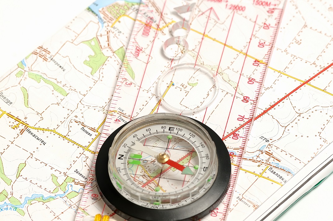 Whenever an engineer begins to sketch out a construction project, they cannot use an ordinary map. This is because an ordinary map will not tell them everything about the land they want to build on. It may explain what is there, like cities or major landmarks, but it will not explain dimensions, heights, or what could be underneath. This is where the need for a good survey comes in. However, you do not want to use just any survey, but rather one that will outline the land in detail. This means getting a topographic survey done. Any engineer worth their salt will want to start with one of these surveys first. In the Odessa area, there is one company that can help you get the quality survey you need for construction. Land-Mark Professional Surveying, Inc., is a quality company that can help you get your construction project started off right.
What Is a Topographic Survey?
A topographic survey is required whenever you are trying to get an idea of any property you own. These surveys focus on every and any aspect of the land. Trees, hills, valleys, even manholes will be included in the reports for these surveys. All this info is designed to let you know where things are, and what might be obstacles too big to build over. this kind of information is useful to engineers, architects and construction workers. All of them rely on the information provided in order to stay on time and keep their people safe.
Why Do I Need a Topographic Survey?
Getting a topographic survey is useful whenever you are planning a construction project. The info provided will help your engineer and architect decide the best place to begin construction or what they need to build around. Having the lay of the land spelled out in dimensions and graphs will also help them see which areas of your land need to be avoided. This info helps an engineer decide how to proceed with the project. In order for this work, of course, you need a quality topographic survey to be conducted.
Contact Us Today
If you are planning any kind of construction project, then you need a company that understands the local Odessa area. Let Land-Mark Professional Survey help you get started on construction. We offer a wide variety of surveys and our experts have years of experience. Call today to set up an appointment!
Superior Planning With a Construction Survey
15 June Before any construction project can begin, a survey of the land is required by law. This process consists of having a professional come out to the property about to be developed. They will then mark out the land, and create map of the property. This map will then be used to decide where and when the construction can begin. Having any project begin without a survey is not only inadvisable but dangerous. Imagine not knowing whether or not there is sand or rock beneath a structure? This is what can happen without a construction surveyor conducting proper work.
What is a Construction Survey
Construction surveys are done to map out the best way to build on a specific piece of land. Included this survey is information valuable to the company, architects and construction workers. This information might include the best place to lay a foundation, or the best spot for drainage. The way the survey is able to do this is by taking a lay of the land and estimating the propensity it has to carry weight. Making these estimations includes the consideration of ground type, weather patterns, and whether or not there might be any obstacles to the construction team. Having a quality survey conducted before building is essential to keeping a project on budget and on schedule.
Don’t Start Your Project Without It
The importance of having a construction survey cannot be underestimated. The information provided by one is invaluable. Engineers use the survey to estimate the best places to build, or add extensions. What if an engineer had to guess where to put a load bearing wall, or beam? What if they guessed wrong and cost the structure its integrity? The cost of rebuilding and trying again could be enormous. Having a survey done not only helps engineers make wise decisions, it also avoids disaster. Planning out roads such as freeways and highways are also easier with construction surveys. In these types of construction projects, surveys help plot out land measurements and routes. For every construction project, a construction survey will help provide valuable information. Having a professional conduct such a survey ensures the success of your constructions project.
Contact Us Today
For all surveying needs in Odessa, turn to Land-Mark Professional Surveying, Inc.! They can help get your project off the ground. Contact them today before starting any construction project.
Land Surveys in Odessa
18 April Land surveys are essential for certain circumstances. Surveying is the process of calculating and measuring specific points in relation to each other. It is used to create maps, establish boundaries and more. Land surveyors in Odessa use a wide range of tools to complete the task at hand. When you hire a firm to conduct a survey you may be baffled at the info they provide. You may even find it hard to understand some of the terminology, or even what surveying may be all about. We have a few facts here for you.
Understanding Land Survey Terms
The first thing to understand about a land survey is the fact that wide range of units of measurements can be applied. Surveying even pretty much has its own language rooted in a deep history of tradition and accuracy. The best thing you can do is speak directly with your surveyor over the questionable terms at hand. Most firms will provide a glossary for client use.
Determine Land Size and Measurements
Surveys are often used to find the exact size and measurement of a plot of land at hand. This can be useful for government use when city lines and districts are drawn. Map making is a large part of the survey industry. This can include creating road, topographical, and other types of maps. State-of-the-art technology, GPS tools, and satellite imaging are employed to create accurate intelligible maps.
Land Survey for Construction in Odessa
A survey is an important part of any construction project. Surveyors provide vital info that can streamline and improve construction projects. A surveyor can inform engineers the best place for roads, drainage, buildings, parking and more. They can also provide info concerning the makeup of the soil and land, which in turn can affect which equipment and processes will be employed.
Find the Proper Land Boundaries
Finding the proper land boundaries is a large part of surveying. Establishing boundaries to put up fences or settle disputes is an important part of the industry. Overtime land lines that aren’t marked can shift, leaving landowners shortchanged.
Contact Us Today
If you are interested in hiring Land-Mark Professional Surveying, Inc. in Odessa be sure to contact us right away. We offer a wide variety of surveys and can help you in any circumstance. Whether you have a new construction project or you need to establish boundaries, our experts have the experience to provide you accurate, timely service. Give us a call today for more info.
What Does a Land Surveyor in Odessa Do?
13 February We get asked all the time — What does a land surveyor in Odessa do? The truth is, the information that we provide within the construction industry is invaluable. We create maps and reports that help avoid catastrophic mistakes all the time. Building in one place or another on a plot of land can affect the timeline, building materials and equipment, and more. We provide information to help a project run smoothly and effectively.
What Does a Land Surveyor in Odessa Do?
A land surveyor is often hired to find the boundaries of a piece of property. This is valuable info for settling disputes, building roads, and creating maps. However, the job duties don’t stop there. They will also look into old surveys conducted of the property at hand. A surveyor will also take his own survey of the land utilizing special tools and expert knowledge. They will create a report and map of the area. The info is so accurate it is actually legally binding. The report that they create can help contractors find the most beneficial areas for building, drainage, parking lots, roads, and so on.
How Can a Land Surveyor Help Your Project?
A land survey of your building project is actually extremely necessary. You don’t want to start a project without a detailed account of your property and land conditions. The architecture will depend on the info provided. If you had previously decided to build in a certain portion of the property but then find out that water will flood the area when it rains you have to make adjustments. A land surveyor in Odessa can help you decide if altering the area would be sufficient to solve the problem. If problems arise that may have been unforeseen to you they can provide insight. This can include land that is extremely rocky and requires special equipment to dig into. Or perhaps soil that is too soft to build a foundation on.
Contact Us Today
If you are about to embark upon a new building project be sure to call our land surveyors in Odessa in to provide the info you need. We can help your building and timeline run more smoothly without the annoying hangups due to unforeseen circumstances. At Land-Mark Professional Surveying we provide thorough, reliable service. Contact us today before you get started on your next building project in Odessa.
A Land Surveyor Can Help With Pre-Construction Planning
16 January A land surveyor in Odessa can add value to any project. Utilizing the guidance and expertise of a surveyor is crucial to wise pre-construction planning. They have a wealth of experience in mitigating risks, determining site conditions, minimizing cost delays and so much more!
What Does a Construction Survey Consist of?
A land surveyor conducts specific services for a construction survey. This starts with an assessment of the current site conditions. They will find out how the current land will stand up to above ground and in-ground building infrastructure. They will also collect topographic data to map areas for drainage, piping, and manholes. Surveyors also stake elevations for footings. When you employ an experienced surveyor chances are they are probably already familiar with the land that its at hand. They more than likely are already familiar with the area’s soil, water, natural soundings, habitats, and even protected species. This kind of invaluable information can prove to be invaluable.
How Does a Land Surveyor Help With Pre-Construction Planning?
A surveyor will do much more that site analysis and boundary surveys. They can help to diminish the risks of future and possible regulation enforcement. You can be sure to be free of delays in project schedules when you have a land surveyor on your team. With regulatory planning you can also rest easy knowing your project startups will run more efficiently. Your surveyor will also have established standards for quality control, work production, safety, and schedules. This kind of guidance will only lead to improved project progress and heightened quality.
A good surveying firm will also have software and technology at their fingertips to assist you with planning as well. They will provide data to build models and 3D mapping. Geographic Information System, GIS, software and Building Information Modeling, BIM, are powerful tools to assist with pre-construction. The GIS is great for large scale planning. It is often used for resource management, infrastructure management, zoning and boundaries, market analyses and more. The BIM is useful in planning physical features. This can include gas, power line, communication lines, roads, and more.
Contact Us Today
Land-Mark Professional Surveying, Inc. offers a wide variety of services. Our land surveyors have expert knowledge to assist with pre-construction planning as well as a variety of other boundary and site analysis needs. Contact us today to set up an appointment.
Why are ALTA Surveys Important?
7 April When you are constructing new property or acquiring a piece of land for some reason, it’s very important for a land surveyor to measure boundaries and make a list of which things are where. Sometimes an ALTA survey is needed for land and can be a very extensive process. If you are in the Odessa area and need this type of survey, our team at Land-Marking Professional Surveying can take care of that today. We are trained professionals and know exactly what to do when it comes to this type of survey,
A Strict Survey For A Good Reason
An ALTA survey follows national requirements and can be much more strict and extensive than a regular land survey. It is common for a banking institute that is giving you a loan to request that you get ALTA surveys done on your property. This type of survey is very good at determining the actual value of the land that you are considering purchasing or refinancing. When it comes to making an investment with land there are many requirements and surveys you must get in order to proceed with the processes you are involved in. ALTA surveys will help give you and the other officials the information needed to proceed with the rest.
Is The Investment Really Worth It?
The information that you will get from this type of survey is invaluable and important. With all properties, it is important to know the physical and legal boundaries of the plot of land. This can help everyone determine what is near the land, if there are gas or electric lines, and if there are parks and cemeteries that the land is encroaching on. This is a great survey to get done before the purchasing point because it can essentially help you to decide if you are even still interested in purchasing the land after seeing the report from the survey. Most people just want to know if the specific land is really worth the investment they are planning to make.
Make Sure It Is What You Need
While these surveys can be more expensive, they really do inform the buyer and show very valuable information to all of the parties involved. At the same time, it is always important to make sure you really need one before you go about purchasing one because they are expensive. If you are in the Odessa area, our team at Land-Mark Professional Surveying can perform an ALTA survey when you find out you need one. We have over 25 years of experience and know the importance of accurate information when it comes to purchasing and investing in land.
Contact Land-Marking Professional Surveying!
We have the skills necessary to assess the land and find out as much information as possible about it for ALTA surveys. We are dedicated and committed to helping all of our clients and customers in the Odessa area. If you would like more detailed info on how we can assist you, please do not hesitate to contact us today with any questions you may have!
Why You Should Always Hire a Land Surveyor for Land Transactions
20 December You need to hire a land surveyor Odessa if you are going to be entering into any transactions. If you are selling a property, you may need a survey to know exactly what belongs to you and where the property lines are. You don’t want any unexpected surprises when it comes time to close the deal and you find out the sale can’t close because the title search shows you don’t own the whole property. You also need to hire a land surveyor if you are going to be buying a property so you will be aware of the complete bundle of rights you are acquiring. The good news is, Land-Mark Professional Surveying Inc. makes it easy to hire a land surveyor and get a survey done right.
Why Hire a Land Surveyor Odessa
You should hire Land-Mark Professional Surveying Inc. to make sure that you know where the property lines are so you don’t build on a neighbor’s land. You also need a surveyor to help you understand where utility lines and easements are on the property, and to assist you in exploring the topography of the property in-depth. If you are going to be buying a property by using bank financing, the lender will likely require a survey from a professional to protect their own interests. Which means you may have no choice but to hire a surveyor if you want the sale to go through. If you plan to develop land, you’ll also need a survey to explore the best sites for development and to address issues like drainage.
Surveying Your Land
We have been in business for over 25 years serving the Southwest area. Our clients consider us one of the most dependable and sought out companies for land surveying in the area. We have the experience and expertise you need. When you are ready for a professional land survey Odessa contact us. Call Land-mark Professional Surveying Inc. to find out how we can help you.
A Land Survey Helps Avoid Cemeteries, Gas Lines, and More
25 October If you want to place boundaries in Odessa, maybe you should get a land survey. Land measurements can be difficult to make because there are constant changes in elevation. Even more so, where the land is flat, the lengths of the land can take time to accurately notate. That is why a land survey is important to have to mark territories. Landmark Professional Surveying is a company that provides accurate, expert land surveying. Here is what landowners should know about a survey and how it can help them avoid future problems.
Land Survey in Odessa Presents Accurate Ownership
A land surveyor can measure land and determine the property’s physical and legal boundaries. Land survey maps are also legally binding, and a surveyor is often called in court to support claims by either party that emanate from a map he has created. This is why accurate land surveying can help recover lost land. Without a survey, you may be underestimating the size of your land. Not only that, having a legal document will provide protection.
A Survey Can Reveal Service lines
When developing a property, it is crucial to follow zoning regulations. As a builder, you can only follow these regulations with an accurate survey. That’s because an accurate survey can show you where service lines lay. This includes electrical, water, and sewage lines that can mark where it is appropriate to build . This is crucial because you will avoid your property getting brought down for violation of these regulations. Even more so, you can avoid accidents from unintentionally hitting lines.
Safeguard Your Property
Therefore, if there is ever a property dispute, a survey can provide a factual info. Without a survey map, any claim would be groundless. It may happen that the government tries to take your land for public interests. In this case they should give compensation. Without an accurate survey map, your land could be under appraised for its true value. By giving the evidence of a land survey, you can regain the value of your land. A legal document is your best defense.
A land survey in Odessa can go a long way into protecting your rights as a land owner. By accurately representing the borders of your property, you value your land properly. At Land Mark Professional Surveying, we want to use our experience to help you protect the land you own. Our experts are prepared to help you and answer any questions. Contact us today.
Do I Need to Hire a Land Surveyor or Can I Do It Myself?
23 September If you are buying or developing a property, you need a professional land surveyor in Odessa. Surveying is a highly technical art form and surveyors receive extensive training. They have knowledge of how to conduct surveys in accordance with appropriate standards, and they understand the requirements of surveying land to satisfy requirements by banks or zoning boards. Here at Land-Mark Professional Surveying, Inc., we have extensive experience and can provide the professional help you need to protect your property investment.
Why You Need to Hire a Land Surveyor in Odessa
You need to hire a land surveyor in Odessa when buying land if: land is going to be subdivided; a mortgage loan inspection is necessary; you are building a house; you are building any structure or making any improvements close to the property line; if you are securing permits or insurance including title insurance; or if there is a question about the location of the property line.
You cannot do the survey yourself unless you are credentialed and you have an understanding of formal protocols for performing and recording an accurate survey. Most banks, permit offices, insurers, and zoning boards have strict requirements in regards to the qualifications of surveyors in order to make sure everything is right. Land-Mark Professional Surveying, Inc. has the credentials necessary to prepare a survey that financial and governmental institutions will accept.
Getting Help from Land-Mark Professional Surveying, Inc.
You cannot afford to take a chance and try to conduct a survey yourself when mistakes can be so costly. With this in mind, choose a professional land surveyor in Odessa at Land-Mark Professional Surveying, Inc. You can also have a consummate professional perform your survey. So, don’t leave it up to chance, let the professionals do the hard work for you. Contact Land-Mark Professional Surveying, Inc. today!