Understanding Property Lines: Land Surveys and Maps When Buying Property
28 May Whether you are a large company purchasing acres of your next commercial infrastructure, or your a government agency looking to build some kind of installation, or you’re a property investor, or even a prospective homebuyer looking to buy acreage on which to put your home, a land survey is more than likely relevant to you.
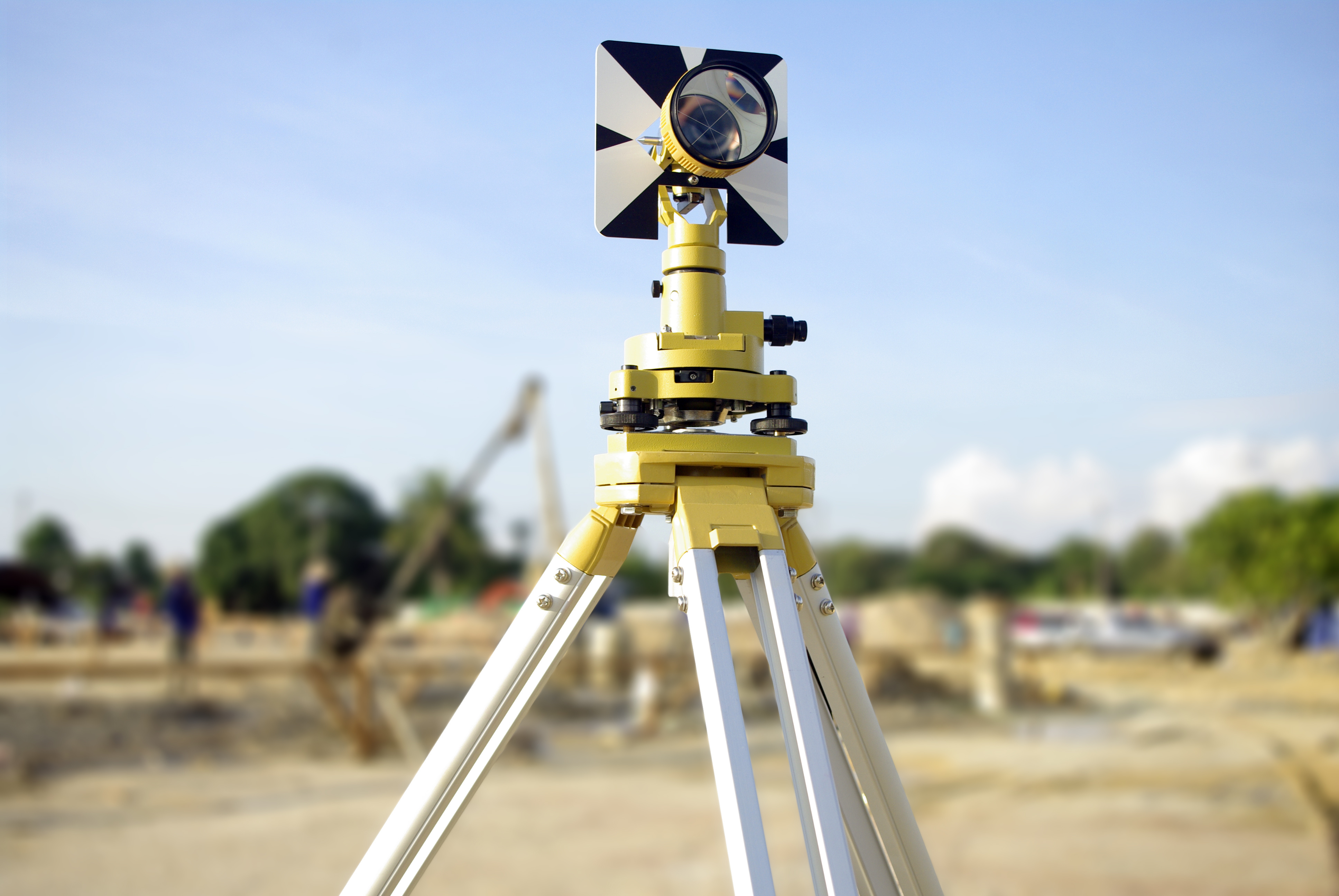
Chances are that, at some point in your life, you have seen land surveyors at work on the side of the road on your everyday commute or drive across town. It looks like they’re taking photographs, as they are looking through a telescopic-looking device sitting on a tripod. And yes, it looks like they’re out there taking panoramic photos or admiring the horizon but really they are hard at work taking specific measurements and mappings of the land. The expertise of a land surveyor is in their ability to determine land measurements, topographic heights, and more.
The Right of Way Surveys
One of the main services of many land surveyors, such as Land-Mark, include what are known as Right of Ways Surveys. This refers to the legal right, established by usage or grant, to pass through specific grounds that form part of someone else’s property. In other words, it is the right of passage to another person’s land or property. The term is a common way that land surveyors and other civil engineers use to describe the ability to access another’s property, as it pertains to land usage rights. Examples of a Right of Way might include utilities— gas, electricity, water, telephone, or drainage— to pass through neighboring land, or if your neighbor must access your land in order to get to their property.
There are a couple of options with this:
Property Right of Way: This type of Right of Way (ROW) allows individual access to a person that needs it in order to reach it another location. This might be common on properties that are adjacent to another property that has the only access to the property in question. This may be in absence of a public walkway, lake, or river.
Public Right of Way: A public ROW allows members of the public to access a right of way that is on private land.
Pipeline Right of Way: This type of ROW applies directly to utilities or services that must access private property. This is when the utility company needs to use this private piece of land in order to provide its services and are vital to its operations.
A land surveyor can help you determine the specific details of the ROW by taking measurements of the property and assessing where the property line begins and ends. It is important that if you are the property owner, that you are aware of any ROW that might pertain to your land.
Before you renovate or develop on your land…
This information is key to the development and maintenance of your piece of property. If you are planning on developing your land or building on it, knowing the specifics is essential to ensure a successful project. You don’t want to find out that you have a ROW after you have built over it or disrupted it in some way. By law, it is necessary that you are aware of these types of details on your property.
A ROW can also refer to land owned by a municipality or company that transports goods and/or people. In a way our streets and highways are located on right of ways and so access to any adjacent properties are always to be provided.
Why is a Land Survey Important for Renovations and Development of Property
Knowing precisely the dimension and topography of any site is essential in order to ensure full compliance and abidance of building guidelines, town plans, etc. Even if you think your renovation project is just a room addition or something simple, knowing the precise measurements and boundaries of your property is necessary.
If you are looking to build on your land, a planning permit and/or building permit may be required. A land survey will be a mandatory part of these planning permits.
Get Necessary Land Surveying with Land-Mark
So if you are a property owner that is looking to develop on their land, understanding the historical data that you must take into account will ensure a successful build, project, or expansion. Owning a ROW is important too, as it informs you of necessary access you must provide to others through your property. Call Land-Mark today to get quality land surveying that is not only done quickly but effectively.
What Can I Do If My Neighbor Builds on My Property?
26 February
Imagine this: you’ve finally found that white-picket fence, American dream of a house that you’ve always wanted and dreamed about, and then…your neighbor starts building on your property. Whether it’s a fence that cuts into your yard or you find your neighbor pruning what doesn’t belong to him, property disputes with neighbors are actually quite common, especially when there aren’t clear barriers or lines denoting whose property is whose. Here are a few things you can do if you find yourself dealing with a property dispute.
#1: Start With a Civil Discussion
Many times, when property disputes happen, simply talking to your neighbor about it can oftentimes resolve the problem. But we know that isn’t always the case, especially when the borders dividing your yards aren’t so cut and dry. If a civil discussion doesn’t cut it, don’t fret because there are other options for you.
#2: Bring it Up With a Property Manager
If you’re renting your property, your property manager may be able to help you resolve the dispute, especially if they are renting out your neighbor’s property as well, as is the case for many neighborhoods in El Paso. However, we’ve seen that many property disputes happen between two people who own the home they live in. If that’s the case, obviously this step is one you can skip.
#3: Contact a Land Surveyor to Help
A land surveyor’s job involves surveying land to identify property lines, among other things. So, if there is a dispute between you and your neighbor, a land surveyor can help you identify where your property lines fall so you and your neighbor can build and install to your heart’s’ content without worrying about building on each other’s property.
#4: Talk to a Lawyer as a Last Resort
If all else fails, a lawyer can help you dispute the barriers as well using the information the land surveyor gathers about your property lines. It’s a worst case scenario but sometimes it has to be done.
The Importance of Land Surveying and Property Lines
Land surveying is important for all sorts of functions in life, from architecture and homebuilding to economics and landscaping. Land surveying can identify property lines, help people build and expand thoughtfully, and can help with things like habitat preservation. At Land-Mark Professional Surveying, Inc., we can help people dispute property boundary issues civilly. Call us today to learn more!
A Few FAQs for Your Land Planning
11 September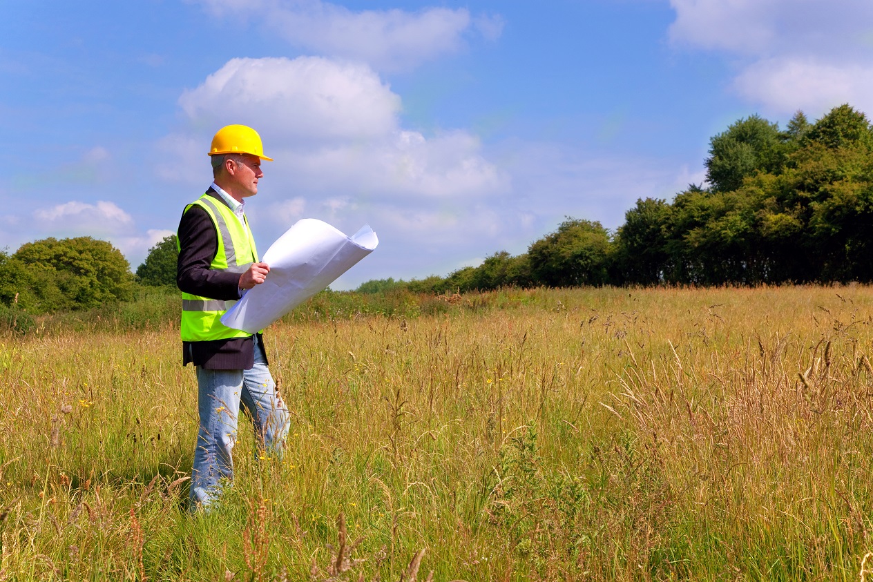 If you are in the process of building on your land, you probably already know that the local government will want a site plan. You will more than likely need to enlist the help of a good surveyor for a land planning survey. On a good note, getting a survey done will also provide you with valuable info for your site planning needs. Whether it is a personal plot and you are building a home, or you are working on a commercial plot to build a retail center, it doesn’t matter! A survey can point out all the different aspects of your land that will impact your building plans. At Landmark Professional Surveying, Inc., we have a few FAQs here for your planning:
Question: Do I Really Need a Land Planning Survey?
Answer: First of all, your local government probably requires some kind of survey in order for you to obtain the proper permits to build on your land. But, as mentioned, land surveys offer valuable info for land planning, as well. This can include the type of ground you are building on, best areas for drainage, finding out if you are on a floodplain or hard rock, and so on. When you are planning buildings and improvements that interact with the land, a survey is always good to have, whether it is required or not.
Question: What Do I Need to Know About Land Planning Surveys?
Answer: First of all, your local survey agency will know the details of your required land survey for permit needs. They will have a firm understanding of what this legal document needs to provide. Not only will they create a proper survey to satisfy permit needs, but will provide info about your land for building purposes. From topography, property boundaries to proposed grading you can be sure to get a thorough account of your land.
Question: How Do I Get Started?
Answer: Getting started on your land planning needs and survey is as simple as giving us a call at Land-Mark Professional Surveying, Inc. We work with builders, architects, and government officials on a regular basis. We have a firm understanding that is drawn from 17 years of experience in the industry. We have provided services to private and commercial land builders in the Southwest region and offer reputable services. Give us a call today to get started on your land survey. We will be happy to answer your questions or set up a consultation.
Land Surveys in Odessa
18 April Land surveys are essential for certain circumstances. Surveying is the process of calculating and measuring specific points in relation to each other. It is used to create maps, establish boundaries and more. Land surveyors in Odessa use a wide range of tools to complete the task at hand. When you hire a firm to conduct a survey you may be baffled at the info they provide. You may even find it hard to understand some of the terminology, or even what surveying may be all about. We have a few facts here for you.
Understanding Land Survey Terms
The first thing to understand about a land survey is the fact that wide range of units of measurements can be applied. Surveying even pretty much has its own language rooted in a deep history of tradition and accuracy. The best thing you can do is speak directly with your surveyor over the questionable terms at hand. Most firms will provide a glossary for client use.
Determine Land Size and Measurements
Surveys are often used to find the exact size and measurement of a plot of land at hand. This can be useful for government use when city lines and districts are drawn. Map making is a large part of the survey industry. This can include creating road, topographical, and other types of maps. State-of-the-art technology, GPS tools, and satellite imaging are employed to create accurate intelligible maps.
Land Survey for Construction in Odessa
A survey is an important part of any construction project. Surveyors provide vital info that can streamline and improve construction projects. A surveyor can inform engineers the best place for roads, drainage, buildings, parking and more. They can also provide info concerning the makeup of the soil and land, which in turn can affect which equipment and processes will be employed.
Find the Proper Land Boundaries
Finding the proper land boundaries is a large part of surveying. Establishing boundaries to put up fences or settle disputes is an important part of the industry. Overtime land lines that aren’t marked can shift, leaving landowners shortchanged.
Contact Us Today
If you are interested in hiring Land-Mark Professional Surveying, Inc. in Odessa be sure to contact us right away. We offer a wide variety of surveys and can help you in any circumstance. Whether you have a new construction project or you need to establish boundaries, our experts have the experience to provide you accurate, timely service. Give us a call today for more info.
ATLA Surveys in Odessa: Why They’re The Best Option
21 November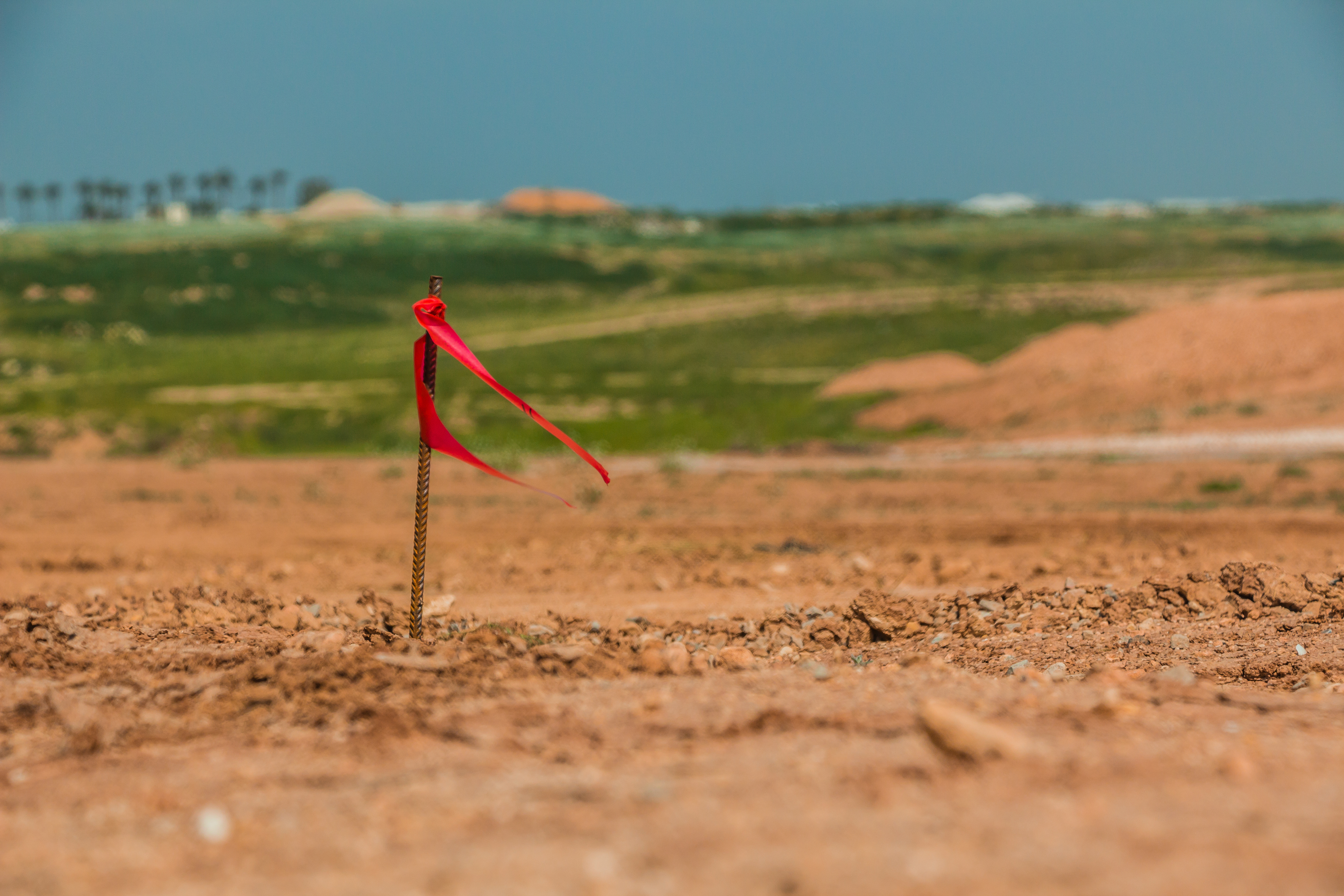 Texas, as a state, has always been a land of opportunity. With so much land available even to this day, this opportunity continues to live on. Take Odessa county for instance. This area of land is vast, it’s a welcome opportunity for individuals from all walks of life to fulfill their dreams and build whatever it is they’ve been wanting to build. Sadly, the days of running up to a piece of land and claiming it for yourself are long gone. Now, there are many legal aspects that must be addressed and dealt with accordingly before any construction can take place.In order to know exactly how far your land stretches and where you can and can’t build, you should consider ATLA surveys.
A Deeper Look at ATLA Surveys
The American Land Title Association has set forth standards which must be followed by registered and licensed surveyors. When preparing a survey in accordance with the ATLA standards, the land surveyor will be more rigorous and intense, providing more detailed information. If you’re in Odessa and you require an ATLA survey, Land-Mark Professional Surveying can help.
Why ATLA Surveys Matter
ATLA surveys are more expensive than ordinary land surveys but the higher cost goes into providing a more comprehensive result. ATLA surveys will provide important information regarding property boundaries in addition to improvements. These can include fences and roads. ATLA surveys also show any means of access to the property in addition to the property’s zoning classification. Common surveys tend to lack the detail necessary for a real estate lender to evaluate the property as properly as possible. This is why ATLA surveys are a much better option.
Learning About ATLA Surveys
When it comes to purchasing land, both the seller and the buyer need to know everything there is to know about said land. Failing to do so could lead to legal disputes further down the road. ATLA surveys yield the most precise results and they will also keep often-forgotten details in mind. This is what makes ATLA surveys stand apart from common boundary surveys.
Choose Land-Mark, Today!
Not all land surveys are created equal. In many instances, a land survey needs to be as detailed as possible. These are instances in which cutting corners or going for a cheaper option is not recommended. If you’re in Odessa and you require an ATLA survey, reach out to Land-Mark Professional Surveying. We’ve been helping individuals from all walks of life gather the information they require to follow their dreams. Contact us today to learn more about what we have to offer!
How is a Land Survey Conducted?
16 November An El Paso land survey might seem like a mystery at first. You may need a survey and not even know how the experts conduct the process. Surveying is technique the experts use to map out points and distances on a piece of land. A land surveyor is the expert that conducts the process. Others use the land marks they set to make maps or set boundaries for property ownership. Most developers can’t start construction without a survey. If you need one conducted for construction or land purchase or sale in El Paso LandMark Professional Surveying, Inc. can help.
The Rectangular Survey System
Land surveying is all about determining measurements of pieces of land. The Rectangular Survey System also called the Public Land Survey System (PLSS) is the process that surveryors usually use throughout the United States. The system is setup on a grid. The main goal is to find out approximate values of one mile square sections. It is actually one square mile of space. This is the main system used because it is accurate and precise.
Existing Property
A surveyor starts by finding out what the property owners legally needs. There are many different reasons why you would need a surveyor in El Paso. Perhaps you”ve bought a property and want to know where the property boundaries are so they can go about making an addition. They might have an existing property and want a topographical survey done so they understand the grades on that land better. Land surveys don’t just map property borders. Surveyors can also provide helpful info about the terrain.
How do Surveyors Conduct a Land Survey?
The first step is to find where the property sits in relation to the other sites around it. This is usually accomplished by finding the property bars which are metal stakes placed in the ground at each corner of the property and often at intervals in between. The expert surveyors look for these bars. The surveyors use a variety of methods to make sure the property stakes are related to each other and the property around them. For example, a land survey could very well need to show a few of the other benchmark property markers used in the area before by other surveys to show this kind of relationship.
Even if you don’t quite understand the process, you may need one done on a specific piece of land. Land-Mark Professional Surveying has been providing service for the El Paso, Las Cruces, and Odessa areas for over 25 years. Please contact us today for more info.
A Quick Guide on Construction Surveys in New Mexico
27 May
Construction Surveys in Las Cruces, New Mexico is an important part of any subdivision that is in the process of development. Land-Mark Professional Surveying, Inc. is highly trained and experienced in conducting the necessary preliminary steps before construction projects are able to begin. We also know just important it is that these projects are carried out properly. Here are some reasons why construction surveying is so critical to the building industry.
Construction Surveys Begin with Land Inspection
One of the most important aspects of construction surveys in New Mexico, includes taking into account the topographical condition of the land. Before any construction can begin, the contours of the land are analyzed. Here in New Mexico, the land is different than other parts of the nation. Our land can be dry and have a mix of sand in the dirt, which is all taken into consideration when assessing the preliminary foundation. These topographical features also includes where the existing drainage patterns are and how the entire area sits in relation to sea level. This is highly important to the elevations that will be used in the construction process. If this part of the process is not properly conducted, it may result in excessive flooding or weak areas in the foundation that cause problems in the future.
Establishing Proper Boundaries
Of course everyone living in a brand new subdivision wants to know where their property starts and where exactly it ends. This is another function of construction surveys in Las Cruces. Surveying the boundary lines includes understanding exactly where the existing points are on the property, so everyone working on the project knows where to position the new construction. 
Workers also need to determine where each individual lot sits and that is the job of professionals in the field like Land-Mark Professional Surveying Inc. Lot lines need to be carefully established in relation to the schools and other municipal buildings that are planned for the area. For more information, contact us today!
Why Are State Land Surveys Needed?
22 February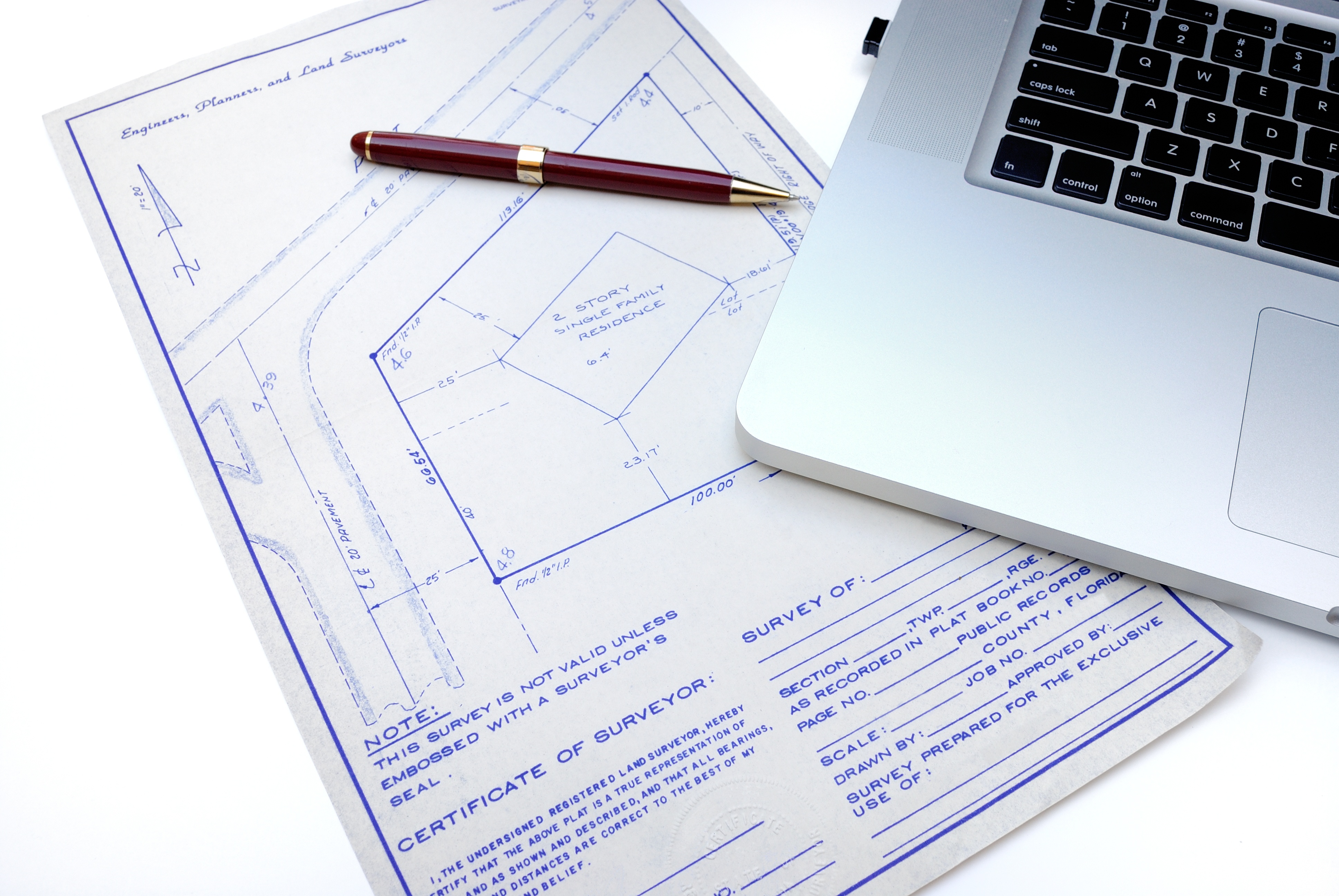
Undertaking the building of a new school is a project many people are involved with from beginning to end. This includes city or town officials, district managers, a construction firm and a company dealing in state land surveys, like Landmark Professional Surveying. This last addition is one not many people think about, but one essential to the whole building process. Once a district gets approval and a construction site is found, one of the first orders of business is to verify the land on which you intend to build. Building a new school is a great idea to mold future generations. Here are just a few reasons why you need to make state land surveys a priority:
Getting construction staking done right the first time is a necessity. You need to make sure you know exactly where your allotted land begins and ends before you start laying in the foundation. Finding the right survey company is the first step in making sure that everything runs smoothly right from the start.
When you use Landmark Professional Surveying, we use all of the latest technology like total stations that ensure the land locations and other necessities for your school are accurate and efficient.
A good surveying company will have a clearly laid out process that is easy to understand. Landmark Professional Surveying has dependable drafting capabilities so the finished product will be clear and easy to understand.
Landmark Professional Surveying is the clear choice for dependable, accurate land surveying. We have been in business since 1991 and are the industry leader when it comes to state land surveys in El Paso. Contact us today to find out more about our surveying services.
How is an ALTA Survey Useful?
25 January
If you have recently acquired a large piece of land in Odessa TX, an ALTA survey can help you understand exactly what your land encompasses. When you inherit land, you may not have an updated survey and the property may not have been surveyed for a long time. In order to know the value of the land, to put it to use, to begin making improvements, or to sell it, you must know exactly what you are working with. Typically, this means having a new survey to update the boundaries, as well as doing research to ensure you have clean title and to understand all easements and encumbrances on the property.
Why do You Need an ALTA Survey?
An ALTA survey can give you the most comprehensive look at what your land includes. Some surveys do not provide the same level of detailed information as an ALTA survey, leaving you guessing or uncertain about some aspects of land ownership. You want to know exactly what you have inherited so you have a full understanding of your rights. This means getting an ALTA survey on Odessa TX performed by a qualified and experienced survey professional.
What does an ALTA Survey Show?
An ALTA survey gets its name because it meets the detailed specifications set by the American Land Title Association. It also meets requirements set forth by the American Congress of Surveying and Mapping. The survey shows the boundaries of the property, but it also shows much more. It shows the location of all structures on the property (including fences) as well as the location of utility lines and easements.
Landmark Professional Survey can perform an ALTA survey in Odessa TX after you inherit a plot of land. Contact us today to schedule a survey so you can move forward knowing what your inheritance encompassed.
Know the Land You Are Building On
29 December
A construction survey in Las Cruces NM is not the same as a land survey. When people want to purchase an acre or two of land, they hire a surveyor to take a land survey so they know all there is to know about the land they want to buy. For a business owner that wants to get another store built, a construction survey is necessary because they are special surveys that have to do with the field of construction. However, these surveys also involve deeper issues that are important especially where a commercial business is concerned.
Construction Surveys Determine Plumbing Pipe Placement
When people see a building or home under construction, the first thing they will see is a lot of piping put all over the ground, and then the foundation is poured. What people may not know is that the placement of those pipes was not just something that was guessed at, but it was actually a construction survey that made it happen due to things like the quality of the ground and to ensure that the soil will support a building. No one wants to risk building something that is at risk from shifting soil or unsteady ground.
Construction Surveys Ensure Projects Don’t Interfere With Each Other
A construction survey is more complicated than a regular land survey because the surveyors have to consider many factors. They deal with buildings and need to make sure they are not interfering with anything like a freeway, highway, or other major projects both in the present and future ones as well. They have to ensure that their work lines up exactly right on the piece of land they are dealing with.
When business owners want a construction survey in Las Cruces NM, Land-Mark Professional Surveying, Inc., can take care of them. We have been a leading surveying company in the Southwest for over 20 years, providing reliable survey services and the utmost professionalism. If you need a construction survey in Las Cruces NM or the surrounding areas, contact us today.