Land Surveying in Harsh Environments: Helping Map the Mysteries of Antarctica
29 November
Human beings have done a lot of exploring since modern civilizations began and ships, automobiles, and airplanes allowed for the traversal across oceans and vast landmasses. There are still places out there, however, that remain to be fully understood.
Antarctica, the fifth-largest continent, with 5.4 million square miles, storage of the planet’s fresh water supply, and a variety of penguins, polar bears, and other animal life is still largely a mystery. Land surveyors, among others, are part of the group of people that have helped understand this amazing landmass little by little.
How do land surveyors work in such harsh environments? What is their role in the slow uncovering of Antarctica’s secrets?
Let’s survey some of the details.
Land Surveyors as Outdoor Explorers — How We Map Harsh Terrain
While many jobs adjusted to the covid pandemic and switched to remote or work-from-home models, land surveyors were doing anything but. Their job cannot be done remotely, nor can it be neglected or left to chance. Precision is everything in land surveying, as it contributes to the mapping and understanding of the landscape while being essential to the building of infrastructure. The United States Antarctic Program (USAP) is a government-sponsored program that represents the country in the region. The program strives to encourage international cooperation, maintain a presence in the region, and conduct quality science research there.
Well-known land surveyor Jeffrey Scannielo is part of a team that works in the Antarctic region. McMurdo Station is the U.S. station in Antarctica and is at the tip of Ross Island about 2, 415 miles south of Christchurch, New Zealand. Most of the field research and activities go through this station. Scannielo— a licensed surveyor in the state of Colorado— was working doing land surveying to help build runways for McMurdo. The runways are essential for planes landing and scientists, biologists, and other researchers to come in.
Scannielo explains part of his mission was monitoring the sea ice conditions for aircraft/vehicle safety. He had to do this in temperatures that raked below -62 F with wind chill. That’s a brisk day at the office! He explains how modern technology has helped land surveyors in dealing with the job in harsh environments such as this. Current GPS receivers, for example, have increased field productivity. The equipment today is efficient, stable, and resilient, which helps when you’re dealing with icy conditions.
Land Surveyors in Antarctica — Just Another Day at the Office
When land surveyors work in the United States, there are a series of tools that allow them to predict the conditions on the ground. That is, accurate weather reports and forecasts can tell a surveyor a lot about the kind of landscape they’re going into. That’s not the case in Antarctica. Land surveyor David Scott realized this when working in the region. He recounts how doing work down there always has some uncertainty, as you never know what kind of conditions you will run into.
Part of his job was also to survey the land to help airplanes land in the area. The issue is the runways in Antarctica are always shifting because of winds and weather conditions. Every year, surveyors have to measure longitudes and latitudes in extreme weather including high winds and low temperatures. Land surveyors have a great responsibility on their shoulders to maintain their equipment and avoid losing precision.
Runways and airfields are important in the Arctic region because harsh weather makes landing difficult. So airplanes have to use instruments to know where the runway is in order to land safely, and to do that, they need accurate measurements of latitude and longitude.
Survey Instruments in Harsh Weather
Land surveying is not only difficult on the land surveyor but also on the equipment needed to make accurate measurements. In early expeditions to extreme weather, telescopes and compasses were covered in leather to protect them. The knobs on the early theodolites were also wrapped in leather to shield them from the cold. Thanks to advancements in this field, the equipment built today are far more durable and withstands a lot more harsh weather, helping the crew get the job done. Data collection has also become easier thanks to some of the instruments, which ensures that no data is lost.
Land Surveyors in the El Paso and Southwest Regions
While we haven’t made our way to Antarctica quite yet, we are here to serve the Southwest region in providing accurate land surveying services. Whether you’re looking to build something on your property, working with government contractors on infrastructure, or building a commercial facility, we have the team, the expertise, and the equipment to do the job.
Want to learn more about our land surveying services? Contact us today.
How Land Surveying Influenced One of America’s Favorite Poet & Essayists
28 May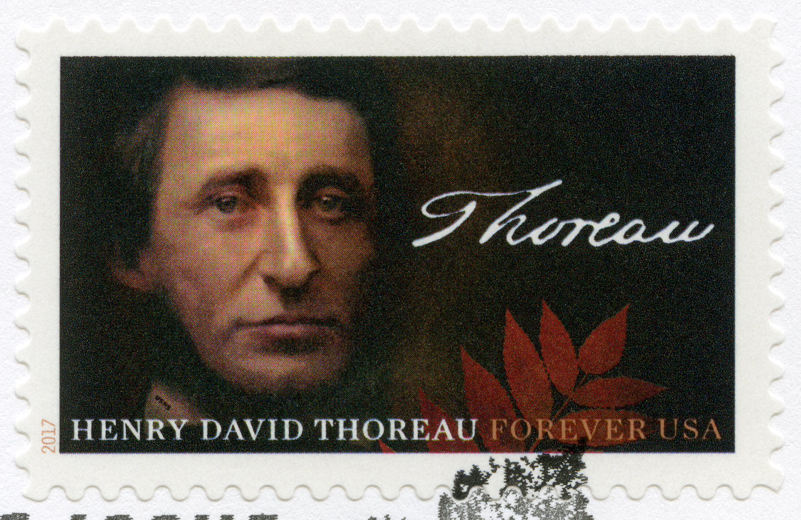
Many prominent people have gotten their start or dabbled in the art of land surveying. As we’ve covered in previous posts, well-known American figures have connected with the land through the art of land surveying. The work is ideal for those who see the beauty of the natural world. During the mid 19th century, America produced many memorable poets and writers that were essential in articulating and refining the American ethos and the philosophies of the New World. One name that is synonymous with harmonious living in the natural world — particularly as technology and cities began to grow— was Henry David Thoreau, known as an American environmental writer and essayist. When he wasn’t philosophizing and thinking profoundly about man’s relationship to nature, Thoreau was working as a land surveyor.
The Mark of Land Surveying on the Life of a Profound Thinker
Classical education in American history will likely come across the likes of Massachusetts native Henry David Thoreau and his work. With such well-composed life advice and profound thinking, Thoreau was known for his thoughts on capitalism, nature, and the individual. The son of a pencil factory owner, Thoreau became an apprentice to Ralph Walde Emerson—another big name in American literature. This meant that young Thoreau would be heavily steeped in the Transcendental tradition of his mentor. For the Transcendentalist, the way to a meaningful life was in the ability to hold oneself or maintain one’s separation from the material world and material wealth. This was an American delineation of the British Romantics, who saw the natural world as the arbiter towards spiritual transcendence and peace. Emerson wrote, “Mind is the only reality, of which all other natures are better or worse reflectors. Nature, literature, history, are only subjective phenomena.” This type of transcendentalist thinking was to inform much of Thoreau’s work, although he would depart from heavily discounting the power of nature on individual development. On the contrary, Thoreau put a lot more significance on nature and its presence in our lives.
Perhaps a little less known fact about the famous writer was that he was also a strong-minded abolitionist who participated in the Underground Railroad and railed heavily against slavery. During this time as a conductor at the Underground Railroad, he helped several slaves escape to Canada.
A Young Land Surveyor Uses Surveying to Inform His Work
As Thoreau worked parceling land that would be sold off to loggers. He used land surveying as his day job and dedicated himself to writing on his time off. He became Concord’s head surveyor in 1851. A close look at land surveying of the 19th century reveals that there were no licensing requirements to do the work. So land surveyors relied heavily on recommendations and their past work to vouch for them. Thorough was a man known in the surveying community as a man of integrity and this fared well for his ability to continue getting work.
The US Coast Survey formed in 1807 was important for the young land surveyor. The survey was conducted under the public spotlight and brought questions to the forefront about the role of science in democracy. These early surveys often had a significant impact on the shaping of society and people’s understanding of private property in the early days of the nation.
Land Surveying in the Mid 19th Century
The century has many important people working as land surveyors, but the work itself — done across the country — would help shape so much of America today. One of the most famous texts was the 18th-century treatise called “The Complete Surveyor or the Whole Art of Surveying Land.” This book was influential for other early surveyors including George Washington and Henry David Thoreau. The process of land surveying looked a little like this:
- The selling or distribution of the land to a prospective owner
- A prospective landowner would obtain a warrant
- A surveyor would go out to the location with the prospective owner
- They would mark out and demarcate the property line
- The surveyor would prepare a plat or special map of the boundaries
- The surveyor would include a textual description
- This document would serve as the deed to the land
The Long Tradition of Land Surveying in America
These figures have included the first president of the United States, George Washington, and founding father Thomas Jefferson. We have also covered the Lewis and Clarke expedition that gave way to a better understanding of the American Western frontier. The Lewis and Clarke expedition helped the American expansion efforts. In Europe at this time, land surveying would use a lot of transits, theodolites, and star charts, early surveying in the colonies used a different method that involved a long Gunter’s Chain to measure and demarcate the property. Most of the land surveyed east of the Ohio River was done using this method.
Land Surveying You Can Trust in the El Paso Area
Here at Land-Mark, we continue the great tradition of land surveying. The great predecessors of the industry have left behind great lessons of land surveying and much of their history.
As one of the Southwest’s most dependable land surveying firms, we are ready to help you survey your land with accuracy and reliability. Call us today and find out more about what we do.
Topographic Mapping: Basics and Benefits
23 September

Topographic mapping is at the heart of what we do here at Land-Mark, but often people aren’t sure what it means. It may sound pretty complex, but it’s actually pretty simple and useful. In this article, we’ll briefly discuss what a topographic map is and its uses.
What Is A Topographic Map?
A topographic map is simply a highly detailed map that shows the change in elevation between swaths of land or water. Modern topographic maps use contour lines but have used a number of other methods in the past. They usually cover large areas of land, as smaller maps of this type qualify as chorographic maps—though those are often labeled as topographic anyway.
As can be seen in the picture above, the contour lines on the map are associated with a number that denotes the elevation on that line. The closer the lines are, the more drastic the change in elevation. Topographic maps can be used to show natural and man-made elements.
The Uses of Topography
Topography has a vast array of uses associated with it. Large-scale architecture, for example, needs topography to determine where and how to build. Hiking may also use these maps, as well as mining, civil engineering, and other geographic activities.
Topography With Land-Mark Professional Surveying
Need a topographic map of an area or just have questions about the process? Contact Land-Mark today, and get started on your topographic needs!
When Do I Need an Alta Survey?
16 August The short answer to this question is yes, as this particular type of survey has many uses. Alta means American Land Title Association, which is responsible for outlining certain standards for land survey work. As such, an Alta survey meets the highest standards of quality. Therefore, it can be recognized throughout the U.S.. Landmark Professional Surveying, Inc. can provide you with an Alta survey. They have helped many Las Cruces residents by providing quality surveys and they can help you too. On the downside, these types of surveys are usually a bit pricey than your average survey. This causes most people to question whether they actually need one or not. After all, how much better can they really be? The answer to that question is a little harder to see, but overall, the cost tends to even out in the long run. Still knowing when to get an Alta survey done can be hard for the average Joe. One bank might say you need it, while another may say you do not. The best way to tell is to consider the following criteria.
Buying or Selling Land
Having an Alta survey can make buying or selling your land much easier. These types of surveys are incredibly detailed. As such, they reveal just about anything that anybody could possibly want to know about your land. From utility lines to fences, boundaries and roads to improvements and possible encroachments. Besides physically going to the land in question, it would be hard to get such a detailed description of the land. In fact, the survey may actually be more useful than a pair of eyes. Having such a document helps any prospective buyer decide on whether they want the land or not. It can help you as a buyer as well.
Refinancing Land
An Alta survey can help you get a better refinancing rate for your land. Most lenders want to avoid survey risks, such as boundary disputes. This is because such disputes can lead to lawsuits later on and no one wants to be involved in such risks. Having this detailed survey can help ease the lenders mind and highlight the value of your land. As result, you are more likely to get a better offer.
Contact Us Today
Landmark Professional Survey Inc. can help you get the Alta survey you need. We have experience surveying the Las Cruces area and can bring quality results. Call us today to get started with an appointment.
A Few FAQs About ALTA Land Surveys
18 May If you are buying a piece of land in Las Cruces, you have probably been asked by the bank or titling company for an ALTA survey. You may be irritated that you need to obtain such a detailed land survey, but this document provides a wealth of info about the property at hand. It may be more costly, but it is an excellent document to have to avoid issues later on down the line. We have answered a few frequently asked questions about these specific surveys here.
Why Do I Need an ALTA Survey?
This land survey is quite detailed, as mentioned before. It can be a bit more costly than the average land survey, but with reason. Title companies as well as lenders may ask for this survey. It can happen either when you are buying, selling or refinancing a property. Most often times, lenders are looking to avoid “survey risks.” This can include disputes over boundaries, encroachments and other difficult issues that can lead to problems and even lawsuits down the line. An ALTA Survey would reveal any of these issues and more. Even if the bank or titling company doesn’t require you to purchase this detailed survey, it may be advisable to avoid problems. This can be especially true when purchasing vacant land that has never been surveyed, or has been survey over a decade ago.
Why is an ALTA Survey More Costly?
Some land buyers in Las Cruces may be unhappy with the higher cost of an ALTA Survey. However, this type of survey is only performed by a registered, licensed surveyor. It means specific standards outlined by the American Land Title Association (ALTA) and the American Congress of Surveying and Mapping (ACSM). In essence, this survey meets the highest standards recognized throughout the U.S. It includes much more detail than most other land surveys. This can include boundaries, fences, utility lines, roads, easements and areas that have been improved.
How Do I Get Started With a Land Survey?
Getting started with any kind of survey in Las Cruces is as simple as calling us up at Land-Mark Professional Surveying, Inc.. We are one of the best and most reliable land surveyors in the Southwest. We provide a wealth of services to help you with your property. Whether you are buying, selling or refinancing a piece of land, our certified experts can help. Contact us today for more info.
A Land Survey Vs. a Construction Survey
14 March A land survey and a construction survey are two different types of surveys that actually serve very different purposes. If you are settles a land dispute or want to find the proper boundaries of your land, a land survey is the right tool for you. However if you are an engineer creating plans for an upcoming hospital or highway in Las Cruces you will want a construction survey. While a land surveyor will conduct both of these, knowing precisely what you need is important. At Land-Mark Professional Surveys Inc. we can help with either of these services. Our professionals have the expert knowledge and skills you are looking for.
A Land Survey in Las Cruces
A land surveyor is a licensed expert that is responsible for survey results. They utilize many tools and techniques to determine land boundaries, corners, and monuments, and the size of a piece of property. These professionals are skilled at using historical evidence, documents, mathematical equations, and surveying tools to conduct their work. A land survey is usually used for legal purposes, creating accurate maps, or during real estate deals. A land surveyor in Las Cruces can help settle disputes and help with traffic accidents as well. They also provide valuable info for breaking land into blocks and parks.
A Construction Survey in Las Cruces
A construction survey provides valuable info for builders and engineers in Las Cruces. They will survey a given plot of land to determine the best building practices. They may provide info on the best location for a foundation, drainage, and other info concerning the land that is helpful for erecting buildings.This invaluable information prevents engineers from making costly mistakes. It can also help with wise decision making. When it comes to highways and freeways they can also provide info about the land and measurements. The construction survey can be especially helpful with large projects that require extra planning.
Contact Us Today
Land-Mark Professional Surveys, Inc. has been providing surveying services to the southwest region for nearly 30 years. If you are looking for reliable, accurate surveys, don’t hesitate to contact us. We are extremely familiar with the Las Cruces area and can provide the expert knowledge and skills you are looking for. Whether you need a construction or land survey, we can help. Be sure to call us today. One of our professionals will be happy to answer your questions or set up an appointment.
How Land Surveying Set America on Its Upward Trajectory
8 December If you require ALTA surveys in Las Cruces, you’re taking part in a historical moment. Land surveys and land surveyors have been a crucial part of American history for centuries. In fact, many presidents of this great country had the distinction of being land surveyors at one point or another. If you require assistance with ALTA surveys in Las Cruces, choose Land-Mark Professional Land Surveyors!
Washington, Jefferson, Lincoln: American’s Land Surveyors
George Washington, Thomas Jefferson and Abraham Lincoln have more in common than the presidency. They all worked as land surveyors. In fact, the first two were Surveyor General for Virginia. At the young age of 17, George Washington was appointed as the Surveyor General of Virginia. Years later, Thomas Jefferson received the same designation as Washington, as County Surveyor for Albemarle County in Virginia. Under Jefferson’s careful tutelage, he appointed surveyors which resulted in the necessary direction to achieve the most orderly settlement acquisition. Abraham Lincoln served as Deputy County Surveyor in 1833, at the age of 24. In less than thirty years, he would become the 16th President of the United States.
The art of land surveying requires an individual to have careful and proper foresight. Through proper land surveying, the space can be used to its fullest extent. Land surveying is an apt metaphor for the presidency. The three men listed above undoubtedly used the skills and experiences they gained from their days of land surveying during their presidencies. It’s no wonder why they helped shaped the United States we know today!
Lewis & Clark: Discovering the True Beauty of the United States of America
Although Merriwether Lewis and William Clark may be most well known for their expedition, they got their start as land surveyors. Their days as land surveyors gave them the skills necessary to properly traverse through the land acquired in the Louisiana Purchase. Basically doubling the size of the United States, the Louisiana Purchase is seen as one of the most important chapters in early American history.
The Importance of ALTA Surveys Today
ALTA surveys in Las Cruces make use of the decades and decades of history and importance set before them. ALTA surveys follow strict guidelines set forth by the American Land Title Association, which got it start in 1907. Land surveying is deeply rooted in American history. If you require an ALTA surveys in Las Cruces, contact Land-Mark Professional Land Surveyors today! We understand the importance of land surveying so our services are as reliable and dependable as you deserve them to be.
The Immutable Necessity of Land Surveyors in Our Society
27 September The city of Las Cruces, New Mexico is quickly growing. In order to accommodate for all the new, exciting opportunities that are making their home in the city, future entrepreneurs must team up with a land surveyor. This way, the land will be perfectly surveyed so any construction can take place correctly. Land surveys are the first “foundation” before any project can take place. Make sure you’re starting off on the right foot, choose Land-Mark Professional Surveying as your team today.
Why Land Surveying Matters
Land surveying has been an important part of human history for centuries. Nowadays, land surveyors makes use of highly advanced tools and practices in order to yield the most precise results. But why exactly is land surveying necessary, especially in this day and age where everything is accounted for? Well, that’s exactly the answer! Since everything is “accounted for,” a land surveyor can make sure the land which you consider your land is actually your land. Without land surveying, disputes can arise. Instead of dealing with this uncomfortable outcome, you can team up with a land surveyor!
How a Land Surveyor Offers Precision
Land surveyors make use of a plethora of studies in order achieve the most precise results. Geometry, trigonometry, physics and engineering are just a few of the elements that go into correctly surveying land. In addition to these sciences and mathematics, surveyors understand the proper laws. With this knowledge, your land can be surveyed accordingly and your project can move ahead without a hitch.
Land surveyors make use of equipment to yield the best results. Theodolites and global positioning systems are the land surveyor’s best friend. With these tools, the land will be surveyed for as precisely as possible.
Get Started on the Right Foot
Any entrepreneur who’s looking to build a new building over a plot of land they’ve just bought must first team up with a land surveying team. This way, the land will be properly accounted for and the boundaries will be set. Avoiding to do this can result in negative consequences. Say you build a large building in the plot of land you bought. If a few feet of your building bleed into the neighboring land (even if the land is barren and empty) you’re illegally on someone else’s land. This can end up in court, which is something you’d like to avoid. Land-Mark Professional Surveying is ready to help. Contact us today to learn more about what we have to offer!
How Can Construction Surveys Help Zoning Projects?
7 March Establishing ownership and jurisdiction over land can seem impossible. Does it matter if someone built on it before? If there is someone else’s property on it? Or if the land has shifted and changed over time? All of these questions can be solved by getting a land survey. This is especially true for the developing city of Las Cruces. Land-Mark Professional Surveying can do quality construction surveys in Las Cruces. Before getting a survey done on any piece of land, you should know what it is for and how to use them.
What Do Construction Surveys Help?
Construction surveys can help any construction project avoid problems. Surveys are often done to mark out land boundaries. This can be done to clarify property and ownership. It is particularly useful whenever issues with a building are concerned. This is because a survey takes the original land grants and measure out their dimensions on the property. Land can change over time. But land documents do not. This makes a survey the best and easiest way to establish boundaries.
For construction, survey’s work the same way, but on a larger scale. First, they take the land dimensions from the contract or deed. Then they measure those dimensions out on the land. This gives the builders a clear boundary, allowing for buildings to be built within the proper boundaries. This is extremely helpful for land that is not developed. The survey will mark off the area and allow builders and architects to create proper buildings for it.
When Can You Use Surveys?
Having construction surveys done helps avoid future problems. Just like with households, land can change over time. Having a survey done makes sure that the building is within its proper boundaries. This avoids problems for neighbors and new development. In addition to this, you can judge whether the land you have is enough for the building you want to build. If you buy land adjacent to your current land, having a survey done will reestablish property as well. Information documented by a survey can be used as legal claims in court too. All of this helps you avoid issues while building.
Surveys are important to development. They help mark and maintain boundaries for construction. This is important for creating a legal and sustainable property for years to come. It also helps avoid trespassing and ownership problems later. Land-Mark Professional Surveying is experienced with construction surveys in Las Cruces. No matter the issue, they can help clarify it. The best way to establish property and ownership is through a survey. No matter what, land dimensions outlined in a deed do not change, even if the land it is for does. This is how surveys can help clarify issues of property, especially when the land in question is being built on.
What is a Land Surveyor?
10 January There are probably many jobs most people haven’t heard of, like snake milkers and professional bridesmaids. A land surveyor, however, plays a significant role in building and construction. Before you build or renovate anything, it’s best to contact someone from Land-Mark Professional Surveying to help ensure you’re on the right track with your project.
What Does a Land Surveyor Do?
A land surveyor is also known as a cartographer. A person in this field measures and maps the environment using mathematics along with specialized technology and equipment. They can measure just about anything on land, in the sky or on the ocean bed. They can even measure polar ice-caps.
Land Surveyors work with engineers, architects and builders so as to produce precise descriptions of the surface of the planet. They also perform a variety of vital tasks including boundary surveys, topographic mapping, and construction staking.
You may need a surveyor to help measure your property in order to determine its boundaries. This information determines where roads or buildings should be constructed, settles property line disputes, and leads to the creation of maps. Moreover, any maps or land descriptions they supply are usually considered legally binding and can be presented in a courtroom setting. This profession requires people to be trained and licensed in order to work..
Other Facts
According to the U.S. Bureau of Labor Statistics, ” the duties of a land surveyor include making a record of the ‘distances, directions and angles between two points’ on the ground, using agreed-upon reference points, called benchmarks, as a starting point.” Surveyors also use global positioning technology to confirm a specific location. They carefully define the boundaries of interest, using both their on-site surveys and records found in land offices, in order to write the legal description of a parcel of land. Furthermore, land surveyors may use a geographic information system device to prepare a highly detailed, layered map of the results of a survey, in order to show all easements, soil conditions, and structures contained on a particular parcel. Surveys filed and recorded in public repositories, including county or parish clerk’s offices, are considered public records documents.
Both Michael Douglas and Hugh Grant starred in movies that had land surveyors as main characters. In addition, three out of the four presidents on Mount Rushmore, George Washington, Thomas Jefferson, and Abraham Lincoln, started as surveyors, as did Lewis and Clark. The Egyptian pyramids influenced land surveying. Land surveyors still use many of the tactics used back then today.
While not quite that old, Land-Mark Professional Surveying of Las Cruces has been in business since 1991. Put our 25 years of experience to work the next time you need property in the southwest region surveyed.