A Land Surveyor’s Tool Kit: What We Use in The Field
21 August
As land surveyors, we have to carry around a great deal of equipment. We’re often mistaken for photographers because of our tripods, but the rest of our gear quickly dispels that thought. We deal with precise measurements, so it’s crucial to have the right tools on hand. Here we’d like to teach more about our equipment, so you can see us and not mistake us for dedicated Instagram photographers.
- Theodolite – A theodolite is a surveying instrument with a telescope for measuring horizontal and vertical angles. Some land surveying crews use transits and total stations as well, which are used for the same purpose. These can be very pricey; they can range from $200 to over $50,000 in retail price!
- Surveying Tripod – Be sure not to spend all your money on the theodolite, because it needs a place to sit as well. The survey tripod is a sturdy tripod that is designed to move as little as possible for accurate measurements.
- Hand Tools – Besides the main equipment, a surveyor will need a host of other equipment to do the job well. Rope and measuring tape are great for rough measurements and marking, while items like picks and saws help clear debris to properly survey.
- Clipboard – All the data needs to go somewhere, right? A clipboard and pencil are necessary to take measurements or notes down onto paper, or a good PDA would suffice as well.
Land Surveying Done Right
If you’re in need of a land survey, Land-Mark Professional Surveying is the best in the southwest. We work in Texas, New Mexico, and Arizona, and provide quality land surveying for all of our clients. Contact us to see what we can do for you!
Where Technology and Infrastructure Meet
15 June Since 1991 Land-Mark has been at the forefront of the land surveying industry. A lot has changed since 1991, of course. In the early nineties, very few people could imagine that their cumbersome beepers would be transformed into sophisticated mobile devices capable of helping them navigate unknown territory (figuratively and literally), facilitate immediate communication across the globe, provide up-to-date news, take decent photographs, and store hundreds of bits of information. Similarly, technology has found its way to land-surveying and other relevant industries, providing equipment that increases accuracy and efficiency.
We use a variety of equipment, depending on the specific job, land, and project at hand. One of our trusted partners includes the company TopCon. These guys are highly innovative and perfectionists in developing new systems and equipment to improve the construction and planning of infrastructure and land planning. Topcon provides the positioning technology for surveyors, civil engineers, construction contractors, equipment owners, and operators. The geospatial solutions from Topcon have the most in-depth precision measurement for land mapping and surveying.
The Use of Digital Systems in Construction, Infrastructure, and Mapping
As land surveyors, Land-Mark is at the opening stages of a construction project. We form, however, part of the bigger picture that is all infrastructure building and construction. The use of technology in all stages of the construction industry has improved construction’s accuracy, safety, and efficiency.
In 1927, as TopCon points out, the world had 2 billion people. Only about one hundred years later did that number rise all the way to 7 billion. This means thousands of more acres developed, millions of more buildings erected, hundreds of more cities extended and expanded, and a constant and consistent demand for better and smarter building solutions.
A Few Amazing Examples….
Building great structures has always come at a human cost. There is not only a demand for human toil and labor but a high risk of accidents and injuries in any construction site. Any great building or structure you can think up has come at a cost of human lives. Some projects have been more successful than others. The Golden Gate bridge, for example, had 11 laborers died, a neighboring bridge, the Oakland Bay Bridge, had 28 people die in its construction. The World Trade Centers had 60 construction deaths. Recent technology, however, has allowed engineers to survey an area using drone technology without putting human lives at risk. A TopCon project to repair the Great Wall of China would have required workers to traverse a dangerous area. Instead, they sent a drone that was able to take thousands of high-resolution images that could then be input into a 3-D model, that was then used to examine the area and determine what needed to be done.
Measurement instruments have improved the ability for land surveyors like ourselves to enhance our workflow and improve our accuracy. Another great thing that technology offers is that added guarantee of accurate measurements and absolute efficiency. Land-Mark personnel is trained in a variety of high-tech and highly-specialized equipment that will ensure the proper mapping and measurements of your land project.
Explore the Wonders of Accurate Land Surveyors
So whether it is expanding a university campus in the middle of the growing El Paso central area or any other construction project in Las Cruces or Odessa, we are here to provide the most accurate topographic, stand land, improvement, and above and below grown surveying in the Southwest. Call Land-Mark today and find out more about our exciting projects in the area, both private and government work, that will show our dedication and find out about what we can do for your upcoming project.
How is a Land Survey Conducted?
16 November An El Paso land survey might seem like a mystery at first. You may need a survey and not even know how the experts conduct the process. Surveying is technique the experts use to map out points and distances on a piece of land. A land surveyor is the expert that conducts the process. Others use the land marks they set to make maps or set boundaries for property ownership. Most developers can’t start construction without a survey. If you need one conducted for construction or land purchase or sale in El Paso LandMark Professional Surveying, Inc. can help.
The Rectangular Survey System
Land surveying is all about determining measurements of pieces of land. The Rectangular Survey System also called the Public Land Survey System (PLSS) is the process that surveryors usually use throughout the United States. The system is setup on a grid. The main goal is to find out approximate values of one mile square sections. It is actually one square mile of space. This is the main system used because it is accurate and precise.
Existing Property
A surveyor starts by finding out what the property owners legally needs. There are many different reasons why you would need a surveyor in El Paso. Perhaps you”ve bought a property and want to know where the property boundaries are so they can go about making an addition. They might have an existing property and want a topographical survey done so they understand the grades on that land better. Land surveys don’t just map property borders. Surveyors can also provide helpful info about the terrain.
How do Surveyors Conduct a Land Survey?

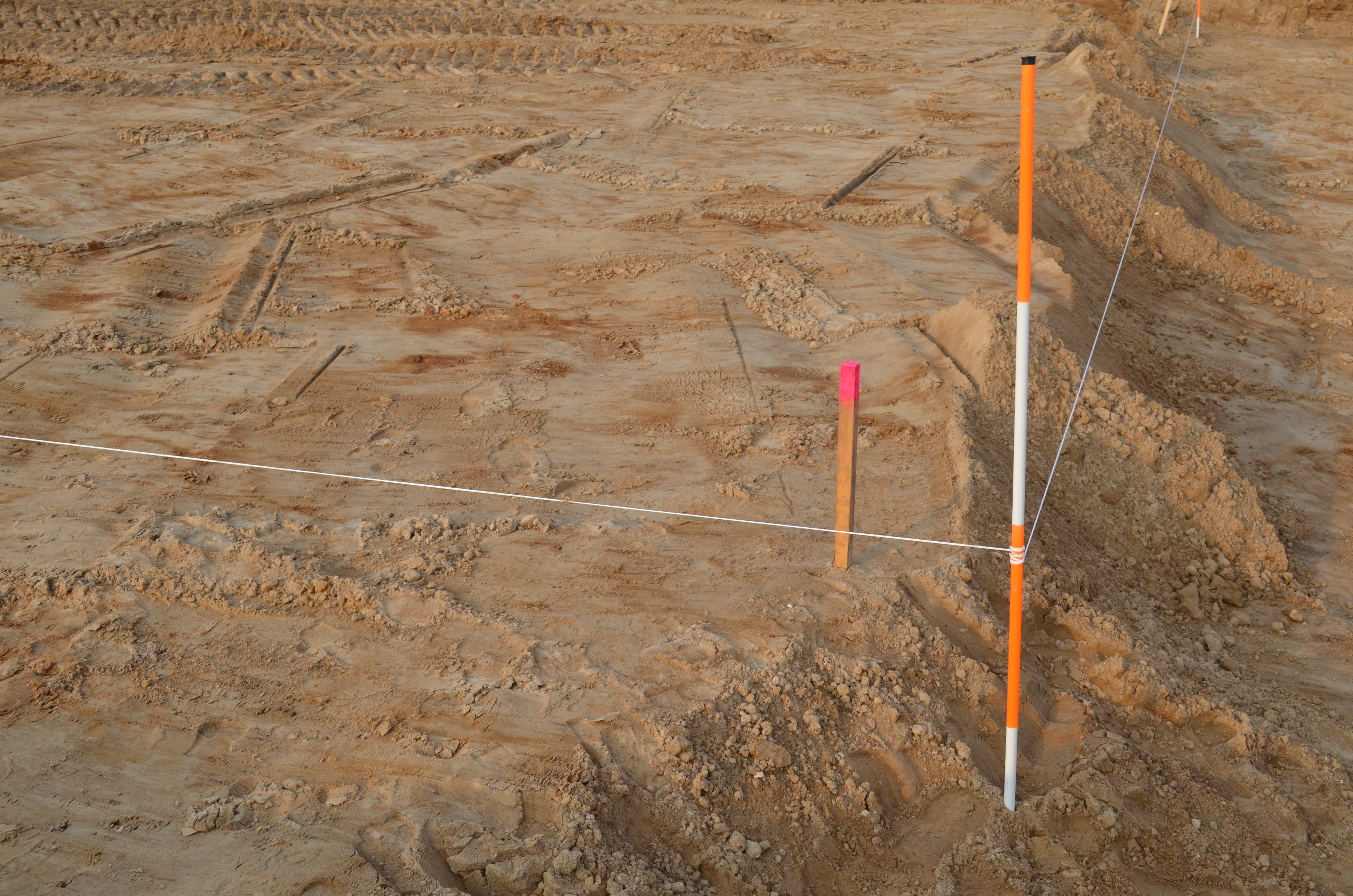
The first step is to find where the property sits in relation to the other sites around it. This is usually accomplished by finding the property bars which are metal stakes placed in the ground at each corner of the property and often at intervals in between. The expert surveyors look for these bars. The surveyors use a variety of methods to make sure the property stakes are related to each other and the property around them. For example, a land survey could very well need to show a few of the other benchmark property markers used in the area before by other surveys to show this kind of relationship.
Even if you don’t quite understand the process, you may need one done on a specific piece of land. Land-Mark Professional Surveying has been providing service for the El Paso, Las Cruces, and Odessa areas for over 25 years. Please contact us today for more info.
Selling? Here’s why you need a land surveyor in El Paso
8 November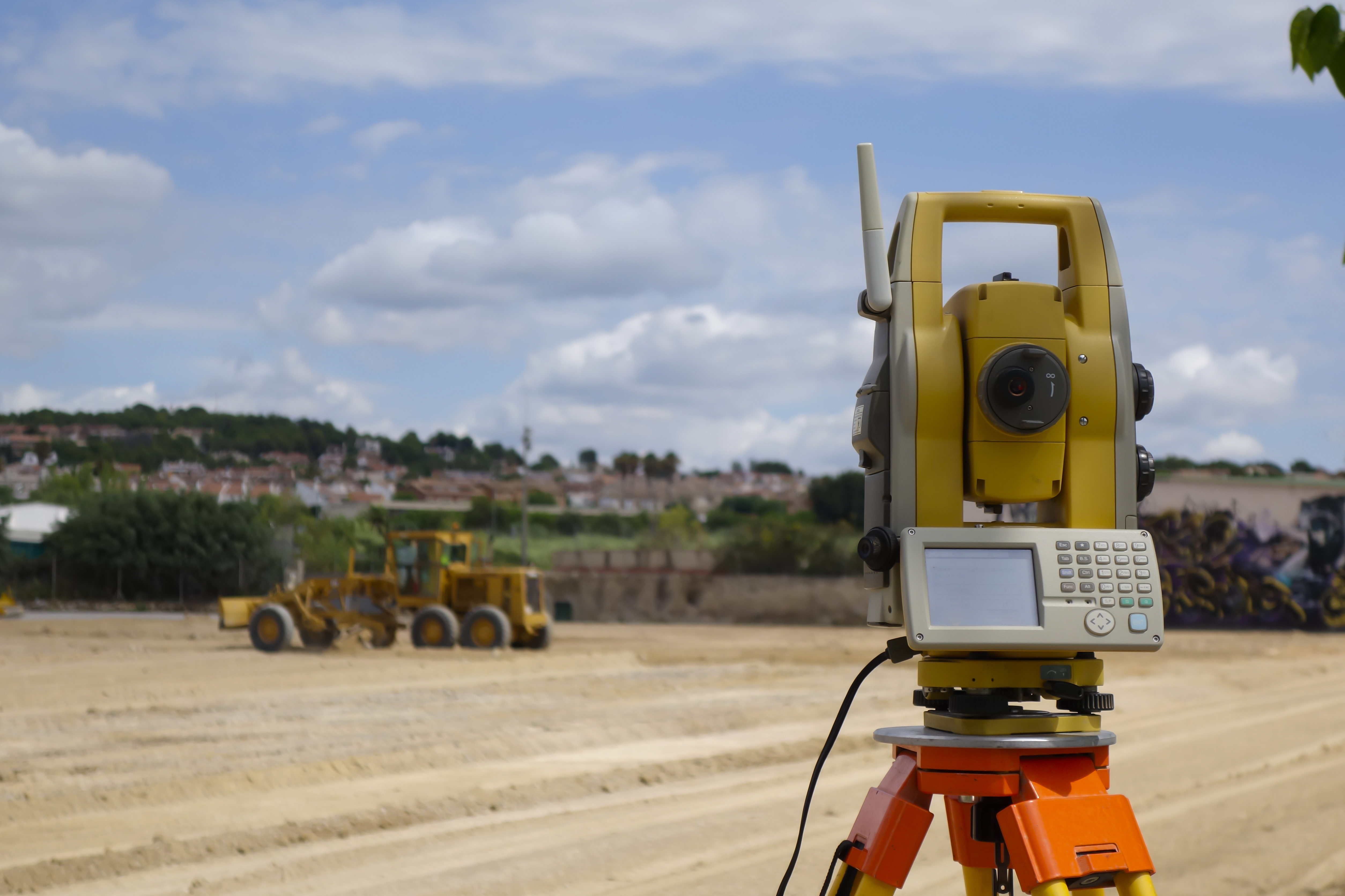
A land surveyor is hardly a thought when it comes to selling a home in El Paso. Getting this work done before you move away and hand the title of your house to another owner would be a wise choice. A land survey is a legal document created by a land surveyor. It will give detailed information about the land and it’s boundaries. prerequisite to make sure there’s no issues. Experts like LandMark Professional Surveying, Inc. will be by your side through this process because they are the experienced land surveyors who understand how to get the job done quickly and efficiently in an affordable way.
Benefits of Hiring a Land Surveyor
If you are selling property without any buildings, it is still a great option to hire a surveyor to conduct a land survey. As a seller, this will benefit you greatly, because you will gain a better understanding of your land. You may be underestimating the value of what you are selling. Secondly, if you are buying a piece of land that hasn’t been surveyed, you may end up finding out the clear boundaries. The last thing you want is to purchase the property and then find out it was smaller than you expected. Obviously, everyone involved in any kind of El Paso real estate transaction wants to know exactly what they’re getting and selling for their money. But there is more to getting a good land survey done in the El Paso area than just that.
An excellent land surveyor will not only mark the boundaries of the property that you are buying and sel ling, they will be also be able to supply a variety of other services including a topographical survey. A professional land surveyor in El Paso like LandMark Professional Surveying, Inc, provides not only info about boundaries are but also how the property they are buying slopes and in what direction. This is helpful in case they are considering building a house or commercial property. It is that kind of extra info that is important to make sure you build in a location that the water slopes away from the foundation of the building after a good rain.
LandMark Professional Surveying, Inc.
Our company is trusted by many El Paso, Las Cruces, and Odessa residential and commercial property owners. This is due to our staff exercising the highest standards of surveying according to Texas, New Mexico, and Arizona laws. We maintain timely delivery of jobs requested. If you want a land surveyor with accuracy and expert knowledge we are here for you. Please contact us today.
Understanding an ALTA Survey
19 October
Having a land surveyor to determine boundaries is crucial, but what if you need an ALTA survey in El Paso? Typically, ALTA surveys have a much longer list of requirements from a land surveyor. That is why these surveys are limited to commercial buildings where the risks are great. At Landmark Professional Surveying, we provide services that meet the survey requirements of different institutions. We understand the different needs of different projects and can help determine which service is required. Here is what you need to know about an ALTA survey before you get one.
Why Get an ALTA survey in El Paso?
If you are looking to get a land survey, you may need to get an ALTA instead. ALTA surveys in El Paso follow nationally requirements that are much more rigid than a regular survey. If you are planning on purchasing a piece of real estate or refinancing one, your banking institute will probably ask you to get one. This is because an ALTA survey will help determine the actual value of the potential piece of land. So if you are merely making additions to your property, then a regular survey will suffice. If you are making an investment, an ALTA survey will give you the information you need to make a decision.
How to Use an ALTA Survey
This type of survey can be very expensive, but the information you get from one is invaluable to you as a land buyer. An ALTA survey in El Paso will locate both the physical and legal boundaries of

the piece of property. This helps determine if the property is encroaching over other pieces of land such as that of a cemetery or park. This survey can help to make a more informed decision. If you are borrowing money to make this purchase, the lender will likely want to know this information. This way, they can decide if the property is worth the investment.
ALTA surveys in El Paso can cost more than other surveys, so it is important to know whether you need one or not. If you need the most information possible about a piece of land you are purchasing, then an ALTA survey is crucial. Landmark Professional Surveying can help you distinguish what you need. With over 25 years of experience we can report with detail , any property you want us to survey. Contact us for more information.
Top 3 Situations That Require a Land Surveyor
10 June
Hiring a land surveyor in Las Cruces makes sense in a wide variety of different real estate transactions. You need to ensure you have a surveyor who can provide you with the information you need about a piece of property before you make plans to either purchase the property or to develop the property. If there is a dispute regarding the boundary lines on a piece of property, getting a comprehensive professional survey done is also important for property owners to protect their interest in the land. Land-Mark Professional Surveying, Inc. can provide you with the help that you need to make sure you understand exactly what your interests in the property are and what kinds of development can be done.
When to Hire a Land Surveyor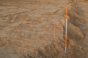
The three most important situations in which you need to hire a land surveyor in Las Cruces are:
- Before a property is purchased
- Whenever you are planning to develop the property
- When you are involved in a boundary dispute
It’s important to hire a surveyor before a property purchase so you will understand exactly what your money is buying you. The bank is usually going to require a survey before lending you money and you will need to provide a survey to the title insurance company so that any disputes on the land are cleared. You will also need a land surveyor in Las Cruces to get the correct layout of the land. This helps you have an idea of its specific layout and reduce any property issues with nearby neighbors.
Getting Help from a Land Surveyor in Las Cruces
Land-Mark Professional Surveying, Inc. can provide the help you need to understand your rights to a piece of land as well as so much more. These are just a few reasons it is a good idea to consult with a land surveyor in Las Cruces. Reach out to us to find out how we can help you get exactly what you need the next time you are in a situation that requires the help of a land surveyor. Contact us today!