Land and Stars: The Zenith Telescope & Other Land Surveying Instruments
30 July Most people that use GPS technology for long drives and family vacations might not think twice about latitude and longitude. Early explorers and navigators had a very different experience when it came to venturing into unknown lands and oceans. And even though we don’t think about it, GPS depends on geodetic coordinates or latitude and longitude. For generations, people have depended on coordinates to travel and navigate the world. The tools and instruments of navigation are not that different from those used for land surveying.
So let’s explore some of these amazing tools that have improved the way we understand our world.
The Mystery of Longitude and How it Was Solved
Latitude runs parallel to the equator and is, therefore, easier to determine. It is determined by nature, whereas longitude proved to be a far more difficult problem to solve. Determining how far east or west a ship was from the land was a challenging endeavor and led to some fascinating maritime history. The difficulty in longitude made travel by ocean and sea very perilous and sometimes costly to merchants, explorers, and sailors.
In a well-known story that happened in the Scilly Isles in southern England, massive wreckage led the British government to offer a big cash prize for anybody that could solve the longitude problem. This was known as the famed Longitude Act of 1714. The wreck at Scilly Isles had caused a lot of damage and had been one of many shipwrecks that had destroyed property, goods, and human lives.
The problem of longitude came down to maintaining consistent time at an agreed-upon zero-meridian. Sailors would have to set the ship’s clock at exactly 12 when the sun was directly overhead, but clocks could not withstand the motion and changes of the sea. So sailors knew that an hour meant 15 longitudinal degrees of separation so they could convert the hour into a geographical measurement. And yet, it kept failing, as establishing precise time and keeping time was difficult on the ships.
This problem was solved by one unschooled fella named John Harrison, who invented an oil-free clock and would carry true-time across any turbulent sea. Harrison was recognized for his genius and his clocks were mass-produced, helping ships calculate longitude accurately and arrive safely at their destination. He is central to British maritime history.
The Zenith Telescope and Geographical Measurements
A zenith telescope has an amazing little story and forms an important part of the study of the skies. It is a refracting telescope that is designed to observe the stars overhead. As early as the 1700s, scientists and sky enthusiasts were looking for ways to better understand and measure the earth’s movement. In 1725, the aberration of starlight was discovered using one of these telescopes. It measures differences in zenith angles which helps to determine latitude location.
Zenith telescopes were also made portable, and this meant they could be used for geodetic purposes. A man by John Bird living in London was responsible for the first zenith telescope used in America.
The U.S. Corps of Engineers
During the 19th century, groups like the U.S. Corps of Engineers created a powerhouse of innovation in various areas of construction and land development. The field of surveying grew and so did the surveyor’s toolbox.
Captain Andrew Talcott of the U.S. Corps of Engineers continued to develop the methods of using zenith scopes to determine latitude. While working on the state boundary between Michigan and Ohio, he used a slightly different method. Earlier surveyors had paid attention to only the stars that passed about one degree or less of the zenith. Talcott focused on pairs of stars that moved through in equal distances. The method of measuring the zenith distance and finding the latitude is called the Talcott method.
The zenith telescope was used to demarcate state borders as newer states were being formed and new boundaries were decided upon.
The Surveyor’s Compass
A surveyor’s compass is unique from other compasses because it has vertical sights for aiming at distant objects. The surveyor’s compass came along in places with vast land exploration and was first referenced in Art of Surveying (London, 1610). These are vernier compasses with a variation arc and vernier mechanism. An Improved Surveyor’s Compass could measure horizontal angles without referencing magnetic north. This newly patented version of the compass helped many early railroad engineers improve their building process.
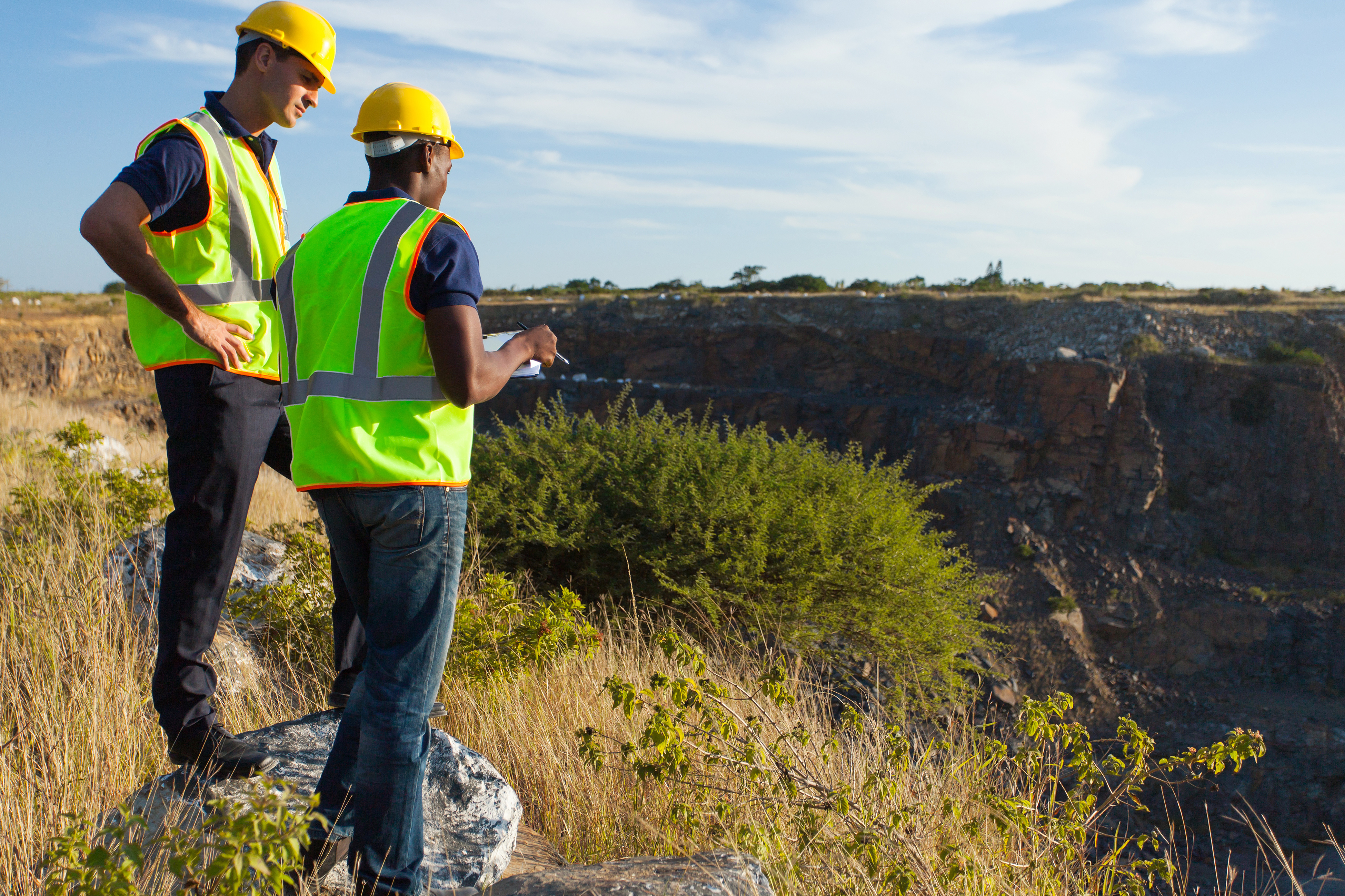
Get Accurate Land Surveys With Experienced Surveyors in El Paso
Whether it’s for a new home, a commercial property, a larger structure, or a building, a land survey is a must. Accuracy is our motto. Customer service is always our driving force. Land-Mark land surveyors are here to serve the community of El Paso and beyond. How can we help?
Land-Mark Professional Surveying provides the southwest with land surveying services. Connect with us today and find out more.
When Do I Need an Alta Survey?
16 August The short answer to this question is yes, as this particular type of survey has many uses. Alta means American Land Title Association, which is responsible for outlining certain standards for land survey work. As such, an Alta survey meets the highest standards of quality. Therefore, it can be recognized throughout the U.S.. Landmark Professional Surveying, Inc. can provide you with an Alta survey. They have helped many Las Cruces residents by providing quality surveys and they can help you too. On the downside, these types of surveys are usually a bit pricey than your average survey. This causes most people to question whether they actually need one or not. After all, how much better can they really be? The answer to that question is a little harder to see, but overall, the cost tends to even out in the long run. Still knowing when to get an Alta survey done can be hard for the average Joe. One bank might say you need it, while another may say you do not. The best way to tell is to consider the following criteria.
Buying or Selling Land
Having an Alta survey can make buying or selling your land much easier. These types of surveys are incredibly detailed. As such, they reveal just about anything that anybody could possibly want to know about your land. From utility lines to fences, boundaries and roads to improvements and possible encroachments. Besides physically going to the land in question, it would be hard to get such a detailed description of the land. In fact, the survey may actually be more useful than a pair of eyes. Having such a document helps any prospective buyer decide on whether they want the land or not. It can help you as a buyer as well.
Refinancing Land
An Alta survey can help you get a better refinancing rate for your land. Most lenders want to avoid survey risks, such as boundary disputes. This is because such disputes can lead to lawsuits later on and no one wants to be involved in such risks. Having this detailed survey can help ease the lenders mind and highlight the value of your land. As result, you are more likely to get a better offer.
Contact Us Today
Landmark Professional Survey Inc. can help you get the Alta survey you need. We have experience surveying the Las Cruces area and can bring quality results. Call us today to get started with an appointment.
ATLA Surveys in Odessa: Why They’re The Best Option
21 November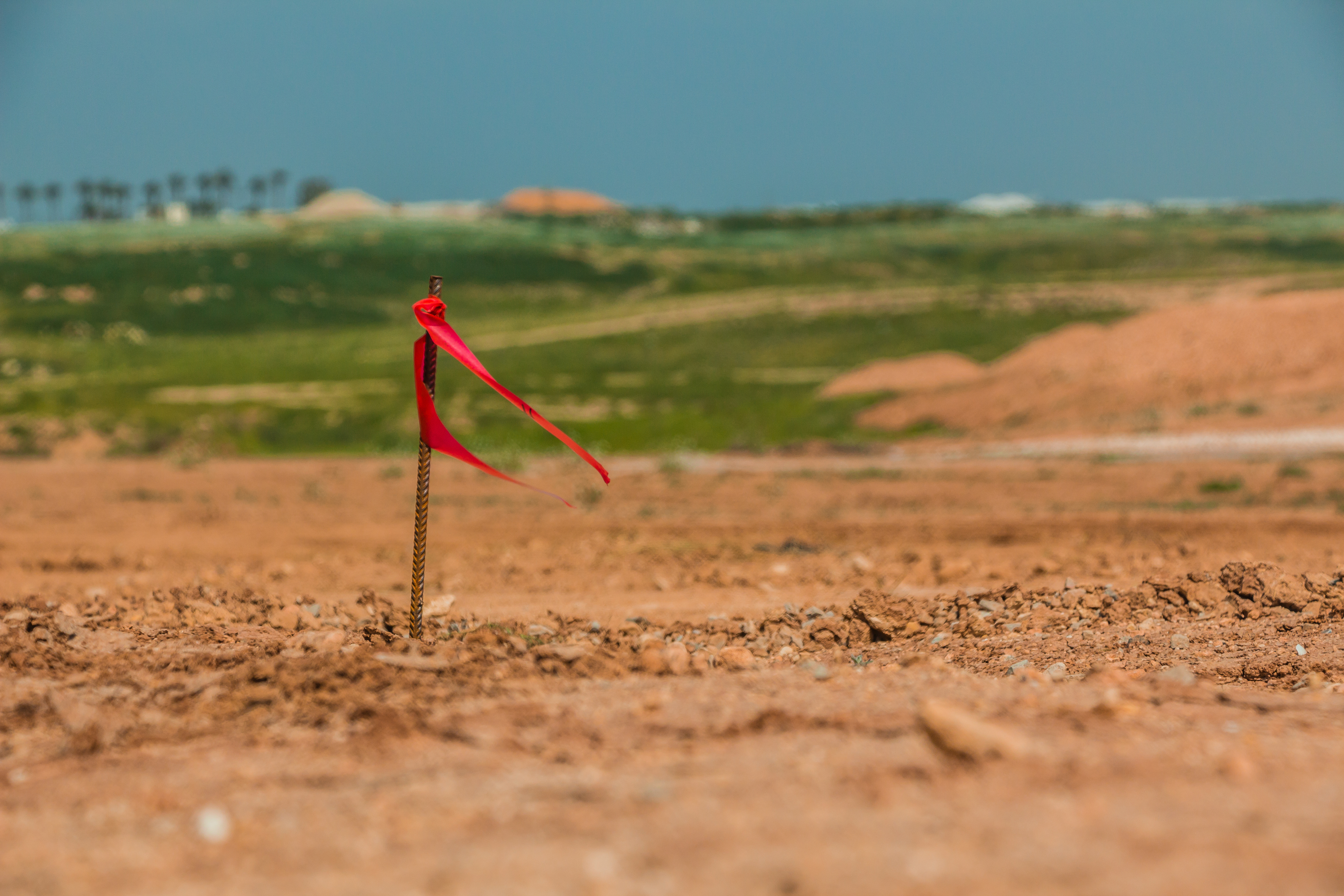 Texas, as a state, has always been a land of opportunity. With so much land available even to this day, this opportunity continues to live on. Take Odessa county for instance. This area of land is vast, it’s a welcome opportunity for individuals from all walks of life to fulfill their dreams and build whatever it is they’ve been wanting to build. Sadly, the days of running up to a piece of land and claiming it for yourself are long gone. Now, there are many legal aspects that must be addressed and dealt with accordingly before any construction can take place.In order to know exactly how far your land stretches and where you can and can’t build, you should consider ATLA surveys.
A Deeper Look at ATLA Surveys
The American Land Title Association has set forth standards which must be followed by registered and licensed surveyors. When preparing a survey in accordance with the ATLA standards, the land surveyor will be more rigorous and intense, providing more detailed information. If you’re in Odessa and you require an ATLA survey, Land-Mark Professional Surveying can help.
Why ATLA Surveys Matter
ATLA surveys are more expensive than ordinary land surveys but the higher cost goes into providing a more comprehensive result. ATLA surveys will provide important information regarding property boundaries in addition to improvements. These can include fences and roads. ATLA surveys also show any means of access to the property in addition to the property’s zoning classification. Common surveys tend to lack the detail necessary for a real estate lender to evaluate the property as properly as possible. This is why ATLA surveys are a much better option.
Learning About ATLA Surveys
When it comes to purchasing land, both the seller and the buyer need to know everything there is to know about said land. Failing to do so could lead to legal disputes further down the road. ATLA surveys yield the most precise results and they will also keep often-forgotten details in mind. This is what makes ATLA surveys stand apart from common boundary surveys.
Choose Land-Mark, Today!
Not all land surveys are created equal. In many instances, a land survey needs to be as detailed as possible. These are instances in which cutting corners or going for a cheaper option is not recommended. If you’re in Odessa and you require an ATLA survey, reach out to Land-Mark Professional Surveying. We’ve been helping individuals from all walks of life gather the information they require to follow their dreams. Contact us today to learn more about what we have to offer!
Understanding an ALTA Survey
19 October
Having a land surveyor to determine boundaries is crucial, but what if you need an ALTA survey in El Paso? Typically, ALTA surveys have a much longer list of requirements from a land surveyor. That is why these surveys are limited to commercial buildings where the risks are great. At Landmark Professional Surveying, we provide services that meet the survey requirements of different institutions. We understand the different needs of different projects and can help determine which service is required. Here is what you need to know about an ALTA survey before you get one.
Why Get an ALTA survey in El Paso?
If you are looking to get a land survey, you may need to get an ALTA instead. ALTA surveys in El Paso follow nationally requirements that are much more rigid than a regular survey. If you are planning on purchasing a piece of real estate or refinancing one, your banking institute will probably ask you to get one. This is because an ALTA survey will help determine the actual value of the potential piece of land. So if you are merely making additions to your property, then a regular survey will suffice. If you are making an investment, an ALTA survey will give you the information you need to make a decision.
How to Use an ALTA Survey
This type of survey can be very expensive, but the information you get from one is invaluable to you as a land buyer. An ALTA survey in El Paso will locate both the physical and legal boundaries of

the piece of property. This helps determine if the property is encroaching over other pieces of land such as that of a cemetery or park. This survey can help to make a more informed decision. If you are borrowing money to make this purchase, the lender will likely want to know this information. This way, they can decide if the property is worth the investment.
ALTA surveys in El Paso can cost more than other surveys, so it is important to know whether you need one or not. If you need the most information possible about a piece of land you are purchasing, then an ALTA survey is crucial. Landmark Professional Surveying can help you distinguish what you need. With over 25 years of experience we can report with detail , any property you want us to survey. Contact us for more information.
Why the American Land Title Association Created the Survey
28 June Why the American Land Title Association Created the Survey
When you see the finished product after ordering an ALTA survey in Odessa, you might wonder about the reasons and the history behind the profession. Landmark Professional Surveying has been in business for years and they understand every aspect of the industry including the survey’s history and why they are needed.
However, the average person might be surprised to find out the history of surveying goes back further than expected. As far back as 1400 B.C., the ancient Egyptians used a system of dividing land so it could be properly taxed. Around 120 B.C., the Greeks developed a system of geometry that was used in dividing land parcels. The Greeks built their system-build upon the work their Egyptians cousins did before them.
Modern ALTA survey Odessa
The modern ALTA survey in Odessa has its background in some of these ancient systems. In fact, the American Land Title Association created the modern survey for some of the same reasons ancient civilizations used them for. The division of land for taxation purposes are just a few of the cornerstones of the modern survey as we know it today.
Landmark Professional Surveying was created in 1991 and has since become one of the biggest land surveying companies in El Paso and surrounding areas. They have an expert staff of highly qualified individuals who understand all of the latest modernization in the ALTA survey. If you take just a few minutes to look at their website, you’ll see the various projects they have successfully completed.
The American Land Title Association created the survey so the modern world would be divided into proper parcels for taxation and construction purposes. It’s interesting to note that these modern surveys have a historical background that reaches back into the ancient past. Contact Landmark Professional Surveying to find out more.
Know Your Boundaries with a Reliable ALTA Survey
7 March
An ALTA survey is one of the first things that you will need to look into when you are re purposing a warehouse and not sure of the land boundaries. As a project manager, one of the partners that you will need to take on is an efficient and affordable surveyor’s company. Landmark Professional Surveying, Inc., has been the leading provider of surveying services in the Southwest for over 20 years. We can provide you with the ALTA survey you need in Las Cruces, NM, or any of the surrounding areas.
An ALTA survey is used to confirm boundaries and other things to know about the land you own or are working on. They outline easements, improvements, and other important information you need to know when you are embarking on a new project. If you are unsure what you need to look for, this handy primer will give you some of the starting criteria that can help you make an informed decision about the company that best suits your needs.
Make sure the company that you are considering can staff the job you need done. It pays to take a moment and go through the company website to see how many survey crews the firm has and how many people are on each one. Take a few extra moments to look over the software systems the company uses as well.
The company that you want to use also needs to have the proper licenses including a good standing with the Registered Professional Land Surveyors in Texas.
It is also a very good idea if they have a list of the most recent projects they have worked highlighted on their website.
Landmark Professional Surveying, Inc., is a company that has all of these credentials and more. For your ALTA survey in Las Cruces NM needs, we are second to none. We have the expert staff and tools to satisfy all of your needs, so contact us today for all ALTA survey and other surveying needs.
How is an ALTA Survey Useful?
25 January
If you have recently acquired a large piece of land in Odessa TX, an ALTA survey can help you understand exactly what your land encompasses. When you inherit land, you may not have an updated survey and the property may not have been surveyed for a long time. In order to know the value of the land, to put it to use, to begin making improvements, or to sell it, you must know exactly what you are working with. Typically, this means having a new survey to update the boundaries, as well as doing research to ensure you have clean title and to understand all easements and encumbrances on the property.
Why do You Need an ALTA Survey?
An ALTA survey can give you the most comprehensive look at what your land includes. Some surveys do not provide the same level of detailed information as an ALTA survey, leaving you guessing or uncertain about some aspects of land ownership. You want to know exactly what you have inherited so you have a full understanding of your rights. This means getting an ALTA survey on Odessa TX performed by a qualified and experienced survey professional.
What does an ALTA Survey Show?
An ALTA survey gets its name because it meets the detailed specifications set by the American Land Title Association. It also meets requirements set forth by the American Congress of Surveying and Mapping. The survey shows the boundaries of the property, but it also shows much more. It shows the location of all structures on the property (including fences) as well as the location of utility lines and easements.
Landmark Professional Survey can perform an ALTA survey in Odessa TX after you inherit a plot of land. Contact us today to schedule a survey so you can move forward knowing what your inheritance encompassed.