Modern Advancements in El Paso Land Surveying
30 September
Land surveying is a detailed study or examination that involves the gathering of information through field measurements, questionnaires, or the analysis of legal documents. It also utilizes analytical techniques to aid in the planning, designing, and setting of property borders. Using mathematics, sophisticated software, and cutting-edge technology, land surveyors help measure and map the environment around us.
Surveyors are needed by businesses in a variety of sectors to assess huge land parcels and provide them with precise mapping and measurements. But one problem with conventional surveying techniques is the amount of time it typically takes to produce accurate maps of a land area.
However, unmanned aerial vehicles (UAVs) or drones are changing the narrative and enhancing surveyors’ operations. Land-Mark Professional Surveying, Inc. is one of the companies leading the charge toward improving land surveying techniques in today’s modern world. Using cutting-edge drone technology, our experienced staff have delivered several land surveying projects across El Paso and the entire Southwest region.
Do you have a project that needs to be delivered with speed and utmost accuracy? If so, contact us online or call (800) 246-1681 today.
Drone Surveying
As mentioned earlier, surveying is the process of mapping the environment using various equipment and techniques. Drone surveying is essentially the same thing, but instead of using conventional tools to do the survey, we make use of a drone.
Surveying a piece of land with a UAV is also known as drone mapping. Hundreds of photos are taken while the drone is flown over a piece of land by its operator. The photos are then stitched and layered together using computer software to produce a representation of the location.
Why use a Drone to Survey?
You might be wondering whether using a drone is better than utilizing conventional techniques. Well, the simple answer to that is yes. Drones are more advantageous in numerous ways.
Using unmanned aerial vehicles for surveying and mapping has a number of benefits, some of which are listed below:
- Cuts Back on Fieldwork and Survey Expenses.
Up to this day, one of the most time-consuming parts of many projects has been gathering land data using conventional surveying techniques. Topographic data can be collected by a drone up to five times more quickly and with less labor than using land-based techniques. Drone technology is transforming the nature of the land surveyor’s job, effectively enabling them to complete more work in less time. In the end, this makes it possible for surveyors to produce survey data more quickly and inexpensively.
- Gives Precise and Thorough Information
Drones have a high degree of accuracy. Drone surveys are frequently expected to be within two centimeters of the actual location. Most drones even offer more accurate measurements than that.
- Quickly and Safely Survey Areas
Surveyors are now able to deploy quickly and map virtually anywhere thanks to unmanned aerial vehicles. Drones allow surveyors to access regions that were previously out of reach, dangerously steep, or inhospitable to traditional measurement equipment.
By using this technique, surveyors’ exposure to environmental hazards when mapping out uncharted territory is reduced.
- Land Development and Management
Drone aerial imagery makes topographic surveys for land development and planning easier. It makes site selection, allotment planning, design, and the actual development of roads, structures, and utilities easier.
Work with the Best Land Surveying Firm in El Paso
We are a professional land surveying firm that can help you work on your El Paso land surveying projects using drone technology to deliver accurate results without wasting time. You can contact us online to learn more or give us a call at (800) 246-1681.
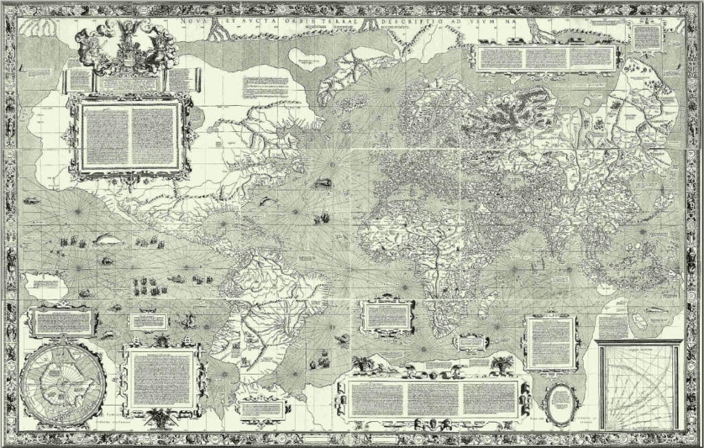
The Mapmakers of History: How Charting our World Became Essential for Civilization
24 March
Is a perfect map possible? For those of us who frequently use our smartphones to find our way around with no wrong turns, the answer might seem like a resounding yes. And yet, map makers and experts contend that there is no such thing as a perfect map. One expert claims that all maps are—to some degree—subjective and that all civilizations in the past have heralded their maps as the correct one when really each one depicts a subjective view. And yet, companies like Google have set on a quest to develop “the perfect map,” using every available tool to approach this much-romanticized perfection. Through satellite imaging, drone images, hikers, and more, Google is attempting to create the perfect picture of our world.
Over the centuries, human beings have engaged with the environment in an effort to better understand it and advance their societies. So here is the story of a few maps that changed the world.
The Early Days of Maps and How It Altered Human History
You may have heard someone say, “so-and-so has a good sense of direction.” Perhaps we recognize that some people are more apt in finding their way around than others. What is this about? Since the 1940s, some scientists have argued that humans have a kind of internal map or “black box” in the nervous system. While this may be true to some extent—we know how to get around our neighborhoods or familiar towns—drop someone in unknown territory and things can go south very quickly.
Yet, humans used this intuition to begin interacting with the world and trying to document it. One of the oldest surviving maps was a clay tablet created around 700 to 500 B.C. in Mesopotamia. This early map was small and primordial, as it was more about giving people a sense of the surrounding worlds by placing Mesopotamia at the center.
Early maps, in fact, were not overly concerned with accuracy. These early representations were more of a form of artistic expression or representing one’s fiefdom or kingdom. Some experts point to the early Roman maps, which seem to be more of a statement or showcase of their great empire than a document meant for navigation or understanding the land.
The First Attempt at Accurate Mapping
The first step towards accurate map-making was due to one man seeking to craft accurate horoscopes. One of the most often cited early maps was from Claudius Ptolemy, an astrologer and astronomer, who was preoccupied with horoscopes and somewhat inadvertently invented geography.
Ptolemy did the leg work to collect documentation that detailed locations of towns and used stories from travelers to embellish his maps. He slowly developed what became a system of lines—latitude and longitude—and drew out almost 10,000 locations. He also knew that it was necessary to have a 2-dimensional map even knowing that the world was round.
Other Notable Maps of the Ancient World
After Ptolemy’s creation of geography, other societies also attempted to depict the world around them in a way that made it possible to understand and engage with. Some of the early maps that changed civilization are detailed below.
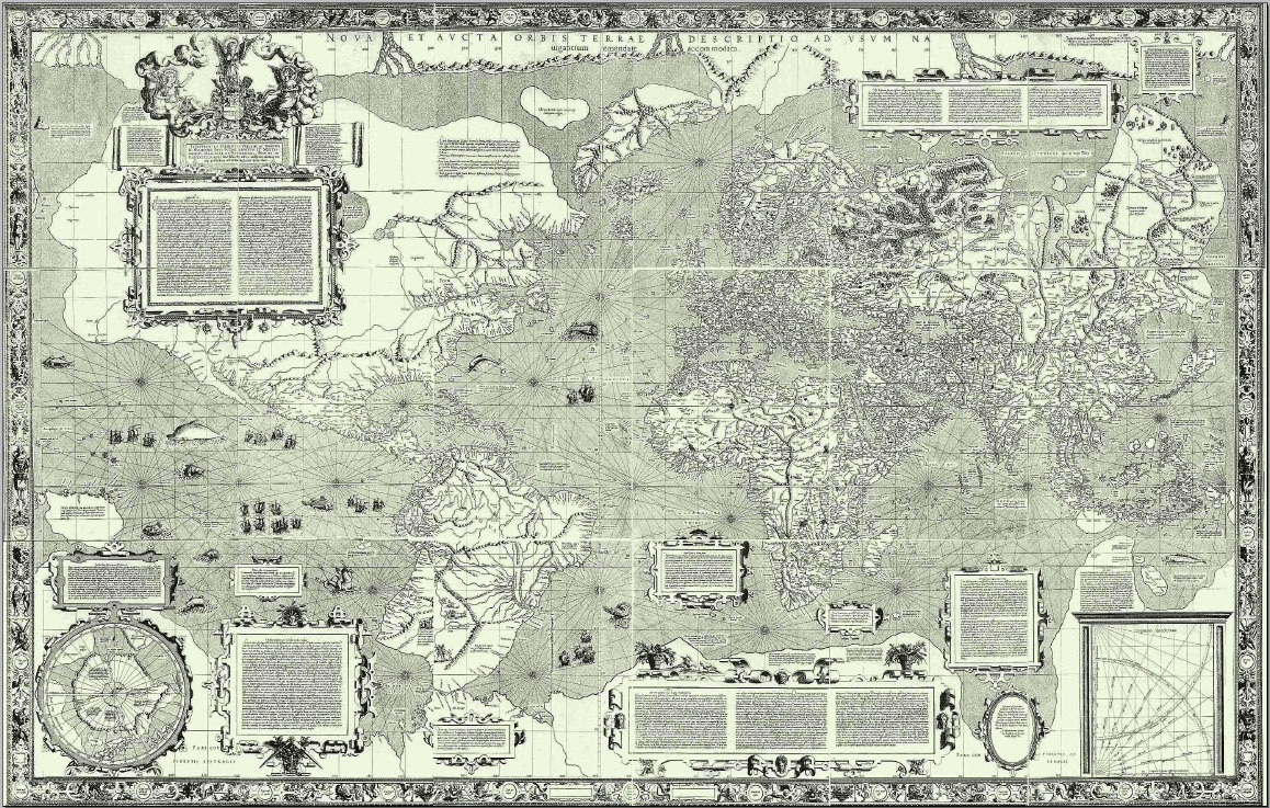
A world map in 1154
This early Arabic-language geography guide drew on Jewish, Greek, Christian, and Islamic traditions. According to the Atlantic, early Muslim mapmakers had a tradition to put the south on top. This early map depicted blue seas surrounding the globe and was more concerned with accuracy without embellishments, monsters, or overly artistic additions.
A Christian representation 1300
Another early map shows how Christians in medieval Europe saw the world. This map used biblical time as the main running theme, with a depiction of Christ looking over the entire globe. In the map, towns and cities are depicted while also showcasing biblical moments and places such as the Garden of Eden, Pillar of Hercules, a crucifix, Jerusalem in the center, and a representation of Africa, embellished with monsters.
Early navigation map
Many experts say that this map, created by Gerardus Mercator, is one of the treasures of early maps. He attempted to mimic the curvature of the earth’s surface on a 2-dimensional representation. The image of this map shows that it was created for European navigators. Experts discuss the artistry of this map, as it represents some political conflicts from a distance—as if to suggest the minuscule nature of man compared to the incredible vastness of the world around us. It was this type of subjective representation that makes early maps a majestic historical document that speaks volumes about society at that moment in time.
Notable Cartographers the Helped to Build the Mapping Tradition
Early mapmakers had limited tools at their disposal but they managed with their early understanding of the cosmos, compasses, and zenith telescopes. Early cartographers then depend a lot on their imagination and their limited knowledge.
Fra Mauro
Mauro was a 15th-century Camaldolese monk who had a cartography studio in Venice around 1450 AD. His map is often considered one of the most well-known and beautiful pieces of medieval cartography.
Gerardus Mercator
Mercator’s map was mentioned above. In fact, Mercator may be a recognizable name to many. The Mercator map projection is named after this map maker. This was created as a navigational tool in the 1500s. It was Mercator’s attempt to accurately depict the Earth’s curvature and taking that into consideration for navigation that put his name on the historical roles of map-makers.
Land Surveyors, The Modern Map-Makers Working to Map Our World
The above is only scratching the surface of the amazing history of map-making and cartography. Today, we have amazing technology helping improve the process. Of course, maps and our interaction with them have changed considerably today. As Google attempts to find the “perfect map” land surveyors across the globe continue to do their job of measuring landmasses and establishing property lines, boundaries, etc.
Do you need property demarcation or a land survey of your property? Want to learn more about what we do? Connect with us at Land-Mark Land Surveying today.
The Evolution of the Land Surveyor’s Tool Kit: From the Romans to the 21st Century
26 March
Land surveys today benefit from hundreds of years of experience, knowledge, and tools. Our map creation of today uses anything from magnetic locators to special telescopes, to drones and satellites. The men tasked with early land surveys had simple equipment and employed special and innovative techniques to get the job done. As we saw in our series about Lewis & Clark, some of America’s most notable land surveyors, these early pioneers didn’t have much to work with but their knowledge of the land propelled them forward. Land surveys rely on smart techniques but also on their tools to get the job done.
Early Tools and Techniques for Surveying and Understanding the Land
Even ancient peoples had the urge and necessity to understand the land that surrounded them. It is an essential part of civilization—though not often discussed as such.
The Roman Groma
One early instrument in the history of land surveyors seems to have made its way from Mesopotamia. The Groma looks rather simple. It is a vertical staff with horizontal staff pieces at right angles. It was also adopted by the early Romans to measure land in the empire for taxation purposes.
The Greek Diopter
With the advancement of math and geometry came advancements in other fields. Land surveying advanced as the art of measurements and mathematical equations developed further. The Greeks developed the diopter. This was a lightweight portable tool composed of a cogwheel. They used water levels and astronomical features to survey a property. The theodolite—an instrument still used today— seems to have derived or at least been inspired by the early Greek diopter.
Land Surveying in Early Europe and American History
As Western civilizations expanded, the need to understand and record features of the land became more and more important. As the British Empire extended its borders across great lands, the explorers that led these expeditions sought to understand the lands in which they ventured.
In 1571, Joshua Habermel created the first theodolite. Modern versions of this tool still exist today and form part of the day-to-day surveyors kit. This is a precise instrument that requires a tripod and compass. When early Europeans began using the technique of triangulation, it improved the accuracy of the measurements of boundary lines. This early European method of triangulation was used up to the 1980s because of its simplicity and accuracy.
The Use of Celestial Maps & the Night Sky
In the mid 18th century, the theodolite was improved by the addition of a scope. Today’s Theodolite, for example, is a rather sophisticated telescope derived from these early versions. Surveyors around this time used sextants, which measured angles using celestial maps.
The Use of Other Early Tools
The land surveyor’s tool kit has evolved but the ideas have remained the same. Below is a list of various other early tools used by pioneer land surveyors that learned to be creative and innovative with what was at hand.
- Gunther’s Chain: This tool was around during the 17th century. It is a thin-looking chain consisting of a linked chain that is pinned to the ground and extended outward up to 60-65 feet. It helped surveyors define a path and record measurements from endpoint to endpoint.
- Gunter Surveyor Compass: Angles are critical for land surveys. Many of the tools that were developed early on focused on using angles to measure distances and terrain. Also known as the circumferentor, this tool helped determine right angles.
- Zenith Telescope: This is a refracting telescope and was pretty sophisticated for its time. It was designed to observe the night skies and contributed to the understanding of Earth’s rotation and axis. Portable versions of this telescope were used for land surveys including latitude determinations.
- Ramsden Theodolite: Jesse Ramdsen developed the Ramsden Theodolite in the late 1700s. He was an innovative London instrument maker that was tasked with creating an accurate instrument that used triangulation to divide England. The instrument weighed up to 200 pounds.
The Day-to-Day Instruments Used for Land Surveying Today
Most days it depends on the job. When surveying relatively flat terrain in the middle of a city to surveying mountain regions or deserts, there are various instruments and equipment that can be used. On any given day you might find your local land surveyor using the following:
- Surveying magnetic locators
- Surveyors safety vests
- Surveying tripods
- Marking paint
- Automatic levels
- Total stations
- Theodolites
- Electronic levels
The list goes on. Depending on the kind of job and the kind of survey that needs to be done, the tool kit may vary slightly.
Get Accuracy and Reliability with Land-Mark Land Surveyors
As experts in the industry, we have seen the development of many new technologies and equipment over the years. It is no substitute for knowing how to do the job. We pride ourselves on efficient and accurate work here at Land-Mark. From residential surveys to government contracts, we get the job done.
Need a reliable land survey? Trust the experts in El Paso and the Southwest. Call Land-Mark today.
Digging Deep Into Land Surveying | Looking Beyond Boundaries
17 May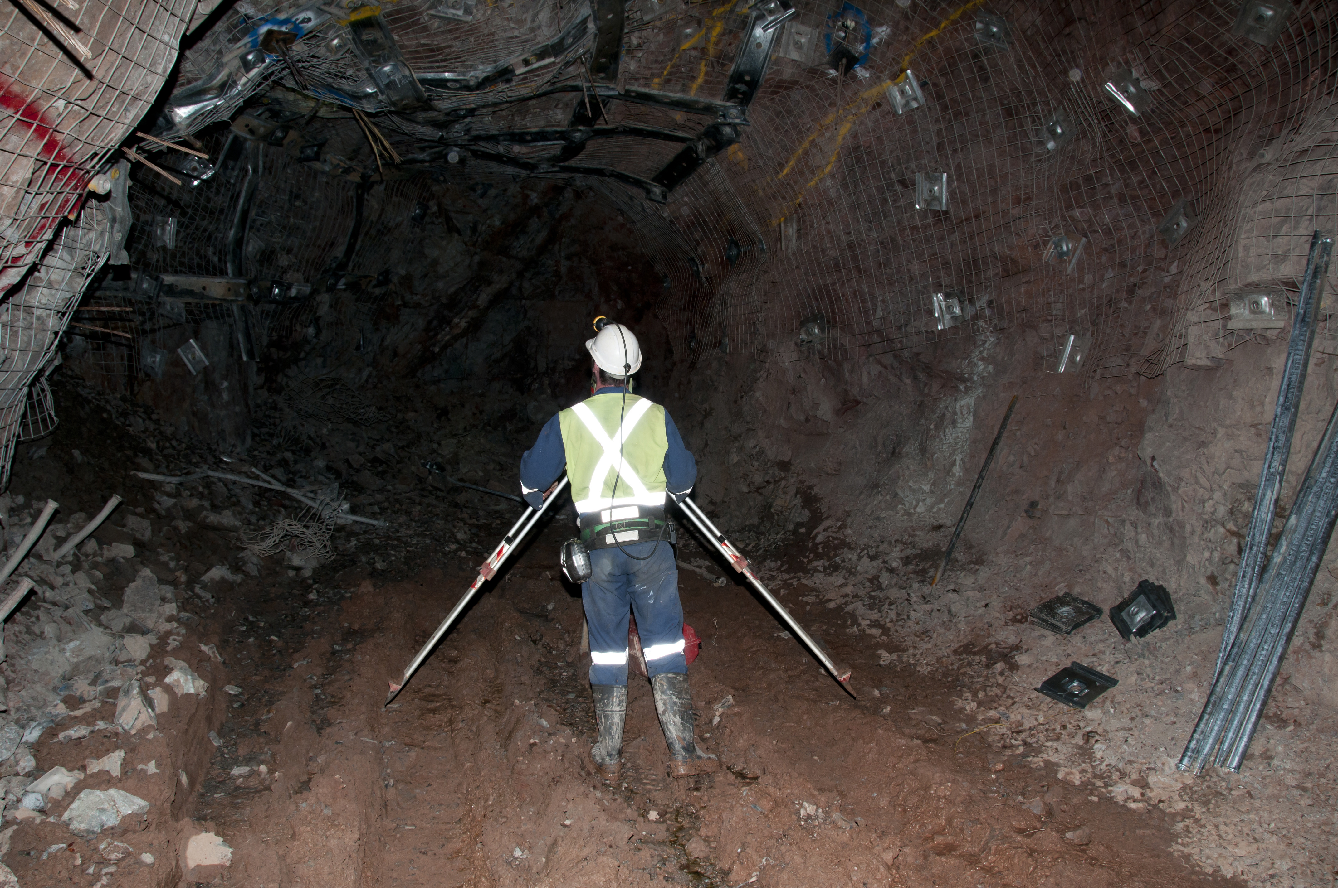
Land surveying may seem like a simple, easily explainable task but it provides much-needed information for a variety of instances. By making these precise measurements, surveyors are able to determine property boundaries, thus avoiding any legal disputes over who owns which part of the land. Land surveyors are mostly used prior to land development. They’re basically the cartographers who draw a map upon which architects will be able to build the dreams of the land owner. Surveyors, along with their handy theodolites, are able to determine boundaries, but they can also do so much more. Keep reading to learn more about the various types of land surveyors out there.
Forensic Surveyors
Not all surveyors measure land to determine boundaries. Forensic surveyors, for example, use their skills to survey and record scenes of accidents. This is done in order to determine potential landscape effects.
Geodetic Surveyors
Ever wonder how maps like Google Earth come to be? Well, geodetic surveyors play a major role in these aspects. By using highly advanced technology, geodetic surveyors are able to measure large areas of Earth. Satellite and aerial observations give the surveyor an astronaut’s point of view, thus giving them the ability to measure Earth itself.
Hydrographic Surveyors
From space, we now go into the ocean itself. Hydrographic surveyors (also known as marine surveyors) use their surveying skills to study harbors and other bodies of water. This is done in order to determine shorelines. Hydrographic surveyors also determine the topography of the ocean floor and water depth, among many other features.
Mine Surveyors
The title speaks for itself but mine surveyors use their surveying abilities to map the tunnels that make up mines underground. They can also survey surface mines in order to determine how many materials have been mined.
Land Surveyors for Your Needs
The wide world of land surveying is incredibly exciting. And, thanks to advancements in technology, land surveyors are now able to survey more efficiently than ever before. It’s necessary to point out that the most common of land surveyors partake in the art of determining boundaries, and they take great pride in helping landowners avoid legal disputes. Our team, at Land-Mark Land Surveying, holds the importance of land surveying close to our hearts. Let us guide the way and shine a light with our theodolites. Contact Land-Mark Land Surveying today to learn more about what we can do for you.
Surveying in El Paso Is Performed For A Number Of Reasons
7 February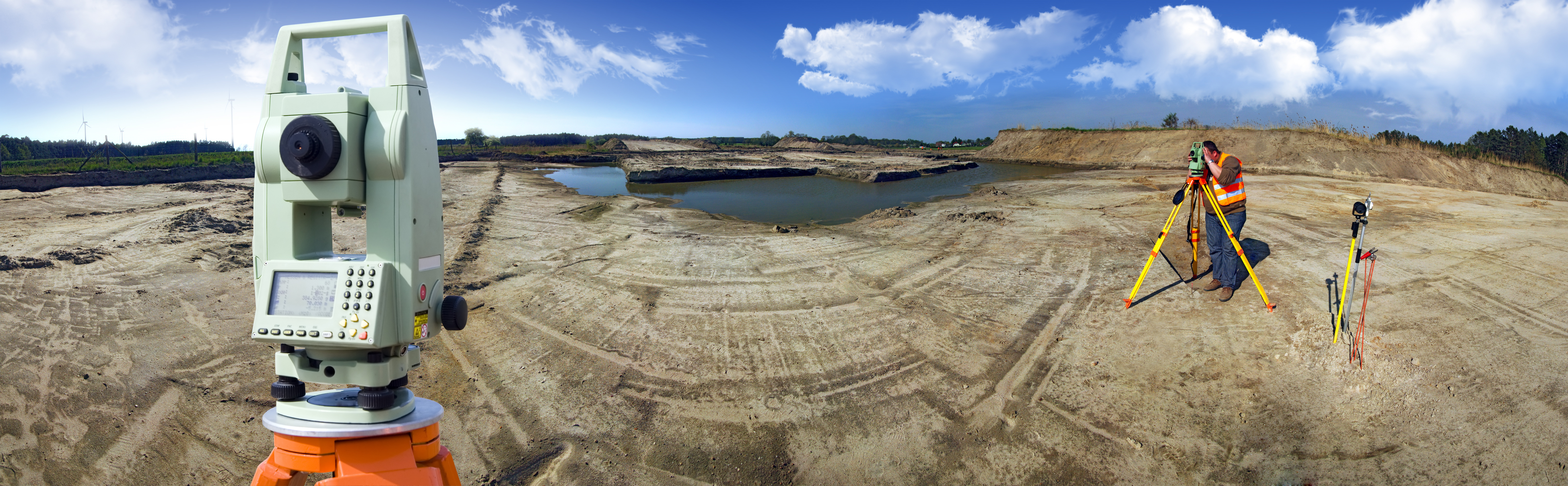 If you are in El Paso and need a land survey, you are probably wondering what it consists of. Many people are curious about this and that is absolutely normal! Surveying in El Paso is probably conducted in similar ways that other places conduct land surveys. If you need a land survey conducted due to selling land or current construction in El Paso, Land-Mark Professional Surveying, Inc. can help you out. Surveying in El Paso is something that is actually done frequently. Here are some reasons why.
Marking Boundaries Is Very Important
Surveying is a technique that expert surveyors use in order to map out points and distances on a specific piece of land. This survey is used to mark boundaries and determine who owns what area. This is something that must be completed before any construction takes place on the land in question. A land surveyor will find out where exactly the property sits and then go from there. There are many reasons for surveying in El Paso. Buying and selling land and property are definitely two of them. Placing boundaries is very important because it will help the landowners avoid serious things such as gas lines, power lines, and cemetery burial grounds.
Find Service And Gas Lines Easily
As stated, this type of land survey can determine where service lines are and make sure that no one is building or constructing on top of them. This is a great thing to know because it can prevent very serious issues from taking place. The last thing anyone wants to do is dig onto a power or gas line as it can be very dangerous.
Lastly, land surveys are great in case there is ever a land dispute. Because surveys are considered legally binding, they are very accurate and can be used to determine which area of land belongs to whom. An accurate survey map will be able to protect your rights and let he government know which land is yours. A survey map can also play a part in how much your land gets appraised for as well. And you will want to make sure that it is appraised at the correct value.
Surveys Can Be Helpful In A Number Of Situations
By accurately representing the borders of the property, a surveying in El Paso can be very beneficial to the owners and public officials involved. Without one, your land and boundaries are considered limitless. This isn’t a great situation that you want to get into. While land surveying might seem confusing, it actually plays a very important role in boundaries, value, and much more. Many people everyday are in need of a land survey for their property. This is because they might want to sell, buy, or build on it.
No matter the reason, a land surveyor will need to be hired to come out and perform the survey. If you are in the El Paso area and need a survey of your land, Land-Mark Professional Surveying Inc., can take care of you today. We are always up for a new job no matter the challenge ahead of us! If you would like more information on how we can better assist you and surveying El Paso, please contact us!
What Does the Cost of a Land Survey Depend On?
4 October
Getting a land survey in Las Cruces is important if you are going to purchase or develop a property. Although it may be a cost you want to skip, a land survey pays off in the long run. Even more so, you may require a land survey to secure financing or to get permits for development. It is important to budget for this cost while you plan for your closing costs on a real estate purchase. You should consider this cost when planning for the development costs for a construction project as well. Land-Mark Professional Surveying, Inc. can provide you with a professional land survey in Las Cruces. Give us a call today to find out about the services that we provide and about the costs associated with that service.
How Much Will I Pay for a Land Survey in Las Cruces?
Land-Mark Professional Surveying, Inc. provides surveying services which are affordable to property owners, investors, and developers. There are many different factors which will go into determining what the cost of surveying a particular plot of land will be. For example, several key things that can affect the cost of a survey include the type of survey to be performed; accessibility of the property; size and shape of the property; time of year; vegetation on the property; and terrain. The cost will also vary depending upon the existence of records on the property, whether there are conflicting deed calls, and what applicable standards of performing the survey. So, if these components sound unfamilar to you, our experts can walk you through every step of the process.
Getting Help with a Land Survey in Las Cruces

If you need a land survey in Las Cruces, have a consummate professional conduct your survey. Find out more about your options for completing your survey for an affordable price; Contact Land-Mark Professional Surveying, Inc
3 Reasons Surveying Your Property is a Good Idea
16 September
 When building over land, you will want first to find a surveyor who is knows about surveying in El Paso property. This is important because a knowledgeable surveyor can give you pertinent information about the property. Here at Land-Mark Professional Surveying, we want you to avoid as many problems as possible. Here are a few things a survey can tell you about a property before you begin to dig.
Surveying El Paso for Boundary Lines
When inspecting a property for purchase or to add onto, you will want to know where the borders reach. Often, it will not be enough to take physical measurements of the building. That is because legally, the property could either extend further beyond the border or closer within it. If it extends further, you can make better use of the space you have. If the border is smaller than anticipated, you may be encroaching on nearby properties. This can become a hassle if neighbors ever survey their own property and find out you withheld information.
Surveying for Zoning Classification
If you are planning on building or buying a building for industrial purposes, a survey can help. Because every city has classified different zones for different purposes, you may not be able to build. For example, if you want to maintain a small farm in your backyard there will be laws prohibiting you. Specifically, a farm belongs in agricultural zones as opposed to a residential zone where your home is.
Utility Company’s Rights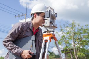

Another advantage to surveying El Paso properties is finding out what equipment a utility company has on your property. If a water company has already built a pipeline underneath the property, they could prevent you from building. While it may not be a problem at first, they can potentially use your property for any repairs. Similarly, if there are electric lines overhead, an electric company can prevent you from growing trees there.
By surveying El Paso property first, you can avoid all of these problems. When you decide to build in El Paso, it is important to find a surveyor with plenty of experience. Land-Mark Professional Surveying has been in business for over 25 years. Our trained professionals can find out if your property may run into trouble in the near or distant future.
Why You Need a Land Survey in Odessa TX
15 April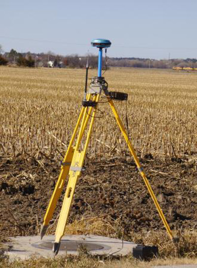
There are several different scenarios where you’ll need a land survey in Odessa, TX and Landmark Professional Survey understands them all. We are the folks that have been looking after your surveying needs in the El Paso area for years. We provide a professional, competent service and our staff is all highly trained, knowledgeable and friendly.
The Most Common Reason
The most common reason to get you land surveyed is when buying a piece of property. It is a fact that in most parts of the country you will need a survey to get any money from a lending institution. Finding a good surveying company is another important part of the process. Landmark Professional Survey are very good at their job and they have the necessary experience to handle several different kinds of surveying.
Professional Land Survey in Odessa
Of course there are several other very good reasons why you will need a land survey done. If you have already bought a piece of property or owned your house for several years and want to make an addition, getting a proper land survey done is an excellent idea.
However, some of the reasons you might want to hire Landmark Professional Survey might not be clear at first. For example, if you have a government easement running through your property it is a good idea to look into an Odessa TX survey. Clearing up any issues between neighbors is another benefit that you will get from having a survey done, especially when your neighbor is building something new on their property. Get professional land survey in Odessa. Contact us today!
Proper Land Planning for University Expansion
18 March When you are expanding a university’s campus in El Paso, there are some key factors you should be aware of for successful land planning and development. One of the most important elements in any building expansion is making sure you first understand the parameters and boundaries of the property. Conducting a thorough research of the property during the initial stage will guide all further building plans and budget costs involved.