Land Surveying: The Best First Step You Can Take
15 July
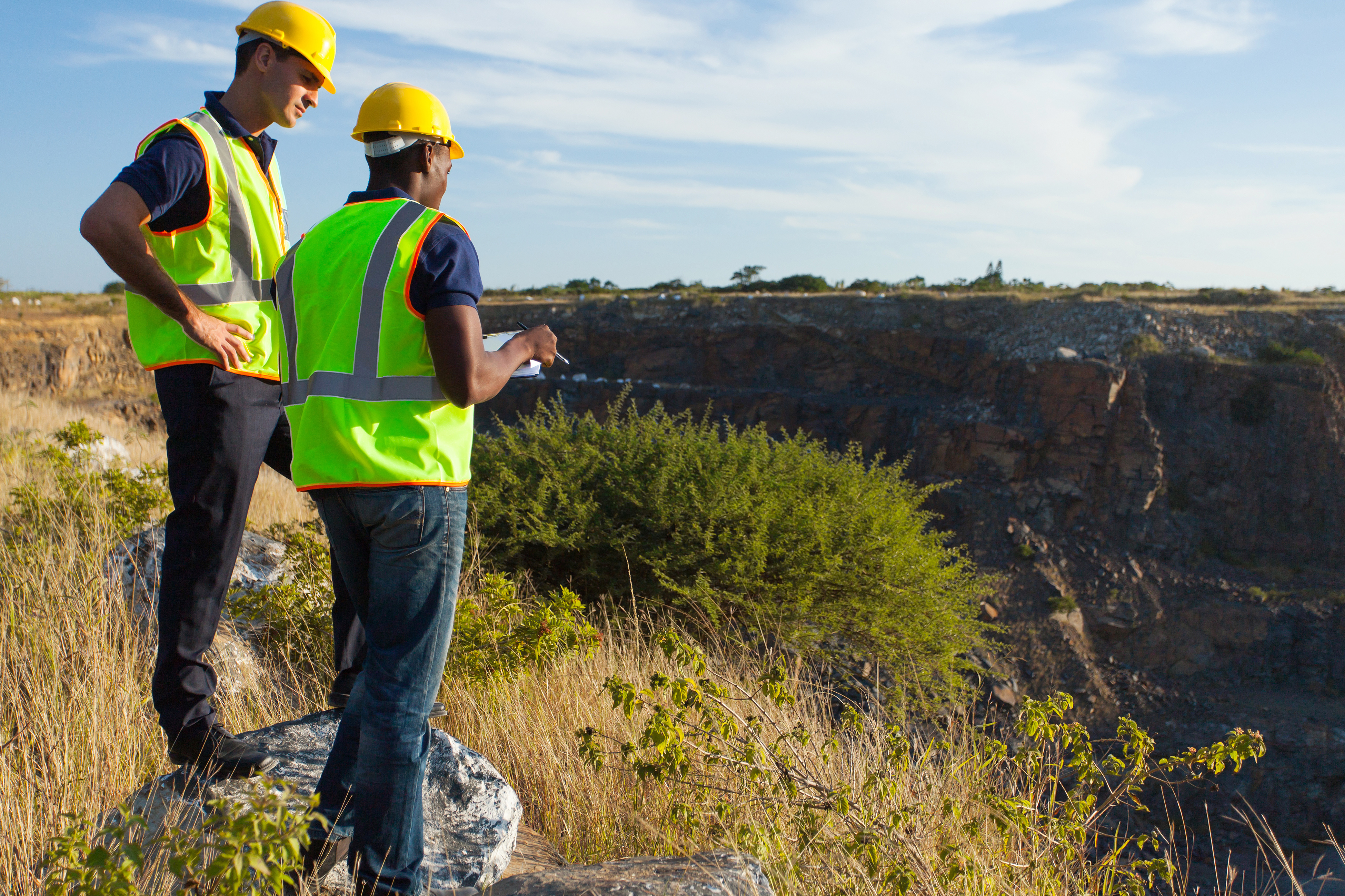
 For many people, owning land is a lifelong dream. If you’ve achieved this dream, you need to look into land surveying services before you break ground and start construction. This way, you won’t face any nasty legal battles in the future. You see, avoiding surveying your land can cause adjacent landowners to seek legal ramifications against you, which can quickly turn your dream of being a landowner into a nightmare.
The Best First Step
When buying land, most people have a somewhat vague understanding of where their land’s borders are. The land seller might’ve said that the land is a few acres across, but how are you to know exactly where your land ends and your neighbor’s beings? This is where we come into play. By using state-of-the-art technology, Land-Mark Professional Land Surveying is able to provide the most accurate information so your dream can proceed without a single hitch. Our services are reliable. In fact, countless individuals and companies alike rely on us for all their land surveying needs.
It’s Time To Get Started!
So, if you’re ready to get started on the right foot, give us a call! We always strive to offer top-notch service to our clients. In fact, we also love talking about our services and processes so you can be as enlightened in the art of land surveying as us! Nothing should stand in your way when it comes to achieving your dreams. Contact Land-Mark Professional Land Surveying today.
Digging Deep Into Land Surveying | Looking Beyond Boundaries
17 May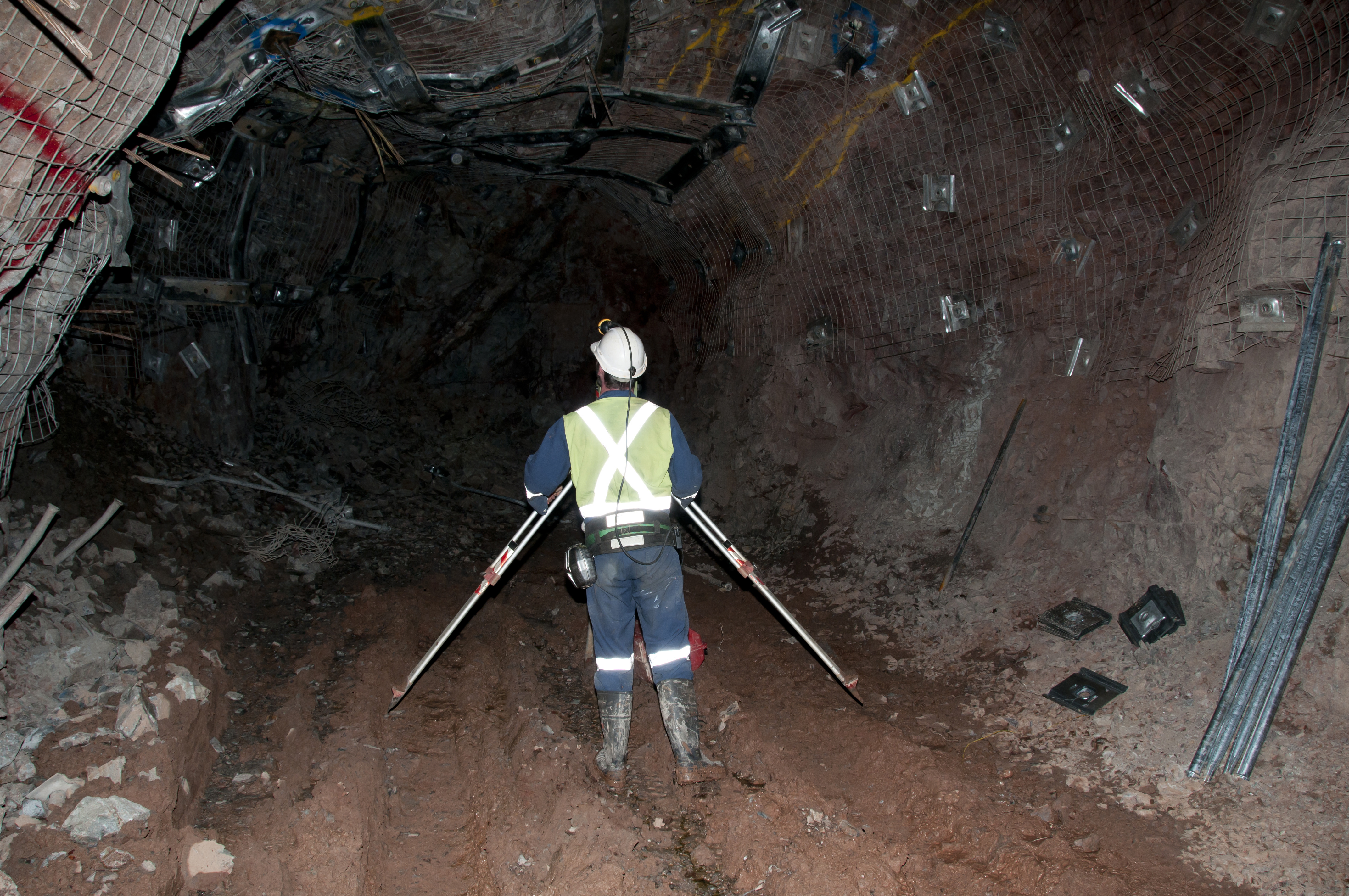
Land surveying may seem like a simple, easily explainable task but it provides much-needed information for a variety of instances. By making these precise measurements, surveyors are able to determine property boundaries, thus avoiding any legal disputes over who owns which part of the land. Land surveyors are mostly used prior to land development. They’re basically the cartographers who draw a map upon which architects will be able to build the dreams of the land owner. Surveyors, along with their handy theodolites, are able to determine boundaries, but they can also do so much more. Keep reading to learn more about the various types of land surveyors out there.
Forensic Surveyors
Not all surveyors measure land to determine boundaries. Forensic surveyors, for example, use their skills to survey and record scenes of accidents. This is done in order to determine potential landscape effects.
Geodetic Surveyors
Ever wonder how maps like Google Earth come to be? Well, geodetic surveyors play a major role in these aspects. By using highly advanced technology, geodetic surveyors are able to measure large areas of Earth. Satellite and aerial observations give the surveyor an astronaut’s point of view, thus giving them the ability to measure Earth itself.
Hydrographic Surveyors
From space, we now go into the ocean itself. Hydrographic surveyors (also known as marine surveyors) use their surveying skills to study harbors and other bodies of water. This is done in order to determine shorelines. Hydrographic surveyors also determine the topography of the ocean floor and water depth, among many other features.
Mine Surveyors
The title speaks for itself but mine surveyors use their surveying abilities to map the tunnels that make up mines underground. They can also survey surface mines in order to determine how many materials have been mined.
Land Surveyors for Your Needs
The wide world of land surveying is incredibly exciting. And, thanks to advancements in technology, land surveyors are now able to survey more efficiently than ever before. It’s necessary to point out that the most common of land surveyors partake in the art of determining boundaries, and they take great pride in helping landowners avoid legal disputes. Our team, at Land-Mark Land Surveying, holds the importance of land surveying close to our hearts. Let us guide the way and shine a light with our theodolites. Contact Land-Mark Land Surveying today to learn more about what we can do for you.
The Path Forward: Understanding the Importance of Land Surveying
19 April Here’s a fun fact for you, did you know that three of the four presidents immortalized on Mount Rushmore were land surveyors? It’s true. George Washington, Thomas Jefferson, and Abraham Lincoln were all proud of land surveyors. It’s a beautiful thought; these men who basically build the America we know and love today also played their part in literally surveying America’s own land. The importance of land surveyors goes as far back as history immemorial. If you’re looking for land surveying assistance in the Southwest region, give Land-Mark Professional Land Surveyors a call!
What Goes Into Land Surveying
Although there have been many advancements in modern technology that have made land surveying as accurate as possible, the basic tenets of land surveying are the same as they were in Washington’s day. The measuring of properties and land in order to determine boundaries is as important in this day and age as it was back when the Louisiana Purchase first went through. Let’s say you purchased some land and you plan to develop said land. Before doing so, you must have it surveyed by a professional land surveyor. Avoiding this can lead to many issues in the future.
The Right First Step
Just imagine, you buy land, develop it, and build a shopping center over it. Then, a few years later, you find out the person who owns the plot of land adjacent to yours wants to develop it as well and a land surveyor determines you built on the neighboring land. This will undoubtedly lead to litigation and other legal issues you’d rather avoid. So, before breaking ground, hire a land surveyor. With their findings, you’ll be able to take the first steps towards building whatever you may have in mind. Even if you’re not currently planning on developing your land, it’s still a good idea to have it surveyed. This information will be incredibly useful, no matter what you plan to do with your land.
Putting Your Best Foot Forward
If you’re ready to partake in the century-long tradition of land surveying, then contact Land-Mark Land Surveying! We are the area’s foremost land surveying team which means our work is second to none. When it comes to land surveying, it’s in your best interest to not cut corners; the end result may be more harmful than good and you’ll have to face the negative ramifications further on down the road. Let our team survey your land so you can move ahead with your dreams, whatever they may be.
What Can I Do If My Neighbor Builds on My Property?
26 February
Imagine this: you’ve finally found that white-picket fence, American dream of a house that you’ve always wanted and dreamed about, and then…your neighbor starts building on your property. Whether it’s a fence that cuts into your yard or you find your neighbor pruning what doesn’t belong to him, property disputes with neighbors are actually quite common, especially when there aren’t clear barriers or lines denoting whose property is whose. Here are a few things you can do if you find yourself dealing with a property dispute.
#1: Start With a Civil Discussion
Many times, when property disputes happen, simply talking to your neighbor about it can oftentimes resolve the problem. But we know that isn’t always the case, especially when the borders dividing your yards aren’t so cut and dry. If a civil discussion doesn’t cut it, don’t fret because there are other options for you.
#2: Bring it Up With a Property Manager
If you’re renting your property, your property manager may be able to help you resolve the dispute, especially if they are renting out your neighbor’s property as well, as is the case for many neighborhoods in El Paso. However, we’ve seen that many property disputes happen between two people who own the home they live in. If that’s the case, obviously this step is one you can skip.
#3: Contact a Land Surveyor to Help
A land surveyor’s job involves surveying land to identify property lines, among other things. So, if there is a dispute between you and your neighbor, a land surveyor can help you identify where your property lines fall so you and your neighbor can build and install to your heart’s’ content without worrying about building on each other’s property.
#4: Talk to a Lawyer as a Last Resort
If all else fails, a lawyer can help you dispute the barriers as well using the information the land surveyor gathers about your property lines. It’s a worst case scenario but sometimes it has to be done.
The Importance of Land Surveying and Property Lines
Land surveying is important for all sorts of functions in life, from architecture and homebuilding to economics and landscaping. Land surveying can identify property lines, help people build and expand thoughtfully, and can help with things like habitat preservation. At Land-Mark Professional Surveying, Inc., we can help people dispute property boundary issues civilly. Call us today to learn more!
Are You Dealing With a Property Dispute? Land Surveying Can Help
24 January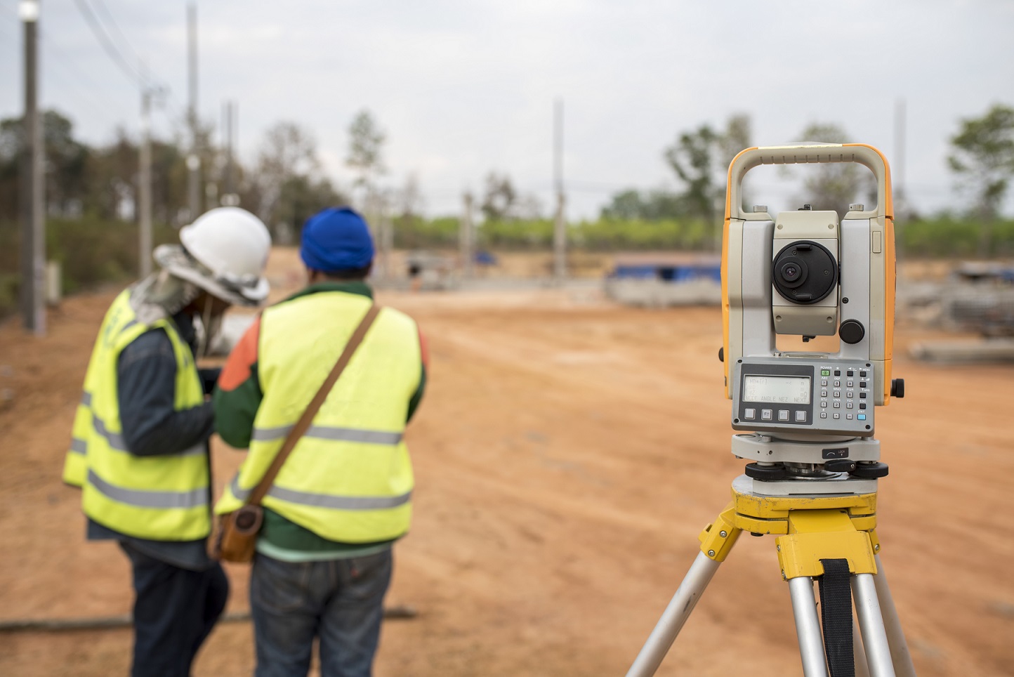
While there is typically a fence or barrier that tells commercial property owners where their land begins and ends, when a conflict coming from their neighbor arises, it can be complicated or downright impossible to settle the dispute. Many times these invisible borders aren’t enough to determine where one property owner’s land begins and where the neighboring property begins. This is where land surveying comes in.
Common Property Disputes
It’s often assumed that when you purchase a piece of land there exists a boundary set in stone. Although this is often the case, in some cases, such as with a change of ownership, the new owner can come in and request to place a wall or fence along his property. It’s common courtesy to speak to the neighbor prior to making any changes but it’s not required. If the neighbor sees an issue with the new fence or wall, he or she can argue that it’s obstructing or interfering with his or her piece of land. They can say that it’s interfering with their view or preventing others from seeing their property, creating a blockade if you will. Moreover, land disputes often come about when property owners decide to make additions to their building such as spreading out the parking lot, adding a front entrance, or extending their offices.
Requesting a Land Survey
Bringing in an unbiased, independent party will help meddle the constant bickering. Who wants to live this way, anyway? A land surveyor will conduct a physical lot line assessment and mark the boundaries that are in accordance with the local, state, and national guidelines. Although many times the land survey provides answers from a legal standpoint, if the issues get out of hand, the land survey can be court-ordered. The goal is to provide answers and have them solidified from a legal stand-point.
Why It Matters
Owning a piece of land is a huge investment. As the owner, it’s important that you do your part to protect your land. A land survey is the best way to provide answers and set the record straight. Even if your neighbor has already put up a fence, you still have the right to dispute the area it currently occupies. Lot line conflicts are quite common, which is why land surveyors are ready to settle the arguments.
Contact Land-Mark Professional Surveying
For professional service, contact Land-Mark. We’re licensed in Texas, New Mexico, and Arizona. As experienced land surveyors, we’ll provide the tangible and legal answers you need to keep your property protected. Connect with us today to learn more!
How Land Surveyors Shaped (and Continue to Shape) America
21 November Let’s transport ourselves to middle school history class. Do you recall the term “manifest destiny?” This was a 19th-century belief that the United States had a destiny (appointed by God) to expand across the entire North American continent. This was much more than a physical expansion of the nation; it was an expansion of the democracy and capitalism that was the foundation of the United States. Manifest destiny was much more than a belief, as it became a reality rather quickly. The Louisiana Purchase in 1803 doubled the size of the young United States, kicking manifest destiny into gear. Soon afterward, the famous Lewis and Clark expedition took place. Meriwether Lewis and William Clark were both land surveyors (amongst many other things) so they were the perfect candidates for such an expedition. This is just one example of the importance of land surveyors in America’s history.
How the Dominion of the United States Spread from East to West
The United States acquired large parts of Mexico in the early and mid 19th century. By 1846, we acquired the Oregon Territory thanks to a treaty with Great Britain. By 1850, the United States had grown to the size it is today. Fewer than 100 years after we declared independence from England, the United States ostensibly quadrupled in size. This is where land surveyors came into play. With so much land available, it was necessary for land surveyors to document each piece of the new America. Many land surveyors actually went on to become presidents of the United States. George Washington, Thomas Jefferson, and Abraham Lincoln all held the title of land surveyor. In fact, it was Thomas Jefferson who sent Lewis & Clark on their famous expedition of the Louisiana Purchase.
Land Surveyors Continue Making History
Although the days of early America are far behind us, land surveying still plays a major role in our modern society. Today, land surveyors pinpoint where your particular land begins and ends so you won’t accidentally build over someone else’s land. Surveyors are able to set boundaries as well. Many things have changed since the days of Lewis & Clark. Now, we’re able to use highly advanced technology to garner the most accurate readings. If you own land and want to begin developing it, make sure to speak with a land surveyor from Land-Mark Professional Surveying. We offer our services to clients in the Southwest regions of El Paso and New Mexico. When you partake in land surveying, you’re partaking in American history!
When Do I Need an Alta Survey?
16 August The short answer to this question is yes, as this particular type of survey has many uses. Alta means American Land Title Association, which is responsible for outlining certain standards for land survey work. As such, an Alta survey meets the highest standards of quality. Therefore, it can be recognized throughout the U.S.. Landmark Professional Surveying, Inc. can provide you with an Alta survey. They have helped many Las Cruces residents by providing quality surveys and they can help you too. On the downside, these types of surveys are usually a bit pricey than your average survey. This causes most people to question whether they actually need one or not. After all, how much better can they really be? The answer to that question is a little harder to see, but overall, the cost tends to even out in the long run. Still knowing when to get an Alta survey done can be hard for the average Joe. One bank might say you need it, while another may say you do not. The best way to tell is to consider the following criteria.
Buying or Selling Land
Having an Alta survey can make buying or selling your land much easier. These types of surveys are incredibly detailed. As such, they reveal just about anything that anybody could possibly want to know about your land. From utility lines to fences, boundaries and roads to improvements and possible encroachments. Besides physically going to the land in question, it would be hard to get such a detailed description of the land. In fact, the survey may actually be more useful than a pair of eyes. Having such a document helps any prospective buyer decide on whether they want the land or not. It can help you as a buyer as well.
Refinancing Land
An Alta survey can help you get a better refinancing rate for your land. Most lenders want to avoid survey risks, such as boundary disputes. This is because such disputes can lead to lawsuits later on and no one wants to be involved in such risks. Having this detailed survey can help ease the lenders mind and highlight the value of your land. As result, you are more likely to get a better offer.
Contact Us Today
Landmark Professional Survey Inc. can help you get the Alta survey you need. We have experience surveying the Las Cruces area and can bring quality results. Call us today to get started with an appointment.
How Land Surveying Set America on Its Upward Trajectory
8 December If you require ALTA surveys in Las Cruces, you’re taking part in a historical moment. Land surveys and land surveyors have been a crucial part of American history for centuries. In fact, many presidents of this great country had the distinction of being land surveyors at one point or another. If you require assistance with ALTA surveys in Las Cruces, choose Land-Mark Professional Land Surveyors!
Washington, Jefferson, Lincoln: American’s Land Surveyors
George Washington, Thomas Jefferson and Abraham Lincoln have more in common than the presidency. They all worked as land surveyors. In fact, the first two were Surveyor General for Virginia. At the young age of 17, George Washington was appointed as the Surveyor General of Virginia. Years later, Thomas Jefferson received the same designation as Washington, as County Surveyor for Albemarle County in Virginia. Under Jefferson’s careful tutelage, he appointed surveyors which resulted in the necessary direction to achieve the most orderly settlement acquisition. Abraham Lincoln served as Deputy County Surveyor in 1833, at the age of 24. In less than thirty years, he would become the 16th President of the United States.
The art of land surveying requires an individual to have careful and proper foresight. Through proper land surveying, the space can be used to its fullest extent. Land surveying is an apt metaphor for the presidency. The three men listed above undoubtedly used the skills and experiences they gained from their days of land surveying during their presidencies. It’s no wonder why they helped shaped the United States we know today!
Lewis & Clark: Discovering the True Beauty of the United States of America
Although Merriwether Lewis and William Clark may be most well known for their expedition, they got their start as land surveyors. Their days as land surveyors gave them the skills necessary to properly traverse through the land acquired in the Louisiana Purchase. Basically doubling the size of the United States, the Louisiana Purchase is seen as one of the most important chapters in early American history.
The Importance of ALTA Surveys Today
ALTA surveys in Las Cruces make use of the decades and decades of history and importance set before them. ALTA surveys follow strict guidelines set forth by the American Land Title Association, which got it start in 1907. Land surveying is deeply rooted in American history. If you require an ALTA surveys in Las Cruces, contact Land-Mark Professional Land Surveyors today! We understand the importance of land surveying so our services are as reliable and dependable as you deserve them to be.
Why is Land Surveying Important for Land Development?
19 April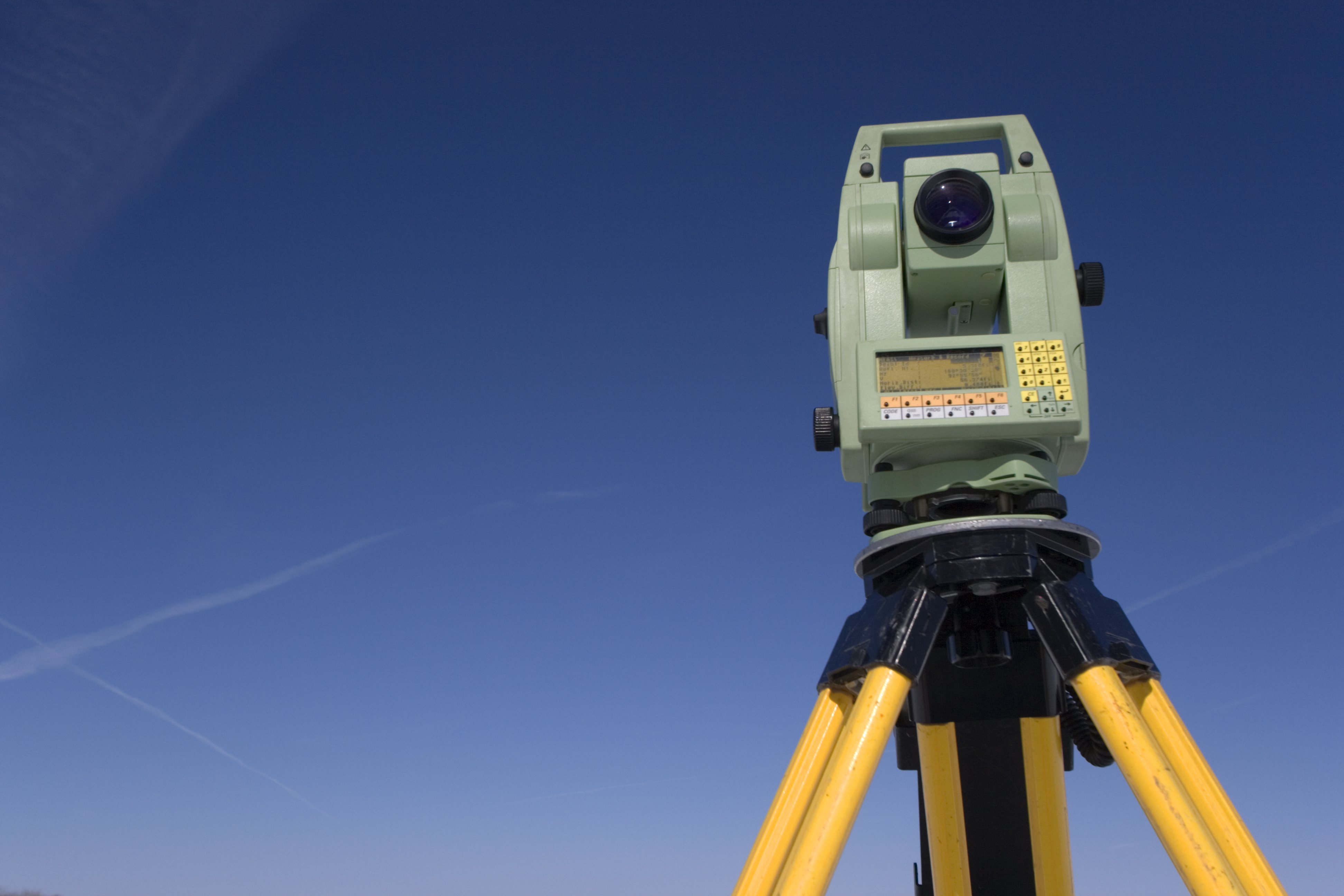 If you are in the business of land development El Paso, you probably know that there are a lot of things that go into it. Getting a plot of land ready for sale or construction require many things including land surveys. A land survey does a number of things for the builders, the owners, and the city officials. If you are in El Paso or the surrounding areas, our team at Land-Mark Professional Surveying can assist you.
Priceless Knowledge That Will Help You
A land survey for land development El Paso is very important and can tell investors and developers a lot about the area. The knowledge you get from a land survey will help you move forward with developing land and being able to sell and build upon it. So what exactly happens with a land survey? A land surveyor in the area will be able to go around and determine boundaries for a plot of land. This can be very helpful so that land owners know the boundaries of their land and where someone else’s land begins. This can help so that they do not cross over into land that is technically not theirs. A survey can also note where improvements can be made on the land and make maps. Mapping will allow everyone to have a visual representation of the boundaries and the area in which you are investing in and developing.
Know Where Important Things Are On Your Piece Of Land
Another reason for a land survey is so that builders and city officials will know where certain things are. It can tell the developers where gas lines, electric lines, water lines, cemeteries, and other important landmarks and pipelines are. This can be very important for a number of reasons. If someone doesn’t know where electric or water lines are, they can dug into them and puncture them. This can be costly to fix if it is a water line. If it is an electric line that is cut, it can be very serious and very dangerous. People can get hurt and electrocuted if they are not careful. A land survey is an essential way to make sure that you know where certain things are and how to effectively maneuver around them during the development and building process.
Get The Best Land Surveying In The El Paso Area
All in all, land surveys are very important for any land development El Paso. It will help more than you can imagine and help you get the most out of your property. If you are in need of excellent surveying services, our team at Land-Mark Professional Surveying can ensure that you get the quality services you need. We know the importance of making sure everything there is to be known about a piece of property is known. We understand how this can hurt or help an investment and we want to help in the best way possible. If you would like more information on our land surveying or how we can help you with your land development, please give us a call today.
Why the American Land Title Association Created the Survey
28 June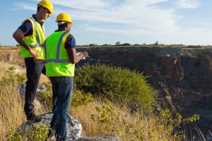 Why the American Land Title Association Created the Survey
When you see the finished product after ordering an ALTA survey in Odessa, you might wonder about the reasons and the history behind the profession. Landmark Professional Surveying has been in business for years and they understand every aspect of the industry including the survey’s history and why they are needed.
However, the average person might be surprised to find out the history of surveying goes back further than expected. As far back as 1400 B.C., the ancient Egyptians used a system of dividing land so it could be properly taxed. Around 120 B.C., the Greeks developed a system of geometry that was used in dividing land parcels. The Greeks built their system-build upon the work their Egyptians cousins did before them.
Modern ALTA survey Odessa
The modern ALTA survey in Odessa has its background in some of these ancient systems. In fact, the American Land Title Association created the modern survey for some of the same reasons ancient civilizations used them for. The division of land for taxation purposes are just a few of the cornerstones of the modern survey as we know it today.
Landmark Professional Surveying was created in 1991 and has since become one of the biggest land surveying companies in El Paso and surrounding areas. They have an expert staff of highly qualified individuals who understand all of the latest modernization in the ALTA survey. If you take just a few minutes to look at their website, you’ll see the various projects they have successfully completed.
The American Land Title Association created the survey so the modern world would be divided into proper parcels for taxation and construction purposes. It’s interesting to note that these modern surveys have a historical background that reaches back into the ancient past. Contact Landmark Professional Surveying to find out more.