Land Surveying in the Age of Coronavirus and New Technologies
29 July Much of the world hit the pause button in the middle of March up to May and even continuing on into the summer of 2020. It has been a strange year for everyone worldwide but despite the many changes and shifts, land surveyors have continued to do their jobs in mapping out our world. As it turns out, surveying land is a pretty essential endeavor and one that we may not realize impacts our lives pretty significantly. The last few decades have had a considerable effect on land surveying, as technologies have improved and embedded themselves in the process. We thought we’d take a look at some of the changes in the industry in the past couple of years and how we have coped with the changes of the virus.
The Close Call — Keeping Land Surveyors Working Through the Pandemic
Across the country, governors made moves to protect their populations by shutting down what they considered ‘non-essential’ businesses. This led to a lot of other businesses to question the metric of ‘essential.’ Who, after all, decides what is essential and what is not in American life. Surveyors across the country began to make a case for their services as quite essential.
President Trump issued two national emergency declarations under the Stafford Act and the National Emergencies Act. Several players petitioned to keep surveying operations open and exempt from the governor’s orders. The letter making this case was shared with other parties including the National Society of Professional Surveyors, which encouraged surveyors all across the country to send to their governors preemptively to prevent shutdowns of surveying operations. While some governors exempted surveyors by name, others did not consider our work particularly necessary. Many appealed this by showing how surveyors are actually critical to the economic well-being of the state. The reason being that many government construction or private construction, building permits, or other infrastructure cannot proceed without a survey.
According to many surveyors across the country, some private-sector jobs have been put on hold by the pandemic but many public sector jobs have increased. This might be because localities and other entities are taking advantage of the reduced traffic and crowds to work on important city projects.
At the same time, land surveyors are not exactly working amidst large crowds. Our profession is pretty isolated and doesn’t require large teams or working in highly trafficked areas. All of our work can easily be done with social distancing and by taking precautions. Here at Land-Mark, we continue to do our important work while ensuring that all of our workers and any member of the public we might come across, is protected.
Another aspect of our industry that has changed considerably has been the use of new technologies. These, of course, have been in the works for many years at this point. We’ve written about how GPS technology specifically has altered our industry, but technology has impacted us in several ways:
Accuracy: Modern instruments allow land surveyors to have an accuracy of measurements. Compared to the tools in use even a decade ago, the accuracy has improved exponentially.
Speed: Today, the speed of the surveying process has also greatly been improved by technology. Accurate results can be presented in a few hours, allowing for projects and infrastructure to get rolling. With the use of drones, for example, areas can be surveyed without exceeding human effort.
Improved possibilities: Development really begins with the land surveys and thanks to the improvement of technology, we are able to create surveys that create even more building possibilities. A lot of cities that are approaching development in a smarter, high-tech way, is a result of improved results in the land surveying arena.
As cities grow, there might be limited space available and large metropolitan areas have to get creative about the way they develop some of these areas. Cities often have to perform complex planning in small and complicated areas. Land surveying is imperative when looking to make the most out of space.
As we look to the uncertain future, we know that land surveying will continue to improve as technology improves. Automation and artificial intelligence will surely trickle into the industry, as they have already begun to do so. The use of drones, for example, has become useful in surveying difficult terrain. Other features like cloud-based storage and instant data seem to be right on the horizon.
Get Accurate Land Surveys for Your Project
Whether you are involved in a private contract, government contract, or public sector infrastructure project, Land-Mark Land Surveying is here to provide the quality land survey you need. Get the right view of the land and proceed with confidence.
Understanding Property Lines: Land Surveys and Maps When Buying Property
28 May Whether you are a large company purchasing acres of your next commercial infrastructure, or your a government agency looking to build some kind of installation, or you’re a property investor, or even a prospective homebuyer looking to buy acreage on which to put your home, a land survey is more than likely relevant to you.
Chances are that, at some point in your life, you have seen land surveyors at work on the side of the road on your everyday commute or drive across town. It looks like they’re taking photographs, as they are looking through a telescopic-looking device sitting on a tripod. And yes, it looks like they’re out there taking panoramic photos or admiring the horizon but really they are hard at work taking specific measurements and mappings of the land. The expertise of a land surveyor is in their ability to determine land measurements, topographic heights, and more.
The Right of Way Surveys
One of the main services of many land surveyors, such as Land-Mark, include what are known as Right of Ways Surveys. This refers to the legal right, established by usage or grant, to pass through specific grounds that form part of someone else’s property. In other words, it is the right of passage to another person’s land or property. The term is a common way that land surveyors and other civil engineers use to describe the ability to access another’s property, as it pertains to land usage rights. Examples of a Right of Way might include utilities— gas, electricity, water, telephone, or drainage— to pass through neighboring land, or if your neighbor must access your land in order to get to their property.
There are a couple of options with this:
Property Right of Way: This type of Right of Way (ROW) allows individual access to a person that needs it in order to reach it another location. This might be common on properties that are adjacent to another property that has the only access to the property in question. This may be in absence of a public walkway, lake, or river.
Public Right of Way: A public ROW allows members of the public to access a right of way that is on private land.
Pipeline Right of Way: This type of ROW applies directly to utilities or services that must access private property. This is when the utility company needs to use this private piece of land in order to provide its services and are vital to its operations.
A land surveyor can help you determine the specific details of the ROW by taking measurements of the property and assessing where the property line begins and ends. It is important that if you are the property owner, that you are aware of any ROW that might pertain to your land.
Before you renovate or develop on your land…
This information is key to the development and maintenance of your piece of property. If you are planning on developing your land or building on it, knowing the specifics is essential to ensure a successful project. You don’t want to find out that you have a ROW after you have built over it or disrupted it in some way. By law, it is necessary that you are aware of these types of details on your property.
A ROW can also refer to land owned by a municipality or company that transports goods and/or people. In a way our streets and highways are located on right of ways and so access to any adjacent properties are always to be provided.
Why is a Land Survey Important for Renovations and Development of Property
Knowing precisely the dimension and topography of any site is essential in order to ensure full compliance and abidance of building guidelines, town plans, etc. Even if you think your renovation project is just a room addition or something simple, knowing the precise measurements and boundaries of your property is necessary.
If you are looking to build on your land, a planning permit and/or building permit may be required. A land survey will be a mandatory part of these planning permits.
Get Necessary Land Surveying with Land-Mark
So if you are a property owner that is looking to develop on their land, understanding the historical data that you must take into account will ensure a successful build, project, or expansion. Owning a ROW is important too, as it informs you of necessary access you must provide to others through your property. Call Land-Mark today to get quality land surveying that is not only done quickly but effectively.
The Beauty of Mapping Our World — From Maps to Land Surveying
30 March
We thought we’d go back this month, all the way back. What we do here at Land-Mark is to understand terrain and land for the purposes of historical records, construction, and more. All of that began, however, with the idea of mapping and what is known as cartography.
Understanding the terrain which we inhabit has been a natural impulse for people and therefore early attempts at mapping our surroundings appear early on in human history. The earliest maps date back to 16, 500 BCE. These maps, however, were focused on the night sky more than they were the earth itself. Ancient cave paintings often depict landscape features like hills and mountains. These early forms of maps were there to help people navigate the world.
In ancient Babylonia maps on clay tablets, as well as routes done by ancient Egyptians on papyrus paper. In fact, many ancient civilizations would come to develop their own systems of mapping and drawing out the landscape.
The Greeks
The Greek civilization was no different. They helped develop the industry of cartography as an important science. Many notable ancient Greeks would study the size and shape of the earth and its habitable areas, climatic zones, and country positions. We might all be familiar with Pythagoras, as he was the first one to draw the map of the earth that showed it as a sphere. Geographers of ancient Greece started trying to calculate the circumference of the earth.
Ancient maps are always fascinating, as they tend to be a little biased. Early Greek maps, for example, tend to show Greece as the center of the world. And this happened with China as well. Other early Greek maps, however, do show the landmasses divided into two continents: Asia and Europe. This was derived, in large part, by Homer’s work and other notable works of the time.
The Roman Empire
The Roman empire began to see a real practical and functional use for their maps. Understanding the terrain meant that this could help them for military purposes and other expansion efforts. The need for the empire to control and protect their empire in both military and economic aspects, meant that they needed to have a precise picture of boundaries and road networks.
Other important map contributions include the Ptolemy map, which is notable for its probable role in the Roman expansion. This is the beginning of latitude and longitude, which we still use today in all of mapping and land surveying. This was originally done around 130 AD but was lost and had to be recreated in 1300 AD. Cartographers that came after this then adopted this system and refined it to be far more accurate.
During the Middle Ages, where so much scientific and artistic advancement was halted, the work of map-making continued. Many Muslim scholars followed the methods of latitude and longitude. As travel across the glove increased, various notes and writing became essential to understanding the new terrain.
Later on, medieval European maps adopted their own form of doing things. They called them ‘mappa mundi.’ The largest Medieval map still in existence includes the Hereford Mappa Mundi—an elaborately and delicately colored map. The Fra Mauro map is another notable map of the ancients. It was created by a monk and it is a large round map of the world.
Let’s skip to the 1600s. There is the famed Ricci Map, a.k.a the Impossible Black Tulip—which is a great name for a map! This map was put together by a Jesuit priest and actually shows the Americas, though it has China in the center.
As Modernity Sets In….
As people continued exploring and mapping out the world, discovering new worlds, mapping those out and so on and so forth, maps became more and more accurate, necessary, and detailed. As the Industrial Revolution set it, trade and commerce began to connect the whole world through a vast network of trading routes and travel. This meant that a more defined understanding of our world was needed. All of a sudden, travel for pleasure was possible and people taking vacations or exploring new areas of the world were looking to move through the areas.
The ornate maps of earlier times, however, were replaced with far more functional and practical maps that could be used for various types of travelers including business travelers, explorers, and even leisure travelers. During the 19th century, railroads expanded rapidly throughout the world, connecting the world once again.
Reading maps is something that used to be taught in school, perhaps not so much anymore if most people use the GPS technology. Nevertheless, the world of mapmaking continues to be a fascinating field, as it is focused on providing detailed information about a certain terrain.
Find a Trustworthy Land Surveyor — A Different Kind of Map Maker
Here at Land-Mark Land Surveying, we don’t make your typical maps but we engage in the practice of creating detailed and informative depictions of a particular landmass or piece of land.
The Evolution of GPS Technology and How It Affected Land Surveying
28 January We live in the age of information. We all probably hear this phrase on a regular basis and are made of aware of this fact again and again when we encounter— and have immediate access to — endless bits of information and media and entertainment. Land surveying involves the gathering of information and data. The world of GPS has also significantly changed the way we travel and move around, as well as the way we understand the terrain. Many people now depend on GPS to get around. As land surveyors, GPS technology has impacted the way we do our work as well.
For centuries, scientists aimed to devise a way to enhance and improve our navigation and improve our ability to pinpoint our position in the world with accuracy. That technology exists today and most of us hardly give it a second thought.
The Beginning of the Technology
The GPS technology has so steadily snuck its way into our cars, our phones, and our lives. It has its origins in the Sputnik era. Scientists were able to track the satellites with shifts in their radio signals. This is known as the Doppler Effect. Throughout the 1960s the United States Navy conducted experiments to track submarines carrying nuclear missiles. In the 70s, the Department of Defense used some of this Navy technology and continued the movement of using satellites to track movement and for sophisticated navigation systems.
The DoD launched its first Navigation System with Timing and Ranging (NAVSTAR) satellite in 1978. By 1993, the 24 satellite system that GPS uses today was pretty much operational. There are two levels of service: the Standard Positioning Service and Precise Positioning Service. Access to the latter is restricted to the U.S Armed Forces. The former is the one most people know today as the GPS utilized by everyone.
So who created this technology and who do we credit as the inventor? After all, we always want to put a face to the name, even though some of the inventors we credit are not often the ones that deserve all the credit. Thomas Edison, for example, gets all the credit for the light bulb, but Humphry Davy might have something to say about that.
When it comes to GPS technology, there are a lot of people that contributed to what ultimately became the technology. There are four people typically credited with at least spearheading the concept that was developed by the US Department of Defense for military purposes. There is Roger L. Easton, the former head of Naval Research Laboratory’s Space Application was the brain behind a lot of the preliminary applications. Another name is Ivan Getting which contributed to the idea of using an advanced system of satellites to allow the calculation of data. Bradford Parkinson was at the forefront was also a chief architect of the technology. And then Dr. Gladys West also contributed to the advancements of calculations for an accurate model.
GPS stands for Global Positioning System and today this system has become quite sophisticated that it allows us to find addresses that might seem otherwise hidden or in the middle of nowhere. GPS uses signals from satellites to pinpoint a location on the Earth’s surface. GPS will use at least 24 separate satellites in a system that consists of six earth-centered orbital planes.
The Main Uses of GPS & How They Help Land Surveyors
- It determines a position or location
- Facilitates navigation
- Allows tracking
- Creates maps
- Aids accurate time measurement
How did GPS make its way into land surveying?
Because land surveyors are essentially marking and measuring terrain and property, GPS was a natural for the industry. The use of technology in surveying was one of the first commercial adaptations of GPS technology. GPS survey equipment allows the ability to obtain location, distance, and height almost instantaneously.
There are some pros and cons, however, when it comes to using/depending on GPS for land surveying. The benefits include:
- It offers a higher level of accuracy
- Calculations are made quickly
- Land surveyors can carry GPS components easily
There are also some slight disadvantages. These might include:
- Requires a clear view of the sky to receive the satellite signal
- When the area has intense foliage, there may be limits
- All GPS survey equipment is subject to failure
- The equipment can be costly
As GPS evolves, of course, land surveying will likely benefit and only increase its efficiency and accuracy. Already, in the last decade there has been quite a lot of changes in the way that land surveying is done, thanks to new equipment and improvement of techniques.
Get Accuracy with Land-Mark Land Surveyors
Just like any other industry in the 21st century, land surveying continues to change and advance as technology does the same. Here at Land-Mark, we do the job right. We use top-of-the-line equipment and the best techniques to ensure an accurate reading.
Land Surveyors: The Enigmatic Nature of Mapping Out Our World
21 November Land surveyors keep an ancient tradition alive. It’s true, land surveying extends far beyond the physical infrastructure. Everyone knows that the world is ‘connected’ today. When we use this phrase we usually refer to digital connections or avenues of communication across borders and oceans via social media sites or websites or access to the same or similar information. And while all that is true—that the world is figuratively more connected than ever—it is also true that there is physical work that is done in order to make these ‘connections’ possible. At the same time, the construction work we see on our way to work, the roadblocks that have us follow detours, all begin with an understanding of the land that is being built on, manipulated, changed. The work before the work is, in some ways, what makes land surveyors enigmatic and somewhat mysterious.
The Building Blocks—Geometry and Ancient Civilizations
Let’s take a step back in time. The concept of surveying or inspecting the land goes way back into civilizations. The division, understanding, and assessment of land serves many purposes and was used as far back as the ancient Egyptians for the purpose of taxation. Early surveys, used different types of instruments to gauge the dimensions of plots of land. According to Purdue University, in 120 B.C the Greeks developed geometry, although there were early versions of it in Egypt. Interestingly enough, the word Geometry means to ‘measure the earth’ and is the science of shape and size of things. Naturally, the science was then used to divide the land into shapes and plots, especially as civilizations grew, governments were established, and personal property needed to be measured and, yes, of course, taxed.
It was in Greece that the first piece of surveying equipment was developed. This was called the Diopter. This instrument was a mobile tool that used a cogwheel and water level to measure terrestrial and astronomical figures on a property. With this tool, the Greeks also developed a standardized method for surveying and basically created a protocol that set the stage for the process for many years.
And on to Europe and then the Industrial Revolution
You might remember a word or two about William the Conqueror from early history classes. Also affectionately known as William the Bastard, as his illegitimate birth was certainly a topic of conversation among royalty circles during his reign (his father impregnated a mistress), he ruled England from the time he was eight years old. Interestingly enough, William the Bastard’s reign was plagued with violence and turmoil, but he managed to maintain control and—despite not knowing English and being illiterate— made great contributions to the development of the English language in early England. He also made a great contribution to land surveying when he ordered a “Domesday Book,” a record of people who owned land in England and the sizes and shapes of their plots. This book placed a great emphasis on demarcating privately owned land and property.
The demarcation of personal property today—and if you are a property owner, then you are highly aware of this— is key in maintaining order and proper city records and plots. In 1571, the first theodolite was created. This was a more precise instrument, as compared with the diopter that came before it. The setup uses a tripod with a compass and is able to create boundary lines. It wasn’t until the 18th century, however, that plots of land began being measured with precise maps of where each was located.
In the 1800s, land surveying became an actual profession. And as the surveying tools improved, the process became more and more important. This was largely due to the rapid increase in population and the growth of cities, roads, and railways. Suddenly surveying land and understanding the landscape on which we built was much more of a necessity.
Land Surveyors in 21st Century Texas
You ask most people what the role of land surveyors is and they might come up with a relatively good educated guess. Most folks, however, know little about the process or understand that it is present before anything can get built. It’s why the surveyor is a kind of ghostly and enigmatic figure that comes in before the groundbreaking begins and plots out the land and territory.
Still in the 20th and 21st centuries, land surveying uses the same basic principles and concepts that were started centuries ago. The development of certain technologies, such as GPS, laser cameras, precision instruments, GIS software, and terrestrial scanning makes everything that much more accurate and efficient.
Surveying the Seas: Internet Cables that Run Our Online World
Another way that these surveying concepts are at work is through the network of cables that connect us all. As the internet has expanded, so has the infrastructure that supports it—even though it’s not often visible. It’s just another arena where the concepts and tools of land surveyors come into play. Fiber optic cable is laid out across the ocean floor to help connect people online. This is often referred to as the secret network that connects the world. It used to be that communications happened through copper cables and electrical signals. Today fiber optic cable that is laid across the land and ocean floor allows for the faster and secure communication we enjoy today. These fiber optic cables are often as thick as a human hair and carry pulses of late that transfer data.
Get An Accurate Land Survey with Land-Mark or Find Out More
At Land-Mark, we take the art of surveying very seriously. We have been in the business for many years and focus on providing accurate readings and maps of the land in question. Whether it is a government contract or a private enterprise looking for their next commercial location, accurate readings of property markings and coordinates are key in protecting yourself down the road from any legal troubles.
Topographic Mapping: Basics and Benefits
23 September

Topographic mapping is at the heart of what we do here at Land-Mark, but often people aren’t sure what it means. It may sound pretty complex, but it’s actually pretty simple and useful. In this article, we’ll briefly discuss what a topographic map is and its uses.
What Is A Topographic Map?
A topographic map is simply a highly detailed map that shows the change in elevation between swaths of land or water. Modern topographic maps use contour lines but have used a number of other methods in the past. They usually cover large areas of land, as smaller maps of this type qualify as chorographic maps—though those are often labeled as topographic anyway.
As can be seen in the picture above, the contour lines on the map are associated with a number that denotes the elevation on that line. The closer the lines are, the more drastic the change in elevation. Topographic maps can be used to show natural and man-made elements.
The Uses of Topography
Topography has a vast array of uses associated with it. Large-scale architecture, for example, needs topography to determine where and how to build. Hiking may also use these maps, as well as mining, civil engineering, and other geographic activities.
Topography With Land-Mark Professional Surveying
Need a topographic map of an area or just have questions about the process? Contact Land-Mark today, and get started on your topographic needs!
A Land Surveyor’s Tool Kit: What We Use in The Field
21 August
As land surveyors, we have to carry around a great deal of equipment. We’re often mistaken for photographers because of our tripods, but the rest of our gear quickly dispels that thought. We deal with precise measurements, so it’s crucial to have the right tools on hand. Here we’d like to teach more about our equipment, so you can see us and not mistake us for dedicated Instagram photographers.
- Theodolite – A theodolite is a surveying instrument with a telescope for measuring horizontal and vertical angles. Some land surveying crews use transits and total stations as well, which are used for the same purpose. These can be very pricey; they can range from $200 to over $50,000 in retail price!
- Surveying Tripod – Be sure not to spend all your money on the theodolite, because it needs a place to sit as well. The survey tripod is a sturdy tripod that is designed to move as little as possible for accurate measurements.
- Hand Tools – Besides the main equipment, a surveyor will need a host of other equipment to do the job well. Rope and measuring tape are great for rough measurements and marking, while items like picks and saws help clear debris to properly survey.
- Clipboard – All the data needs to go somewhere, right? A clipboard and pencil are necessary to take measurements or notes down onto paper, or a good PDA would suffice as well.
Land Surveying Done Right
If you’re in need of a land survey, Land-Mark Professional Surveying is the best in the southwest. We work in Texas, New Mexico, and Arizona, and provide quality land surveying for all of our clients. Contact us to see what we can do for you!
Land Surveying: The Best First Step You Can Take
15 July
 For many people, owning land is a lifelong dream. If you’ve achieved this dream, you need to look into land surveying services before you break ground and start construction. This way, you won’t face any nasty legal battles in the future. You see, avoiding surveying your land can cause adjacent landowners to seek legal ramifications against you, which can quickly turn your dream of being a landowner into a nightmare.
The Best First Step
When buying land, most people have a somewhat vague understanding of where their land’s borders are. The land seller might’ve said that the land is a few acres across, but how are you to know exactly where your land ends and your neighbor’s beings? This is where we come into play. By using state-of-the-art technology, Land-Mark Professional Land Surveying is able to provide the most accurate information so your dream can proceed without a single hitch. Our services are reliable. In fact, countless individuals and companies alike rely on us for all their land surveying needs.
It’s Time To Get Started!
So, if you’re ready to get started on the right foot, give us a call! We always strive to offer top-notch service to our clients. In fact, we also love talking about our services and processes so you can be as enlightened in the art of land surveying as us! Nothing should stand in your way when it comes to achieving your dreams. Contact Land-Mark Professional Land Surveying today.
Where Technology and Infrastructure Meet
15 June Since 1991 Land-Mark has been at the forefront of the land surveying industry. A lot has changed since 1991, of course. In the early nineties, very few people could imagine that their cumbersome beepers would be transformed into sophisticated mobile devices capable of helping them navigate unknown territory (figuratively and literally), facilitate immediate communication across the globe, provide up-to-date news, take decent photographs, and store hundreds of bits of information. Similarly, technology has found its way to land-surveying and other relevant industries, providing equipment that increases accuracy and efficiency.
We use a variety of equipment, depending on the specific job, land, and project at hand. One of our trusted partners includes the company TopCon. These guys are highly innovative and perfectionists in developing new systems and equipment to improve the construction and planning of infrastructure and land planning. Topcon provides the positioning technology for surveyors, civil engineers, construction contractors, equipment owners, and operators. The geospatial solutions from Topcon have the most in-depth precision measurement for land mapping and surveying.
The Use of Digital Systems in Construction, Infrastructure, and Mapping
As land surveyors, Land-Mark is at the opening stages of a construction project. We form, however, part of the bigger picture that is all infrastructure building and construction. The use of technology in all stages of the construction industry has improved construction’s accuracy, safety, and efficiency.
In 1927, as TopCon points out, the world had 2 billion people. Only about one hundred years later did that number rise all the way to 7 billion. This means thousands of more acres developed, millions of more buildings erected, hundreds of more cities extended and expanded, and a constant and consistent demand for better and smarter building solutions.
A Few Amazing Examples….
Building great structures has always come at a human cost. There is not only a demand for human toil and labor but a high risk of accidents and injuries in any construction site. Any great building or structure you can think up has come at a cost of human lives. Some projects have been more successful than others. The Golden Gate bridge, for example, had 11 laborers died, a neighboring bridge, the Oakland Bay Bridge, had 28 people die in its construction. The World Trade Centers had 60 construction deaths. Recent technology, however, has allowed engineers to survey an area using drone technology without putting human lives at risk. A TopCon project to repair the Great Wall of China would have required workers to traverse a dangerous area. Instead, they sent a drone that was able to take thousands of high-resolution images that could then be input into a 3-D model, that was then used to examine the area and determine what needed to be done.
Measurement instruments have improved the ability for land surveyors like ourselves to enhance our workflow and improve our accuracy. Another great thing that technology offers is that added guarantee of accurate measurements and absolute efficiency. Land-Mark personnel is trained in a variety of high-tech and highly-specialized equipment that will ensure the proper mapping and measurements of your land project.
Explore the Wonders of Accurate Land Surveyors
So whether it is expanding a university campus in the middle of the growing El Paso central area or any other construction project in Las Cruces or Odessa, we are here to provide the most accurate topographic, stand land, improvement, and above and below grown surveying in the Southwest. Call Land-Mark today and find out more about our exciting projects in the area, both private and government work, that will show our dedication and find out about what we can do for your upcoming project.
Digging Deep Into Land Surveying | Looking Beyond Boundaries
17 May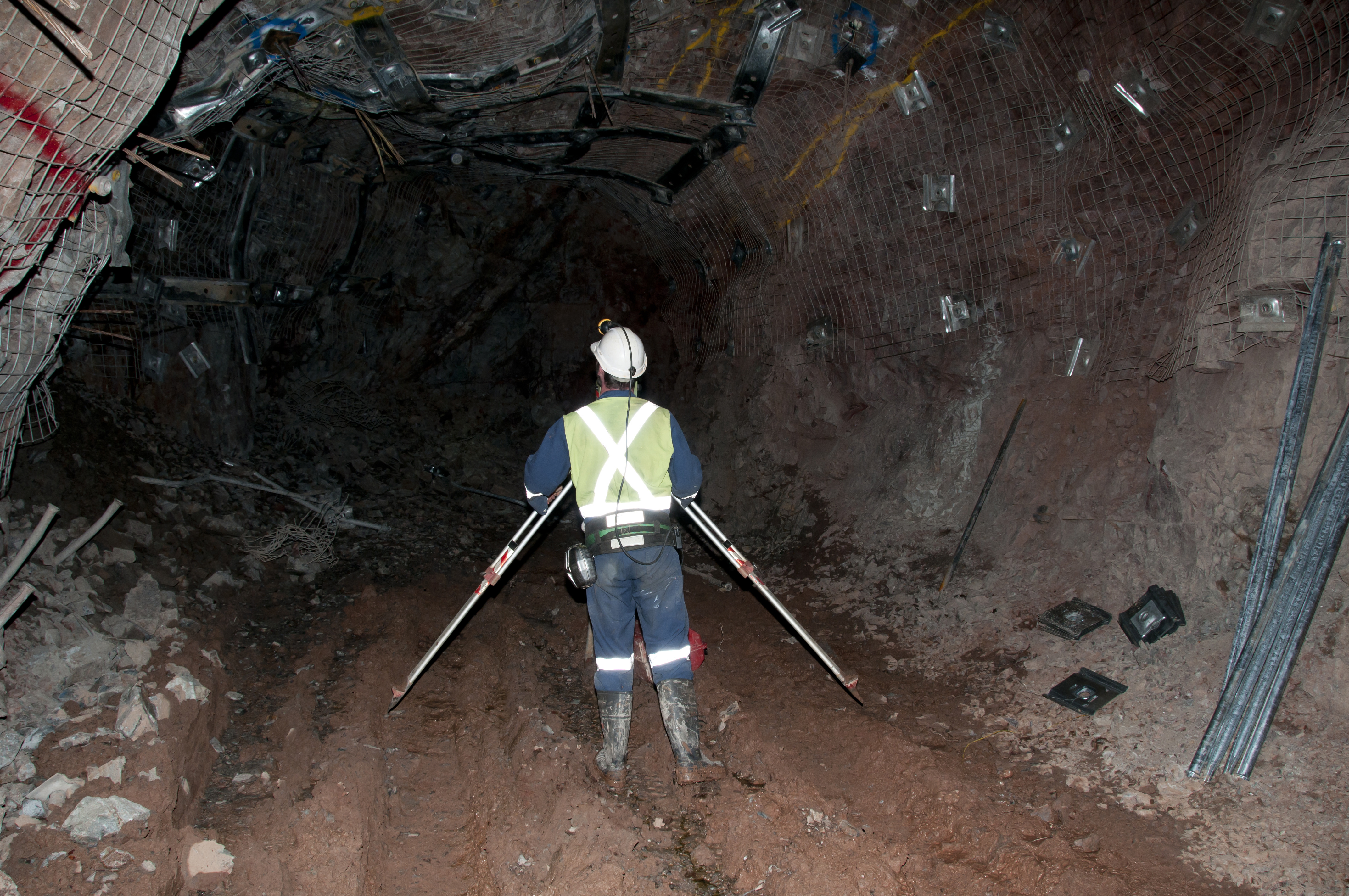
Land surveying may seem like a simple, easily explainable task but it provides much-needed information for a variety of instances. By making these precise measurements, surveyors are able to determine property boundaries, thus avoiding any legal disputes over who owns which part of the land. Land surveyors are mostly used prior to land development. They’re basically the cartographers who draw a map upon which architects will be able to build the dreams of the land owner. Surveyors, along with their handy theodolites, are able to determine boundaries, but they can also do so much more. Keep reading to learn more about the various types of land surveyors out there.
Forensic Surveyors
Not all surveyors measure land to determine boundaries. Forensic surveyors, for example, use their skills to survey and record scenes of accidents. This is done in order to determine potential landscape effects.
Geodetic Surveyors
Ever wonder how maps like Google Earth come to be? Well, geodetic surveyors play a major role in these aspects. By using highly advanced technology, geodetic surveyors are able to measure large areas of Earth. Satellite and aerial observations give the surveyor an astronaut’s point of view, thus giving them the ability to measure Earth itself.
Hydrographic Surveyors
From space, we now go into the ocean itself. Hydrographic surveyors (also known as marine surveyors) use their surveying skills to study harbors and other bodies of water. This is done in order to determine shorelines. Hydrographic surveyors also determine the topography of the ocean floor and water depth, among many other features.
Mine Surveyors
The title speaks for itself but mine surveyors use their surveying abilities to map the tunnels that make up mines underground. They can also survey surface mines in order to determine how many materials have been mined.
Land Surveyors for Your Needs
The wide world of land surveying is incredibly exciting. And, thanks to advancements in technology, land surveyors are now able to survey more efficiently than ever before. It’s necessary to point out that the most common of land surveyors partake in the art of determining boundaries, and they take great pride in helping landowners avoid legal disputes. Our team, at Land-Mark Land Surveying, holds the importance of land surveying close to our hearts. Let us guide the way and shine a light with our theodolites. Contact Land-Mark Land Surveying today to learn more about what we can do for you.