The Path Forward: Understanding the Importance of Land Surveying
19 April Here’s a fun fact for you, did you know that three of the four presidents immortalized on Mount Rushmore were land surveyors? It’s true. George Washington, Thomas Jefferson, and Abraham Lincoln were all proud of land surveyors. It’s a beautiful thought; these men who basically build the America we know and love today also played their part in literally surveying America’s own land. The importance of land surveyors goes as far back as history immemorial. If you’re looking for land surveying assistance in the Southwest region, give Land-Mark Professional Land Surveyors a call!
What Goes Into Land Surveying
Although there have been many advancements in modern technology that have made land surveying as accurate as possible, the basic tenets of land surveying are the same as they were in Washington’s day. The measuring of properties and land in order to determine boundaries is as important in this day and age as it was back when the Louisiana Purchase first went through. Let’s say you purchased some land and you plan to develop said land. Before doing so, you must have it surveyed by a professional land surveyor. Avoiding this can lead to many issues in the future.
The Right First Step
Just imagine, you buy land, develop it, and build a shopping center over it. Then, a few years later, you find out the person who owns the plot of land adjacent to yours wants to develop it as well and a land surveyor determines you built on the neighboring land. This will undoubtedly lead to litigation and other legal issues you’d rather avoid. So, before breaking ground, hire a land surveyor. With their findings, you’ll be able to take the first steps towards building whatever you may have in mind. Even if you’re not currently planning on developing your land, it’s still a good idea to have it surveyed. This information will be incredibly useful, no matter what you plan to do with your land.
Putting Your Best Foot Forward
If you’re ready to partake in the century-long tradition of land surveying, then contact Land-Mark Land Surveying! We are the area’s foremost land surveying team which means our work is second to none. When it comes to land surveying, it’s in your best interest to not cut corners; the end result may be more harmful than good and you’ll have to face the negative ramifications further on down the road. Let our team survey your land so you can move ahead with your dreams, whatever they may be.
Land Surveying on Mars: Using Earth-Based Tech to Map The Red Planet
18 March The planet Mars has held the attention (and curiosity) of earthlings for decades. Ancient peoples, such as Greek and Romans, noticed the red planet and named it after their god of war (Ares for Greek and Mars for Roman). These ancient peoples had a knack for naming planets. The ravaged, cold landscape of Mars does look as if a terrible war on a planetary scale took place on its surface, eons ago. Today, half a millennium later, the planet continues to fill our minds with ideas for the future of mankind. What separates us from the ancients, however, is our ability to learn more about Mars than ever before. Thanks to modern advancements in technology, mankind has been able to gather more information about Mars than ever before. This red planet is being surveyed by rovers and, in the future, by drones. The age-old tradition of surveying will pave a way for humans to potentially make Mars our second home.
The Truth About the Red Planet
It may seem like the Greeks and Romans hit it out of the park when naming Mars after their god of war. The surface of Mars is the definition of desolate, much like a location after thousands of nuclear bomb has been dropped. But the surface of Mars is actually much colder than one might initially think. This all has to do with the planet’s relative location in our solar system. Earth’s location relative to the sun, for instance, is not too hot or too cold. Our neighbors, Venus and Mercury, are far too close to the sun and thus have surface temperatures of 864° Fahrenheit and 801° Fahrenheit, respectively. Mars, on the other hand, has more “livable” temperatures (at least, during the day). Temperatures during a martian day near the equator can reach around 70° Fahrenheit while temperatures at night can reach minus 100° F. Pretty cold, isn’t it? Earth, which is the third planet away from the sun is the perfect temperature for life to thrive. Thanks to Earth’s temperature, water doesn’t immediately evaporate. This is why there’s life on Earth, as opposed to the other planets that surround us.
How NASA is Preparing to Survey the Surface of Mars
But does this mean life never existed on Mars? Thanks to the handful of rovers that have traversed the red planet’s surface, as well as high-quality images from satellites and telescopes, scientists have been able to find frozen ice or even signs of long-dried out rivers on the Martian surface. Perhaps Mars was a green, flourishing planet eons ago but today we only see the cold, distant remnants of an empty planet.
NASA is currently testing the Prandtl-m prototype. This drone will survey Mars’ surface (much how land surveyors surveyed America and the rest of Planet Earth throughout history and today). It’s incredible to think that the long-standing tradition of land surveying will be used to depict the surface of Mars. With this information, Earth-based scientists will be able to formulate what it may take for mankind to live on Mars. Today, however, you can call Land-Mark Land Surveyors to take care of all your Earth-based surveying needs.
How Land Surveyors Shaped (and Continue to Shape) America
21 November Let’s transport ourselves to middle school history class. Do you recall the term “manifest destiny?” This was a 19th-century belief that the United States had a destiny (appointed by God) to expand across the entire North American continent. This was much more than a physical expansion of the nation; it was an expansion of the democracy and capitalism that was the foundation of the United States. Manifest destiny was much more than a belief, as it became a reality rather quickly. The Louisiana Purchase in 1803 doubled the size of the young United States, kicking manifest destiny into gear. Soon afterward, the famous Lewis and Clark expedition took place. Meriwether Lewis and William Clark were both land surveyors (amongst many other things) so they were the perfect candidates for such an expedition. This is just one example of the importance of land surveyors in America’s history.
How the Dominion of the United States Spread from East to West
The United States acquired large parts of Mexico in the early and mid 19th century. By 1846, we acquired the Oregon Territory thanks to a treaty with Great Britain. By 1850, the United States had grown to the size it is today. Fewer than 100 years after we declared independence from England, the United States ostensibly quadrupled in size. This is where land surveyors came into play. With so much land available, it was necessary for land surveyors to document each piece of the new America. Many land surveyors actually went on to become presidents of the United States. George Washington, Thomas Jefferson, and Abraham Lincoln all held the title of land surveyor. In fact, it was Thomas Jefferson who sent Lewis & Clark on their famous expedition of the Louisiana Purchase.
Land Surveyors Continue Making History
Although the days of early America are far behind us, land surveying still plays a major role in our modern society. Today, land surveyors pinpoint where your particular land begins and ends so you won’t accidentally build over someone else’s land. Surveyors are able to set boundaries as well. Many things have changed since the days of Lewis & Clark. Now, we’re able to use highly advanced technology to garner the most accurate readings. If you own land and want to begin developing it, make sure to speak with a land surveyor from Land-Mark Professional Surveying. We offer our services to clients in the Southwest regions of El Paso and New Mexico. When you partake in land surveying, you’re partaking in American history!
A Few FAQs for Your Land Planning
11 September If you are in the process of building on your land, you probably already know that the local government will want a site plan. You will more than likely need to enlist the help of a good surveyor for a land planning survey. On a good note, getting a survey done will also provide you with valuable info for your site planning needs. Whether it is a personal plot and you are building a home, or you are working on a commercial plot to build a retail center, it doesn’t matter! A survey can point out all the different aspects of your land that will impact your building plans. At Landmark Professional Surveying, Inc., we have a few FAQs here for your planning:
Question: Do I Really Need a Land Planning Survey?
Answer: First of all, your local government probably requires some kind of survey in order for you to obtain the proper permits to build on your land. But, as mentioned, land surveys offer valuable info for land planning, as well. This can include the type of ground you are building on, best areas for drainage, finding out if you are on a floodplain or hard rock, and so on. When you are planning buildings and improvements that interact with the land, a survey is always good to have, whether it is required or not.
Question: What Do I Need to Know About Land Planning Surveys?
Answer: First of all, your local survey agency will know the details of your required land survey for permit needs. They will have a firm understanding of what this legal document needs to provide. Not only will they create a proper survey to satisfy permit needs, but will provide info about your land for building purposes. From topography, property boundaries to proposed grading you can be sure to get a thorough account of your land.
Question: How Do I Get Started?
Answer: Getting started on your land planning needs and survey is as simple as giving us a call at Land-Mark Professional Surveying, Inc. We work with builders, architects, and government officials on a regular basis. We have a firm understanding that is drawn from 17 years of experience in the industry. We have provided services to private and commercial land builders in the Southwest region and offer reputable services. Give us a call today to get started on your land survey. We will be happy to answer your questions or set up a consultation.
When Do I Need an Alta Survey?
16 August The short answer to this question is yes, as this particular type of survey has many uses. Alta means American Land Title Association, which is responsible for outlining certain standards for land survey work. As such, an Alta survey meets the highest standards of quality. Therefore, it can be recognized throughout the U.S.. Landmark Professional Surveying, Inc. can provide you with an Alta survey. They have helped many Las Cruces residents by providing quality surveys and they can help you too. On the downside, these types of surveys are usually a bit pricey than your average survey. This causes most people to question whether they actually need one or not. After all, how much better can they really be? The answer to that question is a little harder to see, but overall, the cost tends to even out in the long run. Still knowing when to get an Alta survey done can be hard for the average Joe. One bank might say you need it, while another may say you do not. The best way to tell is to consider the following criteria.
Buying or Selling Land
Having an Alta survey can make buying or selling your land much easier. These types of surveys are incredibly detailed. As such, they reveal just about anything that anybody could possibly want to know about your land. From utility lines to fences, boundaries and roads to improvements and possible encroachments. Besides physically going to the land in question, it would be hard to get such a detailed description of the land. In fact, the survey may actually be more useful than a pair of eyes. Having such a document helps any prospective buyer decide on whether they want the land or not. It can help you as a buyer as well.
Refinancing Land
An Alta survey can help you get a better refinancing rate for your land. Most lenders want to avoid survey risks, such as boundary disputes. This is because such disputes can lead to lawsuits later on and no one wants to be involved in such risks. Having this detailed survey can help ease the lenders mind and highlight the value of your land. As result, you are more likely to get a better offer.
Contact Us Today
Landmark Professional Survey Inc. can help you get the Alta survey you need. We have experience surveying the Las Cruces area and can bring quality results. Call us today to get started with an appointment.
Every Good Engineer Starts With a Topographic Survey
16 July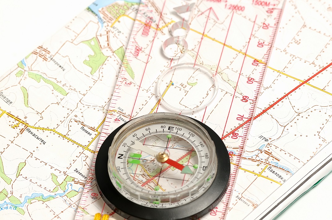 Whenever an engineer begins to sketch out a construction project, they cannot use an ordinary map. This is because an ordinary map will not tell them everything about the land they want to build on. It may explain what is there, like cities or major landmarks, but it will not explain dimensions, heights, or what could be underneath. This is where the need for a good survey comes in. However, you do not want to use just any survey, but rather one that will outline the land in detail. This means getting a topographic survey done. Any engineer worth their salt will want to start with one of these surveys first. In the Odessa area, there is one company that can help you get the quality survey you need for construction. Land-Mark Professional Surveying, Inc., is a quality company that can help you get your construction project started off right.
What Is a Topographic Survey?
A topographic survey is required whenever you are trying to get an idea of any property you own. These surveys focus on every and any aspect of the land. Trees, hills, valleys, even manholes will be included in the reports for these surveys. All this info is designed to let you know where things are, and what might be obstacles too big to build over. this kind of information is useful to engineers, architects and construction workers. All of them rely on the information provided in order to stay on time and keep their people safe.
Why Do I Need a Topographic Survey?
Getting a topographic survey is useful whenever you are planning a construction project. The info provided will help your engineer and architect decide the best place to begin construction or what they need to build around. Having the lay of the land spelled out in dimensions and graphs will also help them see which areas of your land need to be avoided. This info helps an engineer decide how to proceed with the project. In order for this work, of course, you need a quality topographic survey to be conducted.
Contact Us Today
If you are planning any kind of construction project, then you need a company that understands the local Odessa area. Let Land-Mark Professional Survey help you get started on construction. We offer a wide variety of surveys and our experts have years of experience. Call today to set up an appointment!
Superior Planning With a Construction Survey
15 June Before any construction project can begin, a survey of the land is required by law. This process consists of having a professional come out to the property about to be developed. They will then mark out the land, and create map of the property. This map will then be used to decide where and when the construction can begin. Having any project begin without a survey is not only inadvisable but dangerous. Imagine not knowing whether or not there is sand or rock beneath a structure? This is what can happen without a construction surveyor conducting proper work.
What is a Construction Survey
Construction surveys are done to map out the best way to build on a specific piece of land. Included this survey is information valuable to the company, architects and construction workers. This information might include the best place to lay a foundation, or the best spot for drainage. The way the survey is able to do this is by taking a lay of the land and estimating the propensity it has to carry weight. Making these estimations includes the consideration of ground type, weather patterns, and whether or not there might be any obstacles to the construction team. Having a quality survey conducted before building is essential to keeping a project on budget and on schedule.
Don’t Start Your Project Without It
The importance of having a construction survey cannot be underestimated. The information provided by one is invaluable. Engineers use the survey to estimate the best places to build, or add extensions. What if an engineer had to guess where to put a load bearing wall, or beam? What if they guessed wrong and cost the structure its integrity? The cost of rebuilding and trying again could be enormous. Having a survey done not only helps engineers make wise decisions, it also avoids disaster. Planning out roads such as freeways and highways are also easier with construction surveys. In these types of construction projects, surveys help plot out land measurements and routes. For every construction project, a construction survey will help provide valuable information. Having a professional conduct such a survey ensures the success of your constructions project.
Contact Us Today
For all surveying needs in Odessa, turn to Land-Mark Professional Surveying, Inc.! They can help get your project off the ground. Contact them today before starting any construction project.
A Few FAQs About ALTA Land Surveys
18 May If you are buying a piece of land in Las Cruces, you have probably been asked by the bank or titling company for an ALTA survey. You may be irritated that you need to obtain such a detailed land survey, but this document provides a wealth of info about the property at hand. It may be more costly, but it is an excellent document to have to avoid issues later on down the line. We have answered a few frequently asked questions about these specific surveys here.
Why Do I Need an ALTA Survey?
This land survey is quite detailed, as mentioned before. It can be a bit more costly than the average land survey, but with reason. Title companies as well as lenders may ask for this survey. It can happen either when you are buying, selling or refinancing a property. Most often times, lenders are looking to avoid “survey risks.” This can include disputes over boundaries, encroachments and other difficult issues that can lead to problems and even lawsuits down the line. An ALTA Survey would reveal any of these issues and more. Even if the bank or titling company doesn’t require you to purchase this detailed survey, it may be advisable to avoid problems. This can be especially true when purchasing vacant land that has never been surveyed, or has been survey over a decade ago.
Why is an ALTA Survey More Costly?
Some land buyers in Las Cruces may be unhappy with the higher cost of an ALTA Survey. However, this type of survey is only performed by a registered, licensed surveyor. It means specific standards outlined by the American Land Title Association (ALTA) and the American Congress of Surveying and Mapping (ACSM). In essence, this survey meets the highest standards recognized throughout the U.S. It includes much more detail than most other land surveys. This can include boundaries, fences, utility lines, roads, easements and areas that have been improved.
How Do I Get Started With a Land Survey?
Getting started with any kind of survey in Las Cruces is as simple as calling us up at Land-Mark Professional Surveying, Inc.. We are one of the best and most reliable land surveyors in the Southwest. We provide a wealth of services to help you with your property. Whether you are buying, selling or refinancing a piece of land, our certified experts can help. Contact us today for more info.
Land Surveys in Odessa
18 April Land surveys are essential for certain circumstances. Surveying is the process of calculating and measuring specific points in relation to each other. It is used to create maps, establish boundaries and more. Land surveyors in Odessa use a wide range of tools to complete the task at hand. When you hire a firm to conduct a survey you may be baffled at the info they provide. You may even find it hard to understand some of the terminology, or even what surveying may be all about. We have a few facts here for you.
Understanding Land Survey Terms
The first thing to understand about a land survey is the fact that wide range of units of measurements can be applied. Surveying even pretty much has its own language rooted in a deep history of tradition and accuracy. The best thing you can do is speak directly with your surveyor over the questionable terms at hand. Most firms will provide a glossary for client use.
Determine Land Size and Measurements
Surveys are often used to find the exact size and measurement of a plot of land at hand. This can be useful for government use when city lines and districts are drawn. Map making is a large part of the survey industry. This can include creating road, topographical, and other types of maps. State-of-the-art technology, GPS tools, and satellite imaging are employed to create accurate intelligible maps.
Land Survey for Construction in Odessa
A survey is an important part of any construction project. Surveyors provide vital info that can streamline and improve construction projects. A surveyor can inform engineers the best place for roads, drainage, buildings, parking and more. They can also provide info concerning the makeup of the soil and land, which in turn can affect which equipment and processes will be employed.
Find the Proper Land Boundaries
Finding the proper land boundaries is a large part of surveying. Establishing boundaries to put up fences or settle disputes is an important part of the industry. Overtime land lines that aren’t marked can shift, leaving landowners shortchanged.
Contact Us Today
If you are interested in hiring Land-Mark Professional Surveying, Inc. in Odessa be sure to contact us right away. We offer a wide variety of surveys and can help you in any circumstance. Whether you have a new construction project or you need to establish boundaries, our experts have the experience to provide you accurate, timely service. Give us a call today for more info.
A Land Survey Vs. a Construction Survey
14 March A land survey and a construction survey are two different types of surveys that actually serve very different purposes. If you are settles a land dispute or want to find the proper boundaries of your land, a land survey is the right tool for you. However if you are an engineer creating plans for an upcoming hospital or highway in Las Cruces you will want a construction survey. While a land surveyor will conduct both of these, knowing precisely what you need is important. At Land-Mark Professional Surveys Inc. we can help with either of these services. Our professionals have the expert knowledge and skills you are looking for.
A Land Survey in Las Cruces
A land surveyor is a licensed expert that is responsible for survey results. They utilize many tools and techniques to determine land boundaries, corners, and monuments, and the size of a piece of property. These professionals are skilled at using historical evidence, documents, mathematical equations, and surveying tools to conduct their work. A land survey is usually used for legal purposes, creating accurate maps, or during real estate deals. A land surveyor in Las Cruces can help settle disputes and help with traffic accidents as well. They also provide valuable info for breaking land into blocks and parks.
A Construction Survey in Las Cruces
A construction survey provides valuable info for builders and engineers in Las Cruces. They will survey a given plot of land to determine the best building practices. They may provide info on the best location for a foundation, drainage, and other info concerning the land that is helpful for erecting buildings.This invaluable information prevents engineers from making costly mistakes. It can also help with wise decision making. When it comes to highways and freeways they can also provide info about the land and measurements. The construction survey can be especially helpful with large projects that require extra planning.
Contact Us Today
Land-Mark Professional Surveys, Inc. has been providing surveying services to the southwest region for nearly 30 years. If you are looking for reliable, accurate surveys, don’t hesitate to contact us. We are extremely familiar with the Las Cruces area and can provide the expert knowledge and skills you are looking for. Whether you need a construction or land survey, we can help. Be sure to call us today. One of our professionals will be happy to answer your questions or set up an appointment.